Grayback Topo Map Arizona
To zoom in, hover over the map of Grayback
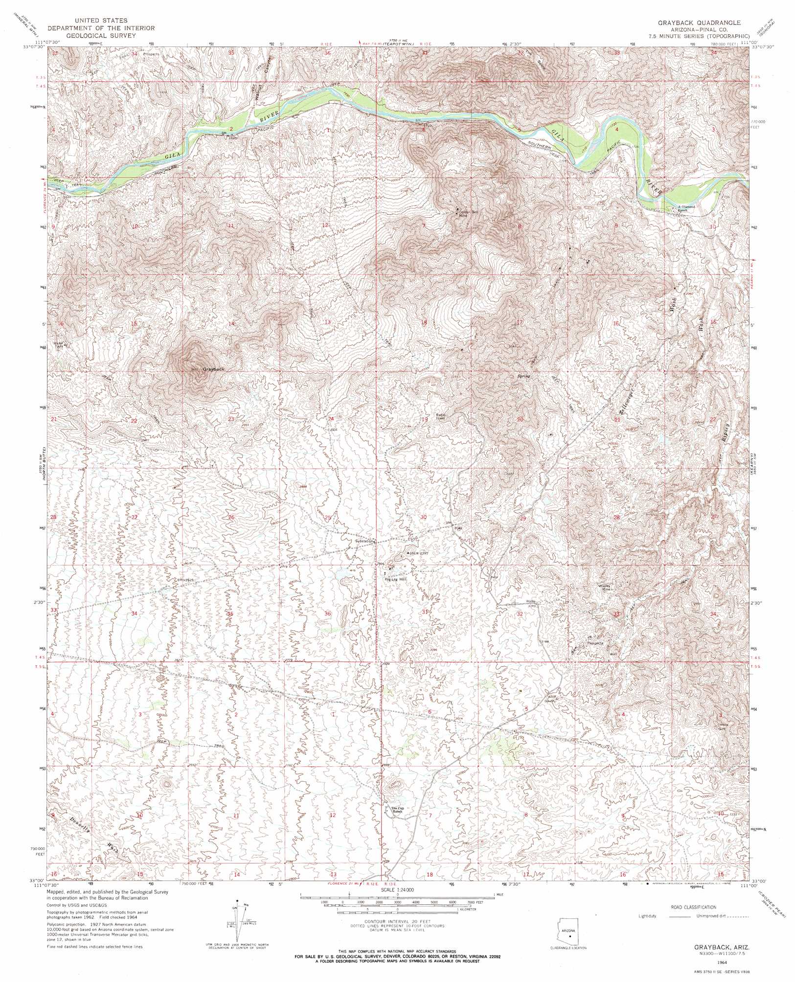
USGS Topo Quad 33111a1 - 1:24,000 scale
| Topo Map Name: | Grayback |
| USGS Topo Quad ID: | 33111a1 |
| Print Size: | ca. 21 1/4" wide x 27" high |
| Southeast Coordinates: | 33° N latitude / 111° W longitude |
| Map Center Coordinates: | 33.0625° N latitude / 111.0625° W longitude |
| U.S. State: | AZ |
| Filename: | o33111a1.jpg |
| Download Map JPG Image: | Grayback topo map 1:24,000 scale |
| Map Type: | Topographic |
| Topo Series: | 7.5´ |
| Map Scale: | 1:24,000 |
| Source of Map Images: | United States Geological Survey (USGS) |
| Alternate Map Versions: |
Grayback AZ 1964, updated 1965 Download PDF Buy paper map Grayback AZ 1964, updated 1970 Download PDF Buy paper map Grayback AZ 1964, updated 1970 Download PDF Buy paper map Grayback AZ 2011 Download PDF Buy paper map Grayback AZ 2014 Download PDF Buy paper map |
1:24,000 Topo Quads surrounding Grayback
Florence Junction |
Picketpost Mountain |
Superior |
Pinal Ranch |
Pinal Peak |
Florence Ne |
Mineral Mountain |
Teapot Mountain |
Hot Tamale Peak |
El Capitan Mountain |
Florence Se |
North Butte |
Grayback |
Kearny |
Hayden |
Cactus Forest |
Ninetysix Hills Nw |
Ninetysix Hills Ne |
Crozier Peak |
Winkelman |
Picacho Reservoir Se |
Ninetysix Hills Sw |
Ninetysix Hills Se |
Black Mountain |
Putnam Wash |
> Back to 33111a1 at 1:100,000 scale
> Back to 33110a1 at 1:250,000 scale
> Back to U.S. Topo Maps home
Grayback topo map: Gazetteer
Grayback: Mines
Golden Bell Mine elevation 749m 2457′Wooley Mine elevation 894m 2933′
Grayback: Streams
Ripsey Wash elevation 528m 1732′Zelleweger Wash elevation 526m 1725′
Grayback: Summits
Grayback elevation 1086m 3562′Grayback: Valleys
Walnut Canyon elevation 511m 1676′Grayback: Wells
Peg Leg Well elevation 897m 2942′Grayback digital topo map on disk
Buy this Grayback topo map showing relief, roads, GPS coordinates and other geographical features, as a high-resolution digital map file on DVD: