Sacaton Ne Topo Map Arizona
To zoom in, hover over the map of Sacaton Ne
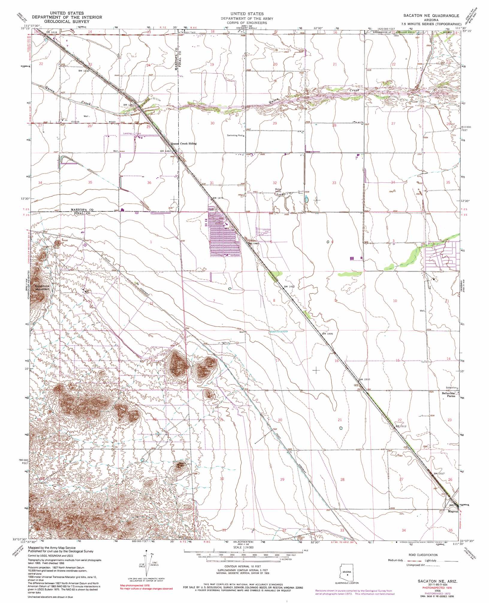
USGS Topo Quad 33111b5 - 1:24,000 scale
| Topo Map Name: | Sacaton Ne |
| USGS Topo Quad ID: | 33111b5 |
| Print Size: | ca. 21 1/4" wide x 27" high |
| Southeast Coordinates: | 33.125° N latitude / 111.5° W longitude |
| Map Center Coordinates: | 33.1875° N latitude / 111.5625° W longitude |
| U.S. State: | AZ |
| Filename: | o33111b5.jpg |
| Download Map JPG Image: | Sacaton Ne topo map 1:24,000 scale |
| Map Type: | Topographic |
| Topo Series: | 7.5´ |
| Map Scale: | 1:24,000 |
| Source of Map Images: | United States Geological Survey (USGS) |
| Alternate Map Versions: |
Sacaton NE AZ 1956, updated 1959 Download PDF Buy paper map Sacaton NE AZ 1956, updated 1959 Download PDF Buy paper map Sacaton NE AZ 1956, updated 1975 Download PDF Buy paper map Sacaton NE AZ 1956, updated 1991 Download PDF Buy paper map Sacaton NE AZ 1971, updated 1972 Download PDF Buy paper map Sacaton NE AZ 2011 Download PDF Buy paper map Sacaton NE AZ 2014 Download PDF Buy paper map |
1:24,000 Topo Quads surrounding Sacaton Ne
Mesa |
Buckhorn |
Apache Junction |
Goldfield |
Weavers Needle |
Chandler |
Higley |
Desert Well |
Superstition Mountains Sw |
Florence Junction |
Gila Butte |
Chandler Heights |
Sacaton Ne |
Magma |
Florence Ne |
Gila Butte Se |
Sacaton |
Blackwater |
Florence |
Florence Se |
Casa Grande West |
Casa Crande East |
Coolidge |
Valley Farms |
Cactus Forest |
> Back to 33111a1 at 1:100,000 scale
> Back to 33110a1 at 1:250,000 scale
> Back to U.S. Topo Maps home
Sacaton Ne topo map: Gazetteer
Sacaton Ne: Airports
Ray Schnepf Ranch Airport elevation 442m 1450′Sacaton Ne: Populated Places
San Tan Valley elevation 462m 1515′Sacaton Ne digital topo map on disk
Buy this Sacaton Ne topo map showing relief, roads, GPS coordinates and other geographical features, as a high-resolution digital map file on DVD: