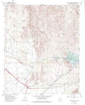
Florence Junction Topo Map Arizona
To zoom in, hover over the map of Florence Junction
USGS Topo Quad 33111c3 - 1:24,000 scale
| Topo Map Name: | Florence Junction |
| USGS Topo Quad ID: | 33111c3 |
| Print Size: | ca. 21 1/4" wide x 27" high |
| Southeast Coordinates: | 33.25° N latitude / 111.25° W longitude |
| Map Center Coordinates: | 33.3125° N latitude / 111.3125° W longitude |
| U.S. State: | AZ |
| Filename: | o33111c3.jpg |
| Download Map JPG Image: | Florence Junction topo map 1:24,000 scale |
| Map Type: | Topographic |
| Topo Series: | 7.5´ |
| Map Scale: | 1:24,000 |
| Source of Map Images: | United States Geological Survey (USGS) |
| Alternate Map Versions: |
Florence Junction AZ 1966, updated 1970 Download PDF Buy paper map Florence Junction AZ 1966, updated 1976 Download PDF Buy paper map Florence Junction AZ 1966, updated 1976 Download PDF Buy paper map Florence Junction AZ 2004, updated 2007 Download PDF Buy paper map Florence Junction AZ 2011 Download PDF Buy paper map Florence Junction AZ 2014 Download PDF Buy paper map |
| FStopo: | US Forest Service topo Florence Junction is available: Download FStopo PDF Download FStopo TIF |
1:24,000 Topo Quads surrounding Florence Junction
> Back to 33111a1 at 1:100,000 scale
> Back to 33110a1 at 1:250,000 scale
> Back to U.S. Topo Maps home
Florence Junction topo map: Gazetteer
Florence Junction: Airports
Florence Junction Airport elevation 568m 1863′Florence Junction: Cliffs
Black Point elevation 730m 2395′Florence Junction: Dams
Whitlow Ranch Dam elevation 665m 2181′Florence Junction: Populated Places
Florence Junction elevation 574m 1883′Gold Camp elevation 604m 1981′
Queen Valley elevation 621m 2037′
Smelter Town elevation 649m 2129′
Florence Junction: Reservoirs
Apache Land Tank elevation 604m 1981′Dons Tank elevation 601m 1971′
Dry Tank elevation 629m 2063′
Hardt Tank elevation 819m 2687′
Junction Tank elevation 580m 1902′
Queen Creek Tank elevation 586m 1922′
Upper Tank elevation 634m 2080′
West Tank elevation 598m 1961′
Whitlow Ranch Flood Control Basin elevation 658m 2158′
Whitlow Tank elevation 628m 2060′
Florence Junction: Springs
Peacock Spring elevation 850m 2788′Florence Junction: Streams
Milk Ranch Creek elevation 708m 2322′Florence Junction: Summits
Comet Peak elevation 814m 2670′Conley Points elevation 592m 1942′
Dromedary Peak elevation 917m 3008′
Elephant Butte elevation 743m 2437′
Florence Junction: Valleys
Tule Canyon elevation 639m 2096′Whitlow Canyon elevation 603m 1978′
Florence Junction digital topo map on disk
Buy this Florence Junction topo map showing relief, roads, GPS coordinates and other geographical features, as a high-resolution digital map file on DVD:


