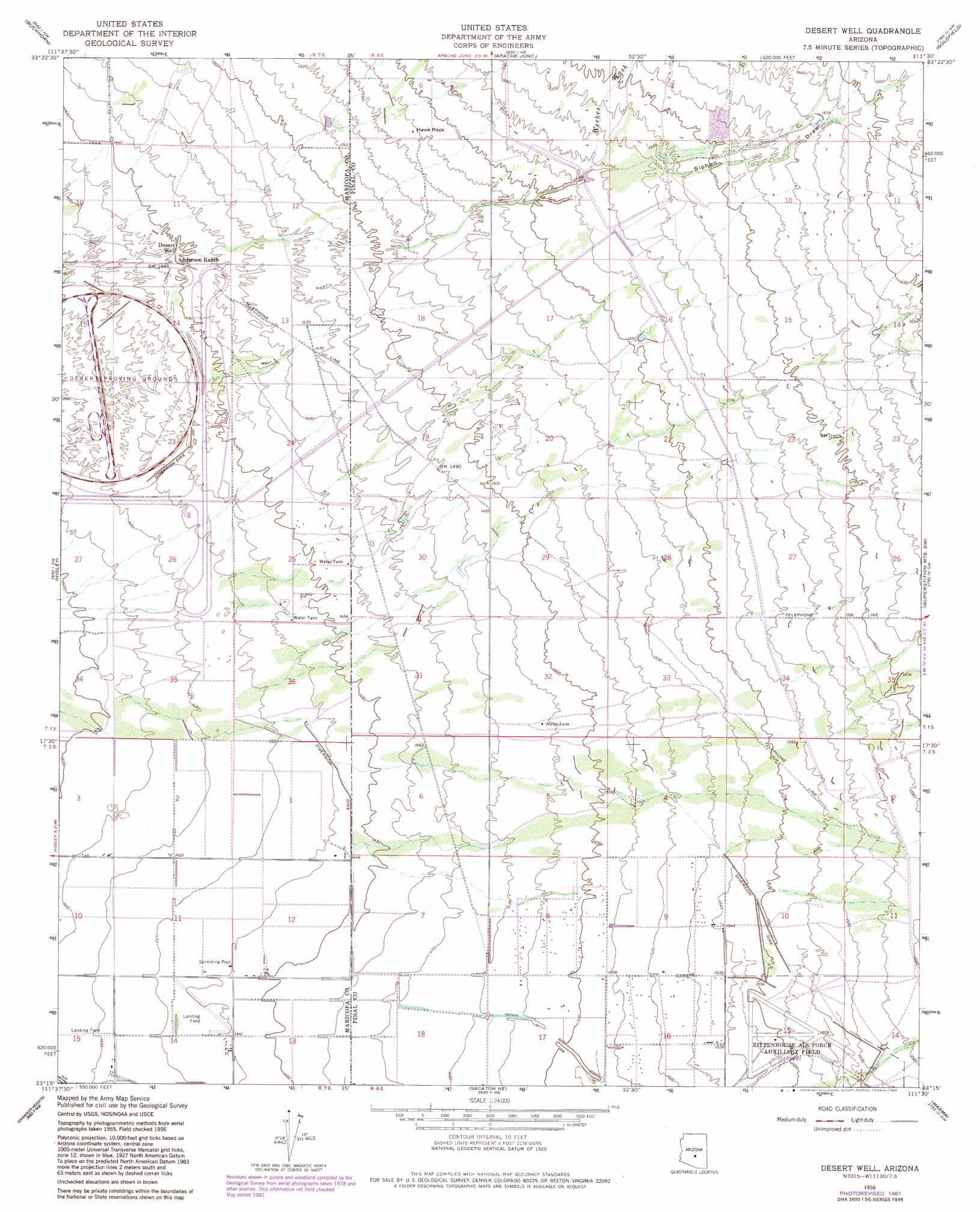
Desert Well Topo Map Arizona
To zoom in, hover over the map of Desert Well
USGS Topo Quad 33111c5 - 1:24,000 scale
| Topo Map Name: | Desert Well |
| USGS Topo Quad ID: | 33111c5 |
| Print Size: | ca. 21 1/4" wide x 27" high |
| Southeast Coordinates: | 33.25° N latitude / 111.5° W longitude |
| Map Center Coordinates: | 33.3125° N latitude / 111.5625° W longitude |
| U.S. State: | AZ |
| Filename: | o33111c5.jpg |
| Download Map JPG Image: | Desert Well topo map 1:24,000 scale |
| Map Type: | Topographic |
| Topo Series: | 7.5´ |
| Map Scale: | 1:24,000 |
| Source of Map Images: | United States Geological Survey (USGS) |
| Alternate Map Versions: |
Desert Well AZ 1956, updated 1959 Download PDF Buy paper map Desert Well AZ 1956, updated 1967 Download PDF Buy paper map Desert Well AZ 1956, updated 1975 Download PDF Buy paper map Desert Well AZ 1956, updated 1982 Download PDF Buy paper map Desert Well AZ 1971, updated 1972 Download PDF Buy paper map Desert Well AZ 2011 Download PDF Buy paper map Desert Well AZ 2014 Download PDF Buy paper map |
1:24,000 Topo Quads surrounding Desert Well
Sawik Mountain |
Granite Reef Dam |
Stewart Mountain |
Mormon Flat Dam |
Horse Mesa Dam |
Mesa |
Buckhorn |
Apache Junction |
Goldfield |
Weavers Needle |
Chandler |
Higley |
Desert Well |
Superstition Mountains Sw |
Florence Junction |
Gila Butte |
Chandler Heights |
Sacaton Ne |
Magma |
Florence Ne |
Gila Butte Se |
Sacaton |
Blackwater |
Florence |
Florence Se |
> Back to 33111a1 at 1:100,000 scale
> Back to 33110a1 at 1:250,000 scale
> Back to U.S. Topo Maps home
Desert Well topo map: Gazetteer
Desert Well: Airports
Womack Airport elevation 474m 1555′Womack Airstrip elevation 475m 1558′
Desert Well: Dams
Powerline Dam elevation 481m 1578′Rittenhouse Dam elevation 485m 1591′
Vineyard Road Dam elevation 476m 1561′
Desert Well: Pillars
Hawk Rock elevation 469m 1538′Desert Well: Streams
Weekes Wash elevation 478m 1568′Desert Well: Valleys
Siphon Draw elevation 462m 1515′Desert Well: Wells
Desert Well elevation 442m 1450′Desert Well digital topo map on disk
Buy this Desert Well topo map showing relief, roads, GPS coordinates and other geographical features, as a high-resolution digital map file on DVD: