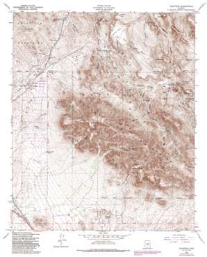
Goldfield Topo Map Arizona
To zoom in, hover over the map of Goldfield
USGS Topo Quad 33111d4 - 1:24,000 scale
| Topo Map Name: | Goldfield |
| USGS Topo Quad ID: | 33111d4 |
| Print Size: | ca. 21 1/4" wide x 27" high |
| Southeast Coordinates: | 33.375° N latitude / 111.375° W longitude |
| Map Center Coordinates: | 33.4375° N latitude / 111.4375° W longitude |
| U.S. State: | AZ |
| Filename: | o33111d4.jpg |
| Download Map JPG Image: | Goldfield topo map 1:24,000 scale |
| Map Type: | Topographic |
| Topo Series: | 7.5´ |
| Map Scale: | 1:24,000 |
| Source of Map Images: | United States Geological Survey (USGS) |
| Alternate Map Versions: |
Goldfield AZ 1956, updated 1959 Download PDF Buy paper map Goldfield AZ 1956, updated 1963 Download PDF Buy paper map Goldfield AZ 1956, updated 1973 Download PDF Buy paper map Goldfield AZ 1956, updated 1982 Download PDF Buy paper map Goldfield AZ 1956, updated 1986 Download PDF Buy paper map Goldfield AZ 2004, updated 2007 Download PDF Buy paper map Goldfield AZ 2011 Download PDF Buy paper map Goldfield AZ 2014 Download PDF Buy paper map |
| FStopo: | US Forest Service topo Goldfield is available: Download FStopo PDF Download FStopo TIF |
1:24,000 Topo Quads surrounding Goldfield
> Back to 33111a1 at 1:100,000 scale
> Back to 33110a1 at 1:250,000 scale
> Back to U.S. Topo Maps home
Goldfield topo map: Gazetteer
Goldfield: Areas
Massacre Grounds elevation 862m 2828′Goldfield: Flats
Garden Valley elevation 733m 2404′Goldfield: Gaps
Bull Pass elevation 821m 2693′Parker Pass elevation 796m 2611′
Tims Saddle elevation 835m 2739′
Upper Black Top Mesa Pass elevation 856m 2808′
Goldfield: Mines
Black Queen Mine elevation 629m 2063′Bluebird Mine elevation 619m 2030′
Golden Hillside Mines elevation 646m 2119′
Goldfield Mine elevation 617m 2024′
Palmer Mine elevation 734m 2408′
Tomahawk Mine elevation 685m 2247′
Goldfield: Parks
Lost Dutchman State Park elevation 628m 2060′Goldfield: Populated Places
Youngberg elevation 617m 2024′Goldfield: Post Offices
Youngberg Post Office (historical) elevation 617m 2024′Goldfield: Springs
Hackberry Spring elevation 665m 2181′Hieroglyphic Spring elevation 848m 2782′
Second Water Spring elevation 623m 2043′
Willow Spring elevation 871m 2857′
Goldfield: Summits
Battleship Mountain elevation 836m 2742′Black Mesa elevation 865m 2837′
Black Top Mesa elevation 1024m 3359′
Hackberry Mesa elevation 820m 2690′
La Barge Mountain elevation 1535m 5036′
Palomino Mountain elevation 886m 2906′
Red Hills elevation 824m 2703′
Superstition Mountain elevation 1535m 5036′
Superstition Mountains elevation 1398m 4586′
Superstition Peak elevation 1535m 5036′
The Flatiron elevation 1419m 4655′
Yellow Peak elevation 928m 3044′
Goldfield: Trails
Black Mesa Trail elevation 773m 2536′Boulder Trail elevation 626m 2053′
Charlebois Trail elevation 736m 2414′
East Boulder Trail elevation 757m 2483′
Garden Valley Trail elevation 728m 2388′
Needle Cutoff Trail elevation 828m 2716′
Quarter Circle U Trail elevation 829m 2719′
Red Hills Trail elevation 715m 2345′
Second Water Trail elevation 731m 2398′
West Boulder Trail elevation 854m 2801′
Goldfield: Valleys
East Boulder Canyon elevation 680m 2230′Hieroglyphic Canyon elevation 700m 2296′
Hog Canyon elevation 714m 2342′
Little Boulder Canyon elevation 686m 2250′
Monument Canyon elevation 730m 2395′
Needle Canyon elevation 659m 2162′
O'Grady Canyon elevation 724m 2375′
Old West Boulder Canyon elevation 786m 2578′
Second Water Canyon elevation 615m 2017′
West Boulder Canyon elevation 680m 2230′
Goldfield: Wells
Government Well elevation 647m 2122′Goldfield digital topo map on disk
Buy this Goldfield topo map showing relief, roads, GPS coordinates and other geographical features, as a high-resolution digital map file on DVD:


