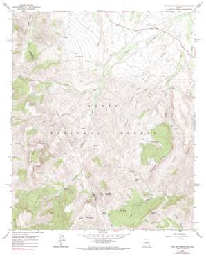
Two Bar Mountain Topo Map Arizona
To zoom in, hover over the map of Two Bar Mountain
USGS Topo Quad 33111e1 - 1:24,000 scale
| Topo Map Name: | Two Bar Mountain |
| USGS Topo Quad ID: | 33111e1 |
| Print Size: | ca. 21 1/4" wide x 27" high |
| Southeast Coordinates: | 33.5° N latitude / 111° W longitude |
| Map Center Coordinates: | 33.5625° N latitude / 111.0625° W longitude |
| U.S. State: | AZ |
| Filename: | o33111e1.jpg |
| Download Map JPG Image: | Two Bar Mountain topo map 1:24,000 scale |
| Map Type: | Topographic |
| Topo Series: | 7.5´ |
| Map Scale: | 1:24,000 |
| Source of Map Images: | United States Geological Survey (USGS) |
| Alternate Map Versions: |
Two Bar Mountain AZ 1964, updated 1965 Download PDF Buy paper map Two Bar Mountain AZ 1964, updated 1973 Download PDF Buy paper map Two Bar Mountain AZ 1964, updated 1990 Download PDF Buy paper map Two Bar Mountain AZ 2004, updated 2007 Download PDF Buy paper map Two Bar Mountain AZ 2011 Download PDF Buy paper map Two Bar Mountain AZ 2014 Download PDF Buy paper map |
| FStopo: | US Forest Service topo Two Bar Mountain is available: Download FStopo PDF Download FStopo TIF |
1:24,000 Topo Quads surrounding Two Bar Mountain
> Back to 33111e1 at 1:100,000 scale
> Back to 33110a1 at 1:250,000 scale
> Back to U.S. Topo Maps home
Two Bar Mountain topo map: Gazetteer
Two Bar Mountain: Gaps
Gunsight Gap elevation 1219m 3999′Reavis Gap elevation 1469m 4819′
Two Bar Mountain: Populated Places
Roosevelt Lake Estates elevation 671m 2201′Two Bar Mountain: Reservoirs
Bobcat Tank Number Two elevation 780m 2559′Charlie Tank elevation 960m 3149′
Cholla Tank elevation 762m 2500′
East Tank elevation 817m 2680′
Granite Tank elevation 979m 3211′
Henderson Tank elevation 810m 2657′
Lower H N Trough elevation 805m 2641′
Schoolhouse Tank elevation 871m 2857′
Substitute Tank elevation 773m 2536′
Top Tank elevation 1160m 3805′
Tule Tank elevation 1220m 4002′
Two Bar Mountain: Ridges
Nonesuch Rocks elevation 1360m 4461′Two Bar Mountain: Springs
Blackberry Spring elevation 939m 3080′Brushy Basin Spring elevation 1141m 3743′
Bull Canyon Spring elevation 1079m 3540′
Cane Spring elevation 1011m 3316′
Cedar Spring elevation 1046m 3431′
Centipede Spring elevation 954m 3129′
Cottonwood Spring elevation 1061m 3480′
Gans Hole Spring elevation 952m 3123′
Hackberry Spring elevation 1070m 3510′
Horrell Spring elevation 891m 2923′
Lily Hole Spring elevation 1390m 4560′
Monkey Spring elevation 1511m 4957′
Mud Spring elevation 1198m 3930′
Nonesuch Spring elevation 1066m 3497′
Swede Spring elevation 1273m 4176′
Tule Spring elevation 1008m 3307′
Upper Two Bar Spring elevation 1366m 4481′
Willow Spring elevation 1305m 4281′
Two Bar Mountain: Streams
Campaign Creek elevation 667m 2188′Spring Creek elevation 677m 2221′
Two Bar Mountain: Summits
Apache Hill elevation 1374m 4507′Black Mountain elevation 1539m 5049′
Granite Mountain elevation 1550m 5085′
Two Bar Mountain elevation 1585m 5200′
Two Bar Mountain: Valleys
Tule Canyon elevation 806m 2644′Two Bar Canyon elevation 826m 2709′
Wildcat Canyon elevation 756m 2480′
Two Bar Mountain: Wells
Campaign Well elevation 725m 2378′Double Corral Trough elevation 947m 3106′
Two Bar Mountain digital topo map on disk
Buy this Two Bar Mountain topo map showing relief, roads, GPS coordinates and other geographical features, as a high-resolution digital map file on DVD:


