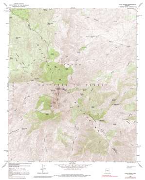
Four Peaks Topo Map Arizona
To zoom in, hover over the map of Four Peaks
USGS Topo Quad 33111f3 - 1:24,000 scale
| Topo Map Name: | Four Peaks |
| USGS Topo Quad ID: | 33111f3 |
| Print Size: | ca. 21 1/4" wide x 27" high |
| Southeast Coordinates: | 33.625° N latitude / 111.25° W longitude |
| Map Center Coordinates: | 33.6875° N latitude / 111.3125° W longitude |
| U.S. State: | AZ |
| Filename: | o33111f3.jpg |
| Download Map JPG Image: | Four Peaks topo map 1:24,000 scale |
| Map Type: | Topographic |
| Topo Series: | 7.5´ |
| Map Scale: | 1:24,000 |
| Source of Map Images: | United States Geological Survey (USGS) |
| Alternate Map Versions: |
Four Peaks AZ 1964, updated 1965 Download PDF Buy paper map Four Peaks AZ 1964, updated 1969 Download PDF Buy paper map Four Peaks AZ 1964, updated 1981 Download PDF Buy paper map Four Peaks AZ 1964, updated 1986 Download PDF Buy paper map Four Peaks AZ 1964, updated 1992 Download PDF Buy paper map Four Peaks AZ 2004, updated 2007 Download PDF Buy paper map Four Peaks AZ 2011 Download PDF Buy paper map Four Peaks AZ 2014 Download PDF Buy paper map |
| FStopo: | US Forest Service topo Four Peaks is available: Download FStopo PDF Download FStopo TIF |
1:24,000 Topo Quads surrounding Four Peaks
> Back to 33111e1 at 1:100,000 scale
> Back to 33110a1 at 1:250,000 scale
> Back to U.S. Topo Maps home
Four Peaks topo map: Gazetteer
Four Peaks: Areas
Three Bar Watershed Research Area elevation 1097m 3599′Four Peaks: Basins
Brushy Basin elevation 1292m 4238′Four Peaks: Flats
Big Oak Flat elevation 1094m 3589′Four Peaks: Gaps
Alder Saddle elevation 1950m 6397′Big Saddle elevation 1646m 5400′
Black Bear Saddle elevation 1578m 5177′
Lone Pine Saddle elevation 1846m 6056′
Four Peaks: Mines
Amethyst Mine elevation 1965m 6446′Laubs Mine elevation 1313m 4307′
Four Peaks: Parks
Buckhorn Mountain Research Natural Area elevation 1504m 4934′Four Peaks: Ranges
Mazatzal Mountains elevation 1299m 4261′Four Peaks: Reservoirs
Water Hole Tank elevation 1516m 4973′Four Peaks: Ridges
Buckhorn Ridge elevation 1911m 6269′Four Peaks: Springs
Amethyst Spring elevation 1971m 6466′Bear Spring elevation 1716m 5629′
Black Bear Spring elevation 1472m 4829′
Browns Cabin Spring elevation 1151m 3776′
Brushy Basin Spring elevation 1503m 4931′
Camelback Spring elevation 1416m 4645′
Chillicut Spring elevation 1567m 5141′
Cienega Spring elevation 1609m 5278′
Dan Neal Spring elevation 1493m 4898′
Four Peaks Spring Number One elevation 1580m 5183′
Four Peaks Spring Number Two elevation 1845m 6053′
Fox Gulch Spring elevation 1013m 3323′
Granite Spring elevation 1633m 5357′
Jacks Spring elevation 1936m 6351′
Middle Water Spring elevation 1502m 4927′
Middle Water Spring elevation 1569m 5147′
Mud Spring elevation 1347m 4419′
Mud Spring elevation 1343m 4406′
Oak Flat Spring elevation 1176m 3858′
Pigeon Spring elevation 1671m 5482′
Shake Spring elevation 1654m 5426′
Tejanos Spring elevation 1255m 4117′
Four Peaks: Summits
Browns Peak elevation 2329m 7641′Buckhorn Mountain elevation 2006m 6581′
Camelback Peak elevation 1717m 5633′
Four Peaks elevation 2101m 6893′
Four Peaks: Trails
Alder Trail elevation 911m 2988′Baldy Trail elevation 967m 3172′
Baldy Trail elevation 1331m 4366′
Four Peaks Trail elevation 1644m 5393′
Lone Pine Trail elevation 1445m 4740′
Soldier Camp Trail elevation 1348m 4422′
Four Peaks: Valleys
Baldy Canyon elevation 824m 2703′Fox Gulch elevation 962m 3156′
Four Peaks digital topo map on disk
Buy this Four Peaks topo map showing relief, roads, GPS coordinates and other geographical features, as a high-resolution digital map file on DVD:


