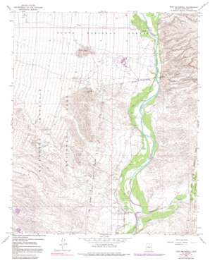
Fort Mcdowell Topo Map Arizona
To zoom in, hover over the map of Fort Mcdowell
USGS Topo Quad 33111f6 - 1:24,000 scale
| Topo Map Name: | Fort Mcdowell |
| USGS Topo Quad ID: | 33111f6 |
| Print Size: | ca. 21 1/4" wide x 27" high |
| Southeast Coordinates: | 33.625° N latitude / 111.625° W longitude |
| Map Center Coordinates: | 33.6875° N latitude / 111.6875° W longitude |
| U.S. State: | AZ |
| Filename: | o33111f6.jpg |
| Download Map JPG Image: | Fort Mcdowell topo map 1:24,000 scale |
| Map Type: | Topographic |
| Topo Series: | 7.5´ |
| Map Scale: | 1:24,000 |
| Source of Map Images: | United States Geological Survey (USGS) |
| Alternate Map Versions: |
Fort McDowell AZ 1964, updated 1965 Download PDF Buy paper map Fort McDowell AZ 1964, updated 1972 Download PDF Buy paper map Fort McDowell AZ 1964, updated 1977 Download PDF Buy paper map Fort McDowell AZ 1964, updated 1991 Download PDF Buy paper map Fort McDowell AZ 1971, updated 1972 Download PDF Buy paper map Fort McDowell AZ 2004, updated 2007 Download PDF Buy paper map Fort McDowell AZ 2011 Download PDF Buy paper map Fort McDowell AZ 2014 Download PDF Buy paper map |
| FStopo: | US Forest Service topo Fort McDowell is available: Download FStopo PDF Download FStopo TIF |
1:24,000 Topo Quads surrounding Fort Mcdowell
> Back to 33111e1 at 1:100,000 scale
> Back to 33110a1 at 1:250,000 scale
> Back to U.S. Topo Maps home
Fort Mcdowell topo map: Gazetteer
Fort Mcdowell: Canals
Jones Ditch elevation 446m 1463′Fort Mcdowell: Dams
Fountain Hills Dam Number Six elevation 557m 1827′Fountain Hills Dam Number Thirty Six elevation 572m 1876′
Fort Mcdowell: Parks
McDowell Mountain Regional Park elevation 573m 1879′Fort Mcdowell: Populated Places
Fort McDowell elevation 439m 1440′Rio Verde elevation 493m 1617′
Rio Verde Estates elevation 494m 1620′
Fort Mcdowell: Streams
Sycamore Creek elevation 427m 1400′Fort Mcdowell: Summits
Asher Hills elevation 614m 2014′Lousley Hill elevation 614m 2014′
Fort Mcdowell: Valleys
Malpais Canyon elevation 456m 1496′Fort Mcdowell digital topo map on disk
Buy this Fort Mcdowell topo map showing relief, roads, GPS coordinates and other geographical features, as a high-resolution digital map file on DVD:


