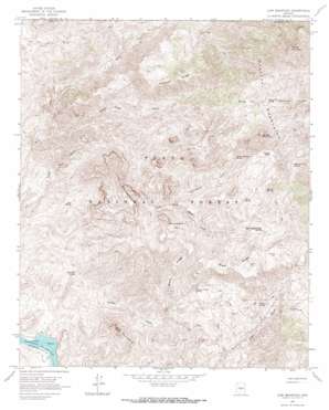
Lion Mountain Topo Map Arizona
To zoom in, hover over the map of Lion Mountain
USGS Topo Quad 33111h5 - 1:24,000 scale
| Topo Map Name: | Lion Mountain |
| USGS Topo Quad ID: | 33111h5 |
| Print Size: | ca. 21 1/4" wide x 27" high |
| Southeast Coordinates: | 33.875° N latitude / 111.5° W longitude |
| Map Center Coordinates: | 33.9375° N latitude / 111.5625° W longitude |
| U.S. State: | AZ |
| Filename: | o33111h5.jpg |
| Download Map JPG Image: | Lion Mountain topo map 1:24,000 scale |
| Map Type: | Topographic |
| Topo Series: | 7.5´ |
| Map Scale: | 1:24,000 |
| Source of Map Images: | United States Geological Survey (USGS) |
| Alternate Map Versions: |
Lion Mountain AZ 1964, updated 1965 Download PDF Buy paper map Lion Mountain AZ 1964, updated 1968 Download PDF Buy paper map Lion Mountain AZ 1964, updated 1968 Download PDF Buy paper map Lion Mountain AZ 2004, updated 2006 Download PDF Buy paper map Lion Mountain AZ 2011 Download PDF Buy paper map Lion Mountain AZ 2014 Download PDF Buy paper map |
| FStopo: | US Forest Service topo Lion Mountain is available: Download FStopo PDF Download FStopo TIF |
1:24,000 Topo Quads surrounding Lion Mountain
> Back to 33111e1 at 1:100,000 scale
> Back to 33110a1 at 1:250,000 scale
> Back to U.S. Topo Maps home
Lion Mountain topo map: Gazetteer
Lion Mountain: Bays
Cat Bay elevation 533m 1748′Lion Mountain: Flats
Potato Patch elevation 1632m 5354′Squaw Flat elevation 1638m 5374′
Tournament Flat elevation 1251m 4104′
Lion Mountain: Mines
Story Mine elevation 1589m 5213′Lion Mountain: Reservoirs
Brunson Tank elevation 1482m 4862′Chalk Tank elevation 1022m 3353′
Copper Tank elevation 910m 2985′
Dry Lake Tank elevation 1145m 3756′
Sparks Tank elevation 1437m 4714′
Lion Mountain: Ridges
Black Ridge elevation 1438m 4717′Cypress Ridge elevation 1583m 5193′
Lion Mountain: Springs
Alder Creek Spring elevation 1158m 3799′Alder Spring elevation 1177m 3861′
Brush Spring elevation 1325m 4347′
Canyon Creek Spring elevation 1074m 3523′
Chalk Spring elevation 1404m 4606′
Chalk Spring Number Two elevation 1299m 4261′
Cholla Spring elevation 772m 2532′
Corral Water Spring elevation 965m 3166′
Dripping Spring elevation 781m 2562′
Dripping Spring Number Two elevation 846m 2775′
Jack Spring elevation 786m 2578′
Lizard Spring elevation 1089m 3572′
Lower Sheep Spring elevation 1152m 3779′
Marion Spring elevation 1467m 4812′
Marion Spring Number One elevation 1478m 4849′
Middle Water elevation 934m 3064′
Mormon Grove Spring elevation 1560m 5118′
Pats Shoe Spring elevation 722m 2368′
Saddle Mountain Spring elevation 1472m 4829′
Sheep Creek Seep elevation 1209m 3966′
Squaw Flat Spring elevation 1562m 5124′
Trap Spring elevation 1165m 3822′
Upper Alder Creek Spring elevation 1157m 3795′
Upper Sheep Creek Spring elevation 1314m 4311′
Walnut Spring elevation 1112m 3648′
Lion Mountain: Streams
Canyon Creek elevation 535m 1755′Copper Camp Creek elevation 728m 2388′
Tournament Creek elevation 1080m 3543′
Lion Mountain: Summits
Lion Mountain elevation 1404m 4606′S B Mountain elevation 1112m 3648′
Saddle Mountain elevation 1990m 6528′
Sheep Mountain elevation 2113m 6932′
Lion Mountain digital topo map on disk
Buy this Lion Mountain topo map showing relief, roads, GPS coordinates and other geographical features, as a high-resolution digital map file on DVD:


