Mobile Topo Map Arizona
To zoom in, hover over the map of Mobile
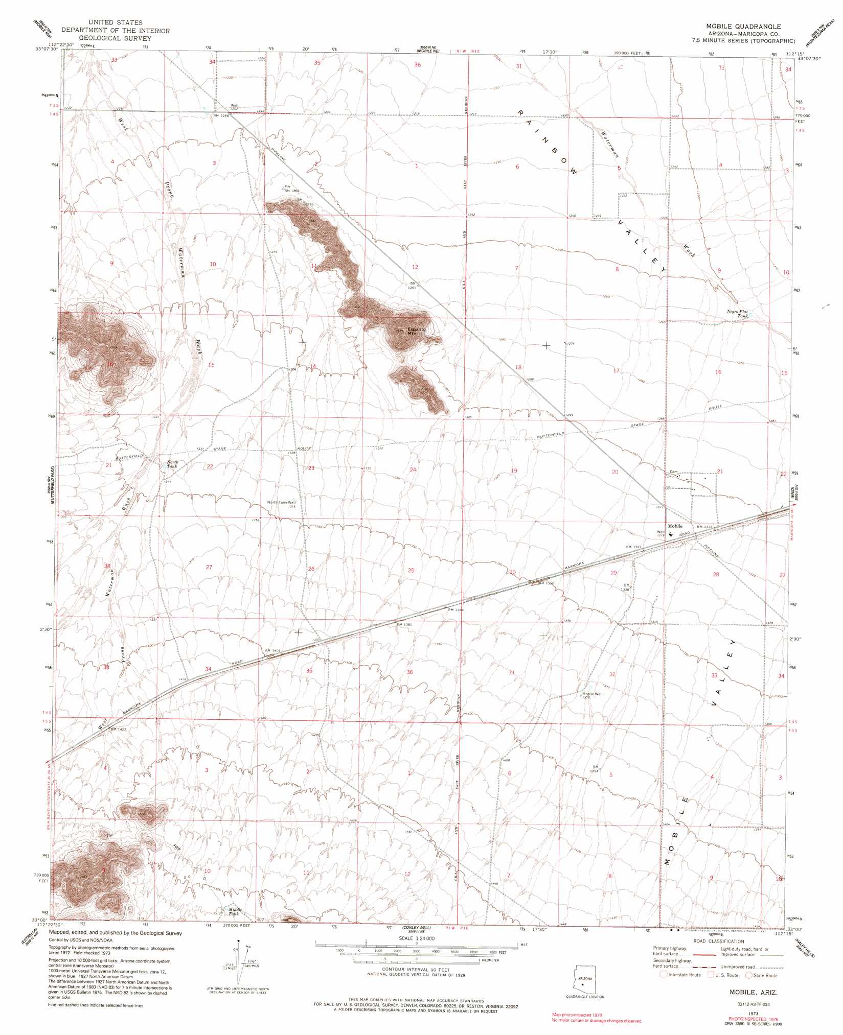
USGS Topo Quad 33112a3 - 1:24,000 scale
| Topo Map Name: | Mobile |
| USGS Topo Quad ID: | 33112a3 |
| Print Size: | ca. 21 1/4" wide x 27" high |
| Southeast Coordinates: | 33° N latitude / 112.25° W longitude |
| Map Center Coordinates: | 33.0625° N latitude / 112.3125° W longitude |
| U.S. State: | AZ |
| Filename: | o33112a3.jpg |
| Download Map JPG Image: | Mobile topo map 1:24,000 scale |
| Map Type: | Topographic |
| Topo Series: | 7.5´ |
| Map Scale: | 1:24,000 |
| Source of Map Images: | United States Geological Survey (USGS) |
| Alternate Map Versions: |
Mobile AZ 1973, updated 1976 Download PDF Buy paper map Mobile AZ 1973, updated 1991 Download PDF Buy paper map Mobile AZ 2011 Download PDF Buy paper map Mobile AZ 2014 Download PDF Buy paper map |
1:24,000 Topo Quads surrounding Mobile
Buckeye |
Avondale Sw |
Avondale Se |
Laveen |
Lone Butte |
Margies Peak |
Mobile Nw |
Mobile Ne |
Montezuma Peak |
Pima Butte |
Cotton Center Se |
Butterfield Pass |
Mobile |
Enid |
Maricopa |
Bosque |
Estrella |
Conley Well |
Haley Hills |
Antelope Peak Ne |
Blue Plateau |
Big Horn |
Lost Horse Peak |
Antelope Peak |
Indian Butte |
> Back to 33112a1 at 1:100,000 scale
> Back to 33112a1 at 1:250,000 scale
> Back to U.S. Topo Maps home
Mobile topo map: Gazetteer
Mobile: Airports
Mobile Airport elevation 381m 1250′Schu Ranch Airport elevation 429m 1407′
Mobile: Reservoirs
Middle Tank elevation 460m 1509′Negro Flat Tank elevation 384m 1259′
North Tank elevation 409m 1341′
Mobile: Summits
Espanto Mountain elevation 554m 1817′Mobile: Valleys
Mobile Valley elevation 398m 1305′Mobile: Wells
Mobile Well elevation 419m 1374′North Tank Well elevation 410m 1345′
Mobile digital topo map on disk
Buy this Mobile topo map showing relief, roads, GPS coordinates and other geographical features, as a high-resolution digital map file on DVD: