Citrus Valley West Topo Map Arizona
To zoom in, hover over the map of Citrus Valley West
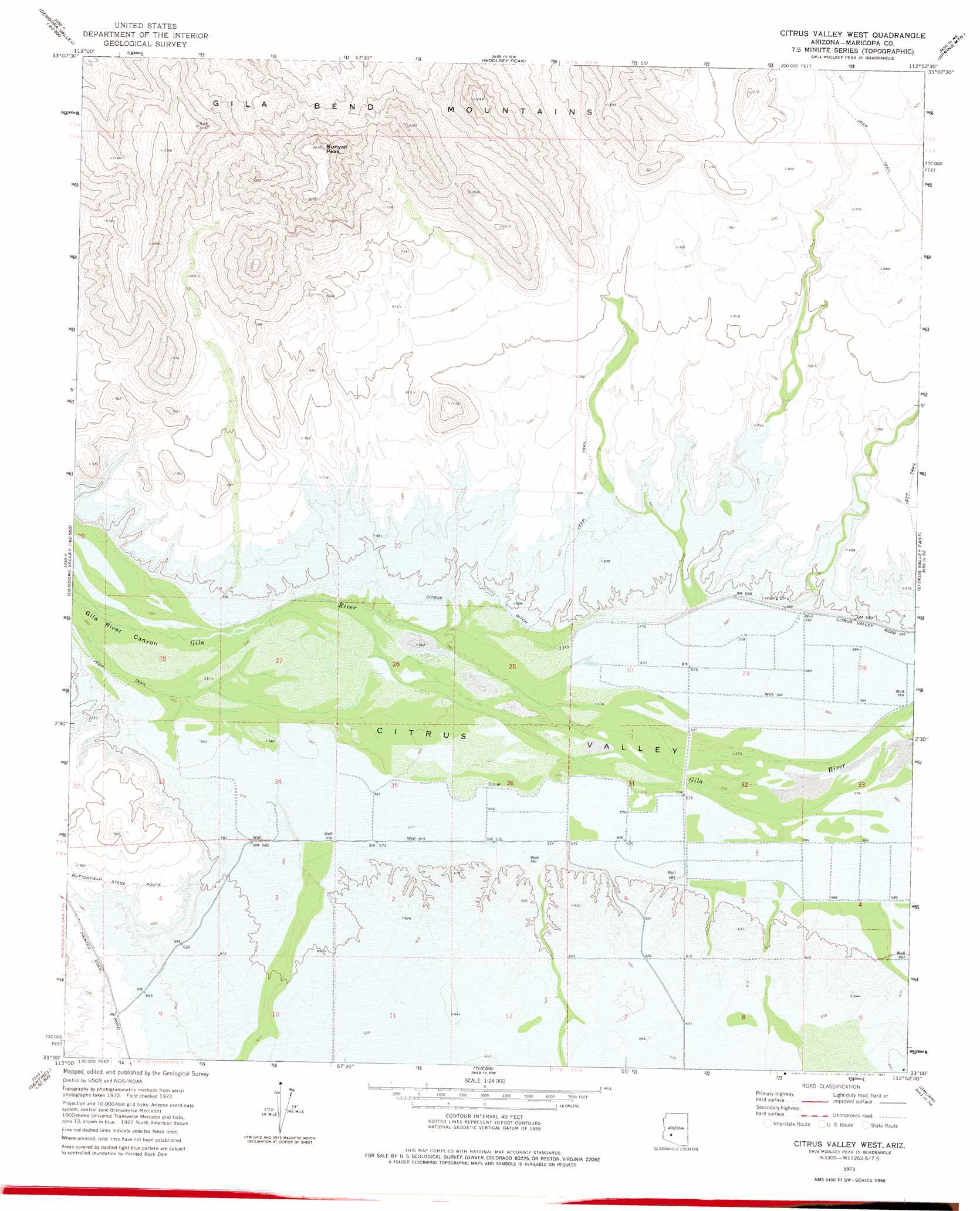
USGS Topo Quad 33112a8 - 1:24,000 scale
| Topo Map Name: | Citrus Valley West |
| USGS Topo Quad ID: | 33112a8 |
| Print Size: | ca. 21 1/4" wide x 27" high |
| Southeast Coordinates: | 33° N latitude / 112.875° W longitude |
| Map Center Coordinates: | 33.0625° N latitude / 112.9375° W longitude |
| U.S. State: | AZ |
| Filename: | o33112a8.jpg |
| Download Map JPG Image: | Citrus Valley West topo map 1:24,000 scale |
| Map Type: | Topographic |
| Topo Series: | 7.5´ |
| Map Scale: | 1:24,000 |
| Source of Map Images: | United States Geological Survey (USGS) |
| Alternate Map Versions: |
Citrus Valley West AZ 1973, updated 1977 Download PDF Buy paper map Citrus Valley West AZ 2011 Download PDF Buy paper map Citrus Valley West AZ 2014 Download PDF Buy paper map |
1:24,000 Topo Quads surrounding Citrus Valley West
Cortez Peak |
Fourth Of July Butte |
Gillespie |
Arlington |
Hassayampa |
Yellow Medicine Butte |
Quail Spring Wash |
Woolsey Peak |
Spring Mountain |
Cotton Center Nw |
Oatman Mountain |
Dendora Valley |
Citrus Valley West |
Citrus Valley East |
Cotton Center |
Sentinel Peak |
Sentinel Ne |
Theba |
Smurr |
Gila Bend |
Sentinel |
Sentinel Se |
South Of Theba |
Black Gap |
South Of Gila Bend |
> Back to 33112a1 at 1:100,000 scale
> Back to 33112a1 at 1:250,000 scale
> Back to U.S. Topo Maps home
Citrus Valley West topo map: Gazetteer
Citrus Valley West: Canals
Citrus Ditch elevation 175m 574′Citrus Valley West: Summits
Bunyan Peak elevation 726m 2381′Citrus Valley West: Valleys
Citrus Valley elevation 168m 551′Citrus Valley West: Wells
Stout Well elevation 178m 583′Citrus Valley West digital topo map on disk
Buy this Citrus Valley West topo map showing relief, roads, GPS coordinates and other geographical features, as a high-resolution digital map file on DVD: