Pima Butte Topo Map Arizona
To zoom in, hover over the map of Pima Butte
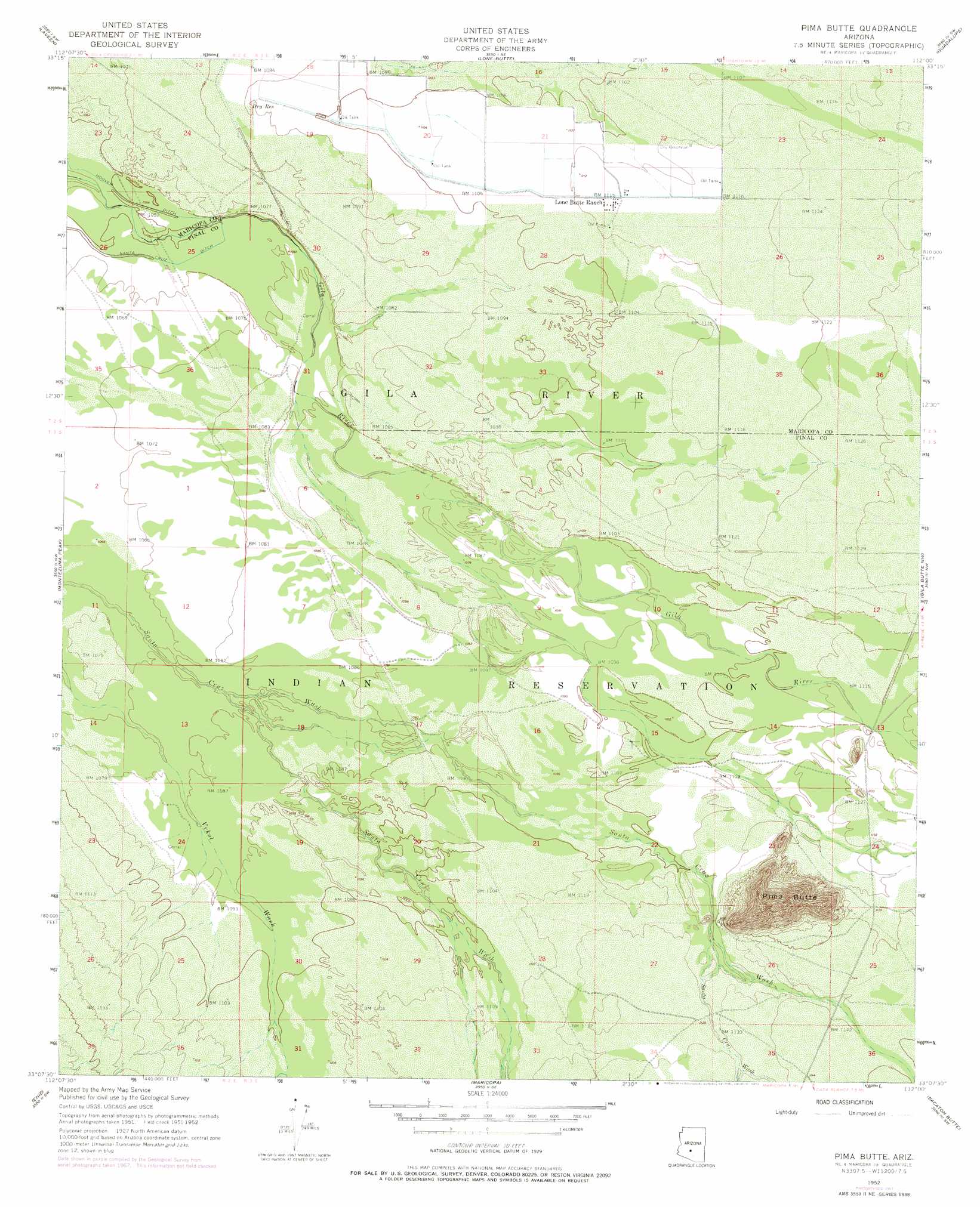
USGS Topo Quad 33112b1 - 1:24,000 scale
| Topo Map Name: | Pima Butte |
| USGS Topo Quad ID: | 33112b1 |
| Print Size: | ca. 21 1/4" wide x 27" high |
| Southeast Coordinates: | 33.125° N latitude / 112° W longitude |
| Map Center Coordinates: | 33.1875° N latitude / 112.0625° W longitude |
| U.S. State: | AZ |
| Filename: | o33112b1.jpg |
| Download Map JPG Image: | Pima Butte topo map 1:24,000 scale |
| Map Type: | Topographic |
| Topo Series: | 7.5´ |
| Map Scale: | 1:24,000 |
| Source of Map Images: | United States Geological Survey (USGS) |
| Alternate Map Versions: |
Pima Butte AZ 1952, updated 1957 Download PDF Buy paper map Pima Butte AZ 1952, updated 1968 Download PDF Buy paper map Pima Butte AZ 1952, updated 1975 Download PDF Buy paper map Pima Butte AZ 1971, updated 1972 Download PDF Buy paper map Pima Butte AZ 2011 Download PDF Buy paper map Pima Butte AZ 2014 Download PDF Buy paper map |
1:24,000 Topo Quads surrounding Pima Butte
Tolleson |
Fowler |
Phoenix |
Tempe |
Mesa |
Avondale Se |
Laveen |
Lone Butte |
Guadalupe |
Chandler |
Mobile Ne |
Montezuma Peak |
Pima Butte |
Gila Butte Nw |
Gila Butte |
Mobile |
Enid |
Maricopa |
Sacaton Butte |
Gila Butte Se |
Conley Well |
Haley Hills |
Antelope Peak Ne |
Stanfield |
Casa Grande West |
> Back to 33112a1 at 1:100,000 scale
> Back to 33112a1 at 1:250,000 scale
> Back to U.S. Topo Maps home
Pima Butte topo map: Gazetteer
Pima Butte: Populated Places
Lone Butte Ranch elevation 339m 1112′Maricopa Wells elevation 333m 1092′
Sacate elevation 333m 1092′
Pima Butte: Reservoirs
Dry Reservoir elevation 333m 1092′Pima Butte: Summits
Pima Butte elevation 506m 1660′Pima Butte digital topo map on disk
Buy this Pima Butte topo map showing relief, roads, GPS coordinates and other geographical features, as a high-resolution digital map file on DVD: