Mobile Nw Topo Map Arizona
To zoom in, hover over the map of Mobile Nw
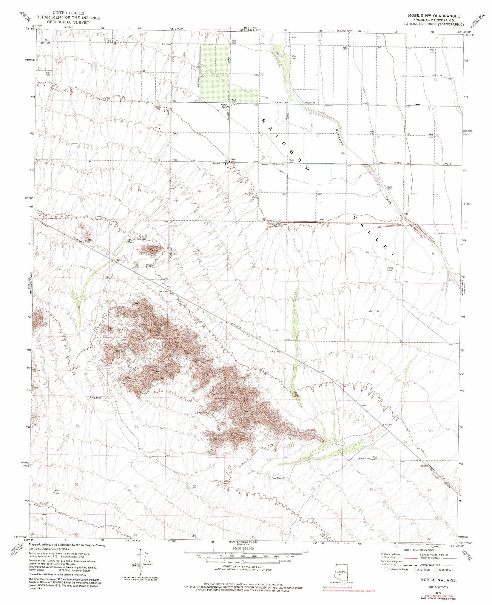
USGS Topo Quad 33112b4 - 1:24,000 scale
| Topo Map Name: | Mobile Nw |
| USGS Topo Quad ID: | 33112b4 |
| Print Size: | ca. 21 1/4" wide x 27" high |
| Southeast Coordinates: | 33.125° N latitude / 112.375° W longitude |
| Map Center Coordinates: | 33.1875° N latitude / 112.4375° W longitude |
| U.S. State: | AZ |
| Filename: | o33112b4.jpg |
| Download Map JPG Image: | Mobile Nw topo map 1:24,000 scale |
| Map Type: | Topographic |
| Topo Series: | 7.5´ |
| Map Scale: | 1:24,000 |
| Source of Map Images: | United States Geological Survey (USGS) |
| Alternate Map Versions: |
Mobile NW AZ 1973, updated 1977 Download PDF Buy paper map Mobile NW AZ 1973, updated 1991 Download PDF Buy paper map Mobile NW AZ 2011 Download PDF Buy paper map Mobile NW AZ 2014 Download PDF Buy paper map |
1:24,000 Topo Quads surrounding Mobile Nw
Buckeye Nw |
Valencia |
Perryville |
Tolleson |
Fowler |
Hassayampa |
Buckeye |
Avondale Sw |
Avondale Se |
Laveen |
Cotton Center Nw |
Margies Peak |
Mobile Nw |
Mobile Ne |
Montezuma Peak |
Cotton Center |
Cotton Center Se |
Butterfield Pass |
Mobile |
Enid |
Gila Bend |
Bosque |
Estrella |
Conley Well |
Haley Hills |
> Back to 33112a1 at 1:100,000 scale
> Back to 33112a1 at 1:250,000 scale
> Back to U.S. Topo Maps home
Mobile Nw topo map: Gazetteer
Mobile Nw: Populated Places
Rainbow Valley elevation 341m 1118′Mobile Nw: Reservoirs
Don Tank elevation 391m 1282′Plug Tank elevation 408m 1338′
West Tank elevation 369m 1210′
Youngker Tank elevation 336m 1102′
Mobile Nw digital topo map on disk
Buy this Mobile Nw topo map showing relief, roads, GPS coordinates and other geographical features, as a high-resolution digital map file on DVD: