Spring Mountain Topo Map Arizona
To zoom in, hover over the map of Spring Mountain
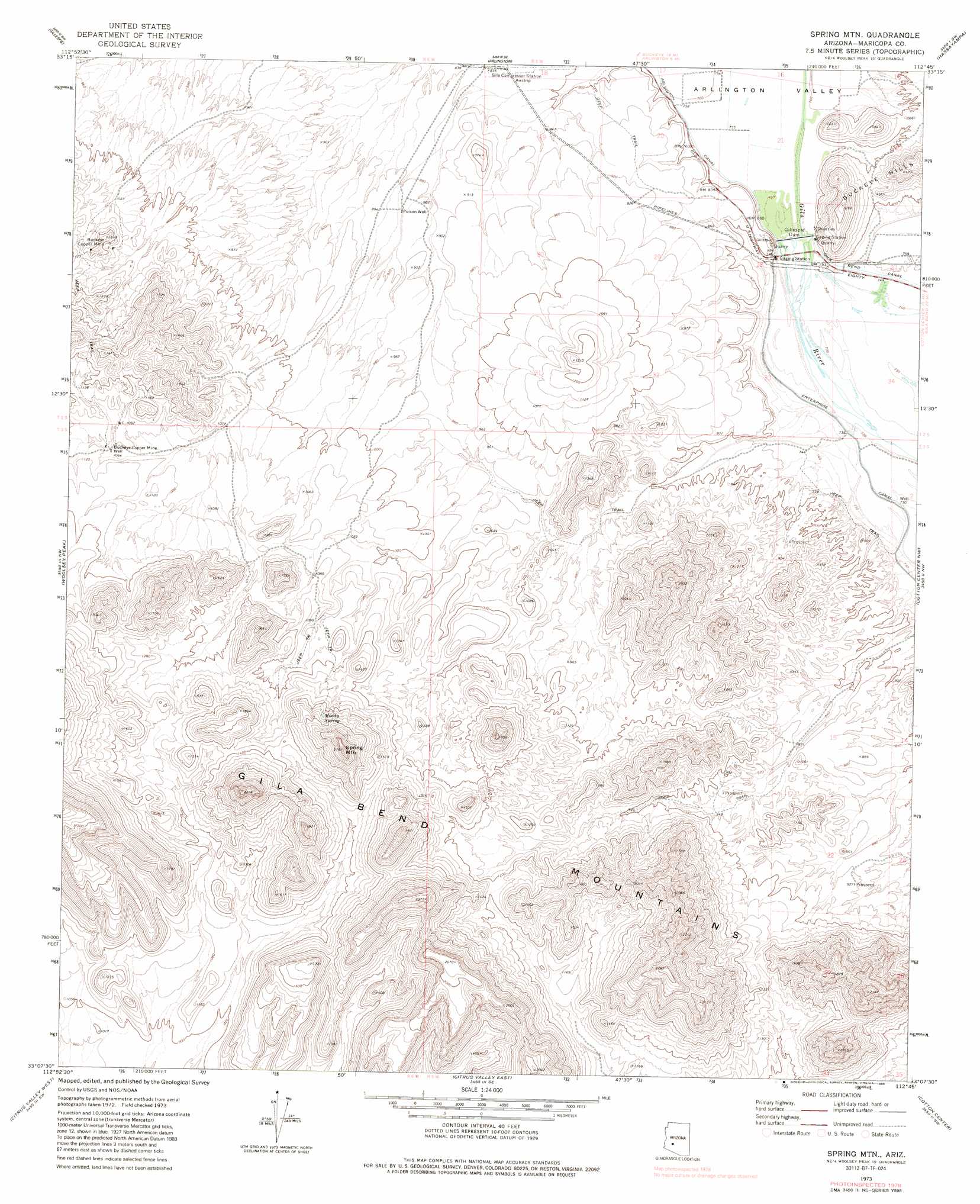
USGS Topo Quad 33112b7 - 1:24,000 scale
| Topo Map Name: | Spring Mountain |
| USGS Topo Quad ID: | 33112b7 |
| Print Size: | ca. 21 1/4" wide x 27" high |
| Southeast Coordinates: | 33.125° N latitude / 112.75° W longitude |
| Map Center Coordinates: | 33.1875° N latitude / 112.8125° W longitude |
| U.S. State: | AZ |
| Filename: | o33112b7.jpg |
| Download Map JPG Image: | Spring Mountain topo map 1:24,000 scale |
| Map Type: | Topographic |
| Topo Series: | 7.5´ |
| Map Scale: | 1:24,000 |
| Source of Map Images: | United States Geological Survey (USGS) |
| Alternate Map Versions: |
Spring Mtn. AZ 1973, updated 1976 Download PDF Buy paper map Spring Mtn. AZ 1973, updated 1986 Download PDF Buy paper map Spring Mountain AZ 2011 Download PDF Buy paper map Spring Mountain AZ 2014 Download PDF Buy paper map |
1:24,000 Topo Quads surrounding Spring Mountain
Saddle Mountain |
Tonopah |
Wintersburg |
Buckeye Nw |
Valencia |
Fourth Of July Butte |
Gillespie |
Arlington |
Hassayampa |
Buckeye |
Quail Spring Wash |
Woolsey Peak |
Spring Mountain |
Cotton Center Nw |
Margies Peak |
Dendora Valley |
Citrus Valley West |
Citrus Valley East |
Cotton Center |
Cotton Center Se |
Sentinel Ne |
Theba |
Smurr |
Gila Bend |
Bosque |
> Back to 33112a1 at 1:100,000 scale
> Back to 33112a1 at 1:250,000 scale
> Back to U.S. Topo Maps home
Spring Mountain topo map: Gazetteer
Spring Mountain: Canals
Enterprise Canal elevation 223m 731′Spring Mountain: Dams
Gillespie Dam elevation 229m 751′Spring Mountain: Mines
Buckeye Copper Mine elevation 349m 1145′Buckeye Copper Mine elevation 329m 1079′
Spring Mountain: Parks
Arlington State Wildlife Area elevation 231m 757′Spring Mountain: Springs
Moody Spring elevation 463m 1519′Spring Mountain: Summits
Spring Mountain elevation 654m 2145′Spring Mountain: Valleys
Arlington Valley elevation 228m 748′Spring Mountain: Wells
Buckeye Copper Mine Well elevation 329m 1079′Poison Well elevation 273m 895′
Spring Mountain digital topo map on disk
Buy this Spring Mountain topo map showing relief, roads, GPS coordinates and other geographical features, as a high-resolution digital map file on DVD: