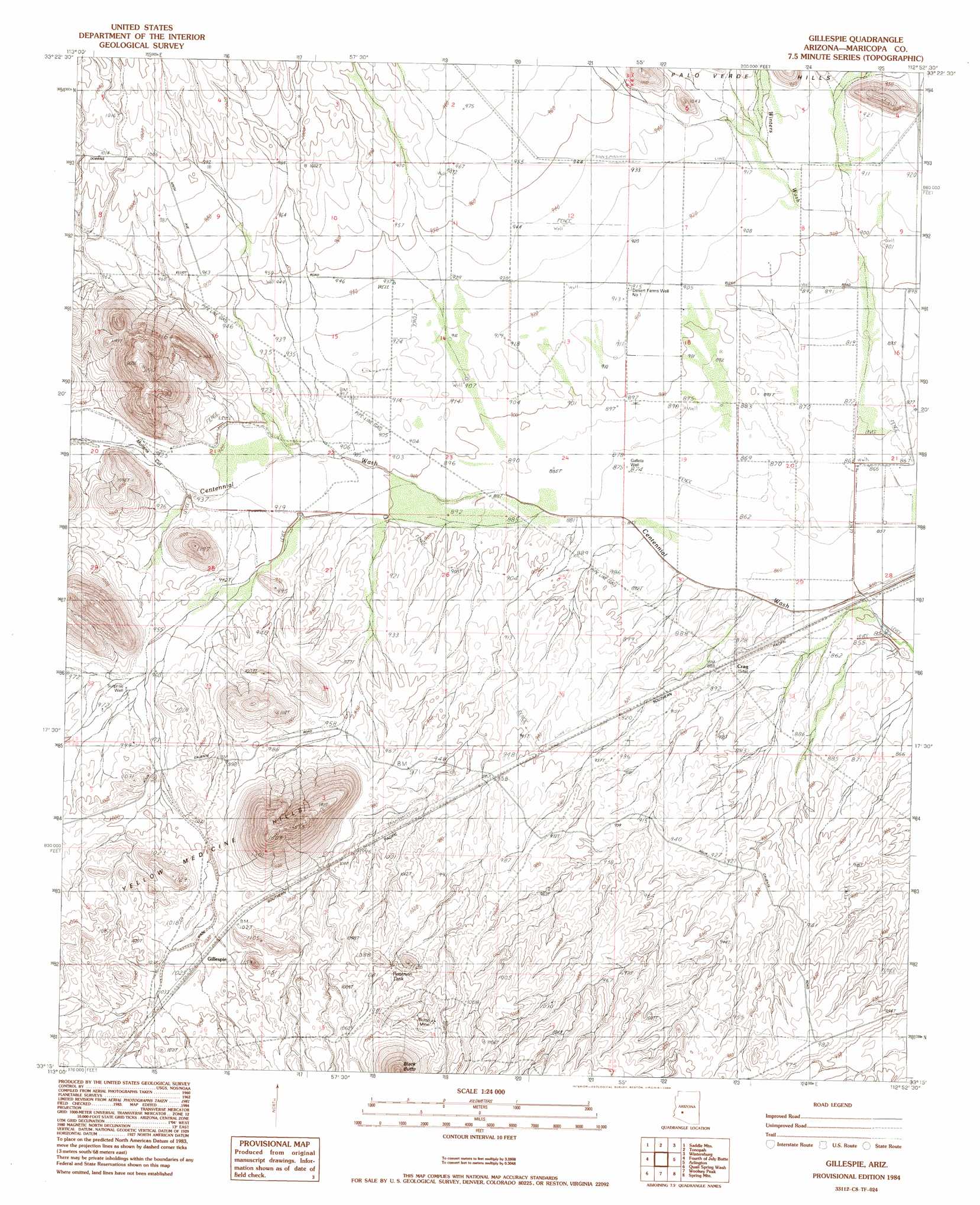
Gillespie Topo Map Arizona
To zoom in, hover over the map of Gillespie
USGS Topo Quad 33112c8 - 1:24,000 scale
| Topo Map Name: | Gillespie |
| USGS Topo Quad ID: | 33112c8 |
| Print Size: | ca. 21 1/4" wide x 27" high |
| Southeast Coordinates: | 33.25° N latitude / 112.875° W longitude |
| Map Center Coordinates: | 33.3125° N latitude / 112.9375° W longitude |
| U.S. State: | AZ |
| Filename: | o33112c8.jpg |
| Download Map JPG Image: | Gillespie topo map 1:24,000 scale |
| Map Type: | Topographic |
| Topo Series: | 7.5´ |
| Map Scale: | 1:24,000 |
| Source of Map Images: | United States Geological Survey (USGS) |
| Alternate Map Versions: |
Gillespie AZ 1984, updated 1984 Download PDF Buy paper map Gillespie AZ 2011 Download PDF Buy paper map Gillespie AZ 2014 Download PDF Buy paper map |
1:24,000 Topo Quads surrounding Gillespie
Big Horn Peak |
Burnt Mountain |
Hot Rock Mountain |
Flatiron Mountain |
Wagner Wash Well |
Cortez Peak Nw |
Saddle Mountain |
Tonopah |
Wintersburg |
Buckeye Nw |
Cortez Peak |
Fourth Of July Butte |
Gillespie |
Arlington |
Hassayampa |
Yellow Medicine Butte |
Quail Spring Wash |
Woolsey Peak |
Spring Mountain |
Cotton Center Nw |
Oatman Mountain |
Dendora Valley |
Citrus Valley West |
Citrus Valley East |
Cotton Center |
> Back to 33112a1 at 1:100,000 scale
> Back to 33112a1 at 1:250,000 scale
> Back to U.S. Topo Maps home
Gillespie topo map: Gazetteer
Gillespie: Gaps
Mullens Cut elevation 283m 928′Gillespie: Mines
Butte Mine elevation 328m 1076′Gillespie: Populated Places
Crag elevation 269m 882′Gillespie elevation 315m 1033′
Gillespie: Reservoirs
Patterson Tank elevation 317m 1040′Petterson Tank elevation 320m 1049′
Gillespie: Streams
Winters Wash elevation 265m 869′Gillespie: Summits
Black Butte elevation 448m 1469′Yellow Medicine Hills elevation 480m 1574′
Gillespie: Wells
Desert Farms Well One elevation 279m 915′Desert Farms Well Two elevation 288m 944′
Dwyer Well elevation 296m 971′
Galleta Well elevation 268m 879′
New Park Well elevation 281m 921′
Surprise Well elevation 294m 964′
Gillespie digital topo map on disk
Buy this Gillespie topo map showing relief, roads, GPS coordinates and other geographical features, as a high-resolution digital map file on DVD: