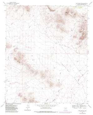
New River Se Topo Map Arizona
To zoom in, hover over the map of New River Se
USGS Topo Quad 33112g1 - 1:24,000 scale
| Topo Map Name: | New River Se |
| USGS Topo Quad ID: | 33112g1 |
| Print Size: | ca. 21 1/4" wide x 27" high |
| Southeast Coordinates: | 33.75° N latitude / 112° W longitude |
| Map Center Coordinates: | 33.8125° N latitude / 112.0625° W longitude |
| U.S. State: | AZ |
| Filename: | o33112g1.jpg |
| Download Map JPG Image: | New River Se topo map 1:24,000 scale |
| Map Type: | Topographic |
| Topo Series: | 7.5´ |
| Map Scale: | 1:24,000 |
| Source of Map Images: | United States Geological Survey (USGS) |
| Alternate Map Versions: |
New River SE AZ 1964, updated 1965 Download PDF Buy paper map New River SE AZ 1964, updated 1972 Download PDF Buy paper map New River SE AZ 1964, updated 1982 Download PDF Buy paper map New River SE AZ 1964, updated 1982 Download PDF Buy paper map New River SE AZ 2011 Download PDF Buy paper map New River SE AZ 2014 Download PDF Buy paper map |
1:24,000 Topo Quads surrounding New River Se
> Back to 33112e1 at 1:100,000 scale
> Back to 33112a1 at 1:250,000 scale
> Back to U.S. Topo Maps home
New River Se topo map: Gazetteer
New River Se: Arroyos
Desert Hills Wash elevation 529m 1735′Desert Lake Wash elevation 540m 1771′
East Fork Desert Lake Wash elevation 540m 1771′
Paradise Wash elevation 525m 1722′
Ranieri Tank Wash elevation 557m 1827′
West Fork Desert Hills Wash elevation 565m 1853′
West Fork Desert Lake Wash elevation 548m 1797′
West Fork Paradise Wash elevation 545m 1788′
New River Se: Reservoirs
Black Tank elevation 532m 1745′Bosco Tank elevation 532m 1745′
Bronco Tank elevation 490m 1607′
Burro Tank elevation 602m 1975′
Circle Tank elevation 507m 1663′
Desert Lake Tank elevation 557m 1827′
Mesquite Tank elevation 561m 1840′
Purcell Tank elevation 541m 1774′
Ranieri Tank elevation 562m 1843′
Skunk Creek Tank elevation 541m 1774′
New River Se: Springs
Apache Spring elevation 663m 2175′Jims Spring elevation 628m 2060′
New River Se: Streams
Rodger Creek elevation 574m 1883′Skunk Tank Wash elevation 536m 1758′
West Fork Apache Wash elevation 605m 1984′
New River Se: Summits
Apache Peak elevation 970m 3182′Gunsight elevation 760m 2493′
New River Se: Wells
Bentley Well elevation 604m 1981′East Joy Well elevation 513m 1683′
New River Se digital topo map on disk
Buy this New River Se topo map showing relief, roads, GPS coordinates and other geographical features, as a high-resolution digital map file on DVD:


