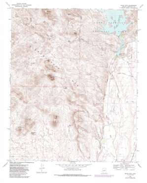
Baldy Mountain Topo Map Arizona
To zoom in, hover over the map of Baldy Mountain
USGS Topo Quad 33112g3 - 1:24,000 scale
| Topo Map Name: | Baldy Mountain |
| USGS Topo Quad ID: | 33112g3 |
| Print Size: | ca. 21 1/4" wide x 27" high |
| Southeast Coordinates: | 33.75° N latitude / 112.25° W longitude |
| Map Center Coordinates: | 33.8125° N latitude / 112.3125° W longitude |
| U.S. State: | AZ |
| Filename: | o33112g3.jpg |
| Download Map JPG Image: | Baldy Mountain topo map 1:24,000 scale |
| Map Type: | Topographic |
| Topo Series: | 7.5´ |
| Map Scale: | 1:24,000 |
| Source of Map Images: | United States Geological Survey (USGS) |
| Alternate Map Versions: |
Baldy Mtn AZ 1964, updated 1965 Download PDF Buy paper map Baldy Mtn AZ 1964, updated 1969 Download PDF Buy paper map Baldy Mtn AZ 1964, updated 1982 Download PDF Buy paper map Baldy Mtn AZ 1964, updated 1986 Download PDF Buy paper map Baldy Mountain AZ 2011 Download PDF Buy paper map Baldy Mountain AZ 2014 Download PDF Buy paper map |
1:24,000 Topo Quads surrounding Baldy Mountain
> Back to 33112e1 at 1:100,000 scale
> Back to 33112a1 at 1:250,000 scale
> Back to U.S. Topo Maps home
Baldy Mountain topo map: Gazetteer
Baldy Mountain: Airports
Clementine Mine Airport elevation 477m 1564′Lake Pleasant Landing Field elevation 459m 1505′
New Waddell Dam Heliport elevation 480m 1574′
Pleasant Valley Airport elevation 484m 1587′
Baldy Mountain: Dams
Camp Dyer Diversion Dam elevation 437m 1433′Carl Pleasant Dam elevation 478m 1568′
Baldy Mountain: Mines
Prince Mine elevation 531m 1742′White Peak Mine elevation 508m 1666′
Baldy Mountain: Reservoirs
Caterpillar Tank elevation 465m 1525′Lake Pleasant elevation 478m 1568′
Lower Lake elevation 437m 1433′
Baldy Mountain: Springs
Big Spring elevation 480m 1574′Burro Spring elevation 499m 1637′
Chalky Spring elevation 535m 1755′
Coyote Springs elevation 601m 1971′
Baldy Mountain: Streams
East Garambullo Wash elevation 435m 1427′Garambullo Wash elevation 433m 1420′
Morgan City Wash elevation 421m 1381′
West Fork White Peak Wash elevation 446m 1463′
West Garambullo Wash elevation 435m 1427′
Baldy Mountain: Summits
Baldy Mountain elevation 841m 2759′Cholla Mountain elevation 723m 2372′
Saddleback Mountain elevation 0m 0′
Twin Buttes elevation 655m 2148′
White Peak elevation 512m 1679′
Baldy Mountain: Wells
Morgan City Well elevation 533m 1748′Windy Well elevation 547m 1794′
Baldy Mountain digital topo map on disk
Buy this Baldy Mountain topo map showing relief, roads, GPS coordinates and other geographical features, as a high-resolution digital map file on DVD:


