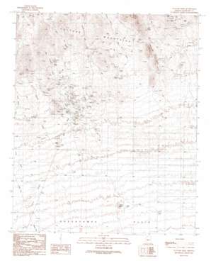
Vulture Mine Topo Map Arizona
To zoom in, hover over the map of Vulture Mine
USGS Topo Quad 33112g7 - 1:24,000 scale
| Topo Map Name: | Vulture Mine |
| USGS Topo Quad ID: | 33112g7 |
| Print Size: | ca. 21 1/4" wide x 27" high |
| Southeast Coordinates: | 33.75° N latitude / 112.75° W longitude |
| Map Center Coordinates: | 33.8125° N latitude / 112.8125° W longitude |
| U.S. State: | AZ |
| Filename: | o33112g7.jpg |
| Download Map JPG Image: | Vulture Mine topo map 1:24,000 scale |
| Map Type: | Topographic |
| Topo Series: | 7.5´ |
| Map Scale: | 1:24,000 |
| Source of Map Images: | United States Geological Survey (USGS) |
| Alternate Map Versions: |
Vulture Mine AZ 1990, updated 1990 Download PDF Buy paper map Vulture Mine AZ 1990, updated 1990 Download PDF Buy paper map Vulture Mine AZ 2011 Download PDF Buy paper map Vulture Mine AZ 2014 Download PDF Buy paper map |
1:24,000 Topo Quads surrounding Vulture Mine
> Back to 33112e1 at 1:100,000 scale
> Back to 33112a1 at 1:250,000 scale
> Back to U.S. Topo Maps home
Vulture Mine topo map: Gazetteer
Vulture Mine: Airports
Vulture Gold Mine Landing Strip elevation 639m 2096′Vulture Mine: Mines
Red Cloud Mine elevation 682m 2237′Vulture Mine elevation 632m 2073′
Vulture Mine: Reservoirs
Garcia Tank elevation 681m 2234′Indian Tank elevation 538m 1765′
Vulture Mine: Streams
Jimmie Wash elevation 589m 1932′Mill Wash elevation 580m 1902′
Red Cloud Wash elevation 661m 2168′
Syndicate Wash elevation 742m 2434′
Tank Wash elevation 574m 1883′
Vulture Mine: Summits
Caballeros Peaks elevation 881m 2890′Indian Buttes elevation 577m 1893′
Vulture Mine: Wells
Argo Well elevation 616m 2020′Desert Well elevation 530m 1738′
Jones Well elevation 632m 2073′
Vulture Mine digital topo map on disk
Buy this Vulture Mine topo map showing relief, roads, GPS coordinates and other geographical features, as a high-resolution digital map file on DVD:


