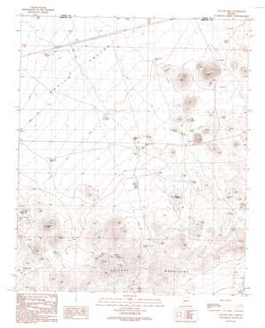
Outlaw Hill Topo Map Arizona
To zoom in, hover over the map of Outlaw Hill
USGS Topo Quad 33112h8 - 1:24,000 scale
| Topo Map Name: | Outlaw Hill |
| USGS Topo Quad ID: | 33112h8 |
| Print Size: | ca. 21 1/4" wide x 27" high |
| Southeast Coordinates: | 33.875° N latitude / 112.875° W longitude |
| Map Center Coordinates: | 33.9375° N latitude / 112.9375° W longitude |
| U.S. State: | AZ |
| Filename: | o33112h8.jpg |
| Download Map JPG Image: | Outlaw Hill topo map 1:24,000 scale |
| Map Type: | Topographic |
| Topo Series: | 7.5´ |
| Map Scale: | 1:24,000 |
| Source of Map Images: | United States Geological Survey (USGS) |
| Alternate Map Versions: |
Outlaw Hill AZ 1990, updated 1990 Download PDF Buy paper map Outlaw Hill AZ 2011 Download PDF Buy paper map Outlaw Hill AZ 2014 Download PDF Buy paper map |
1:24,000 Topo Quads surrounding Outlaw Hill
> Back to 33112e1 at 1:100,000 scale
> Back to 33112a1 at 1:250,000 scale
> Back to U.S. Topo Maps home
Outlaw Hill topo map: Gazetteer
Outlaw Hill: Airports
Forepaugh Airport elevation 737m 2417′Outlaw Hill: Mines
Lucky Cuss Mine elevation 829m 2719′Sunrise Mine elevation 777m 2549′
Outlaw Hill: Reservoirs
Cornelius Tank elevation 763m 2503′Divide Tank elevation 788m 2585′
Forepaugh Tank elevation 754m 2473′
Jerry Tank elevation 802m 2631′
Mine Tank elevation 812m 2664′
O'Haco Tank elevation 757m 2483′
Outlaw Tank elevation 798m 2618′
Quail Tank elevation 785m 2575′
Railroad Tank elevation 730m 2395′
Six-shooter Tank elevation 788m 2585′
Twin Joe Tank elevation 822m 2696′
Wild Horse Tank elevation 757m 2483′
Outlaw Hill: Summits
Outlaw Hill elevation 893m 2929′Outlaw Hill: Valleys
Aguila Valley elevation 765m 2509′Outlaw Hill digital topo map on disk
Buy this Outlaw Hill topo map showing relief, roads, GPS coordinates and other geographical features, as a high-resolution digital map file on DVD:


