Palomas Mountains Nw Topo Map Arizona
To zoom in, hover over the map of Palomas Mountains Nw
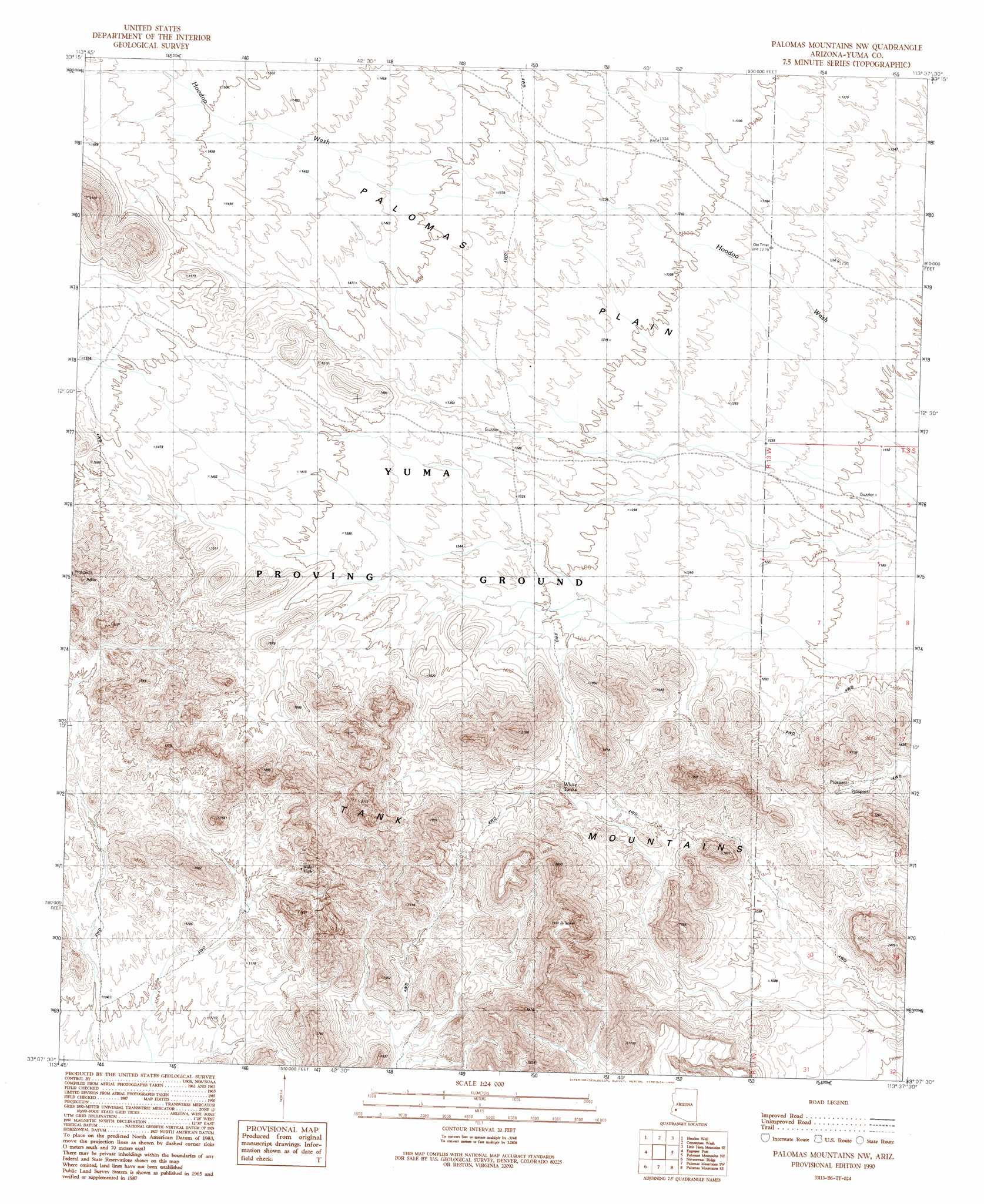
USGS Topo Quad 33113b6 - 1:24,000 scale
| Topo Map Name: | Palomas Mountains Nw |
| USGS Topo Quad ID: | 33113b6 |
| Print Size: | ca. 21 1/4" wide x 27" high |
| Southeast Coordinates: | 33.125° N latitude / 113.625° W longitude |
| Map Center Coordinates: | 33.1875° N latitude / 113.6875° W longitude |
| U.S. State: | AZ |
| Filename: | o33113b6.jpg |
| Download Map JPG Image: | Palomas Mountains Nw topo map 1:24,000 scale |
| Map Type: | Topographic |
| Topo Series: | 7.5´ |
| Map Scale: | 1:24,000 |
| Source of Map Images: | United States Geological Survey (USGS) |
| Alternate Map Versions: |
Palomas Mountains NW AZ 1990, updated 1990 Download PDF Buy paper map Palomas Mountains NW AZ 2011 Download PDF Buy paper map Palomas Mountains NW AZ 2014 Download PDF Buy paper map |
1:24,000 Topo Quads surrounding Palomas Mountains Nw
Owl Head |
Cholla Tank |
Coyote Peak |
Little Horn Mountains Ne |
Eagletail Mountains West |
Kofa Butte |
Hoodoo Well |
Cementosa Wash |
Little Horn Mountains Se |
Nottbusch Butte |
Charlie Died Tank |
Engesser Pass |
Palomas Mountains Nw |
Palomas Mountains Ne |
Turtleback Mountain |
Engesser Pass Sw |
Neversweat Ridge |
Palomas Mountains Sw |
Palomas Mountains Se |
Baragan Mountain |
North Of Roll |
Mesquite Jim Well |
Kofa |
Horn |
Aztec Nw |
> Back to 33113a1 at 1:100,000 scale
> Back to 33112a1 at 1:250,000 scale
> Back to U.S. Topo Maps home
Palomas Mountains Nw topo map: Gazetteer
Palomas Mountains Nw: Reservoirs
White Tank elevation 361m 1184′Palomas Mountains Nw: Ridges
Tank Mountains elevation 445m 1459′Palomas Mountains Nw digital topo map on disk
Buy this Palomas Mountains Nw topo map showing relief, roads, GPS coordinates and other geographical features, as a high-resolution digital map file on DVD: