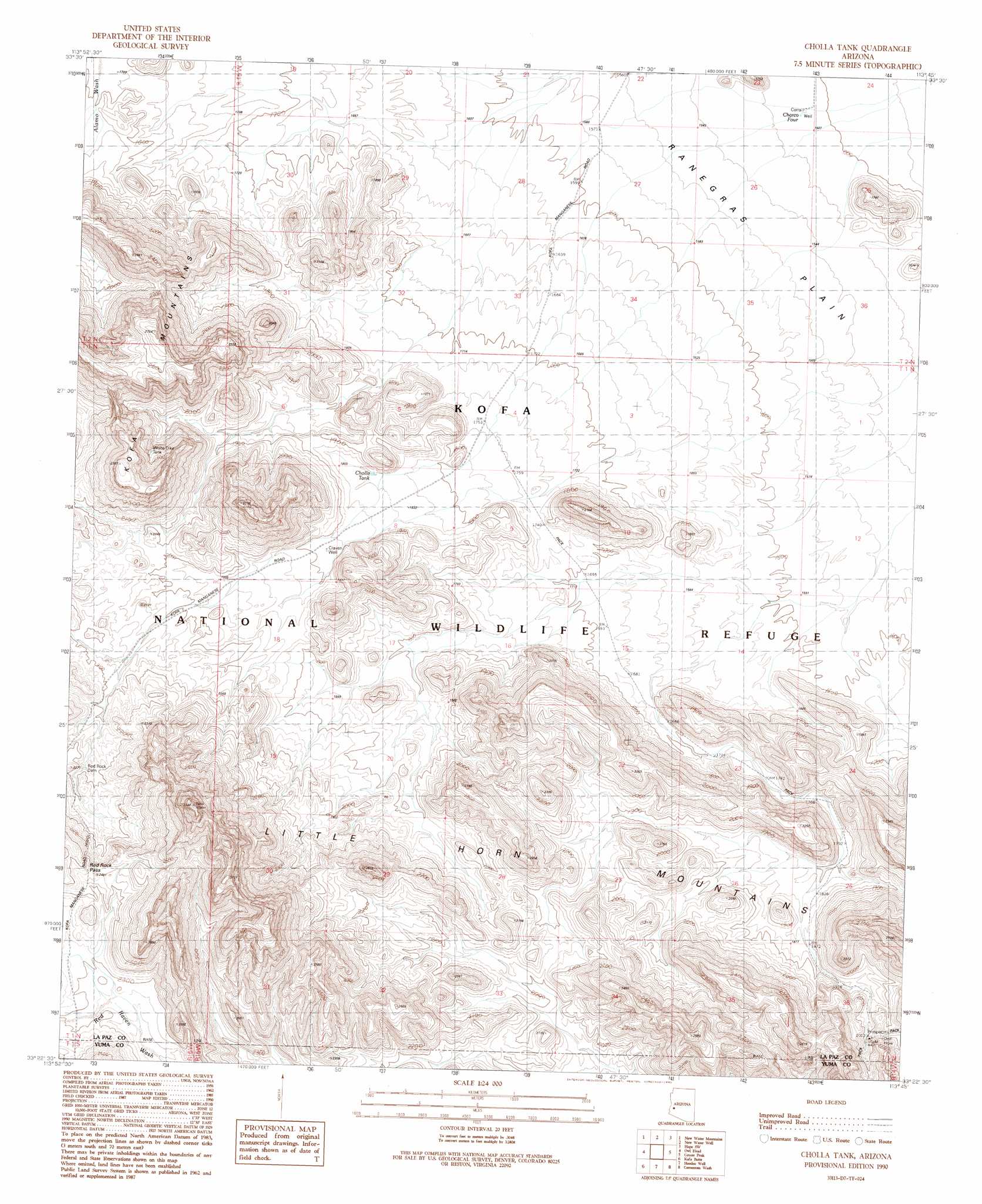
Cholla Tank Topo Map Arizona
To zoom in, hover over the map of Cholla Tank
USGS Topo Quad 33113d7 - 1:24,000 scale
| Topo Map Name: | Cholla Tank |
| USGS Topo Quad ID: | 33113d7 |
| Print Size: | ca. 21 1/4" wide x 27" high |
| Southeast Coordinates: | 33.375° N latitude / 113.75° W longitude |
| Map Center Coordinates: | 33.4375° N latitude / 113.8125° W longitude |
| U.S. State: | AZ |
| Filename: | o33113d7.jpg |
| Download Map JPG Image: | Cholla Tank topo map 1:24,000 scale |
| Map Type: | Topographic |
| Topo Series: | 7.5´ |
| Map Scale: | 1:24,000 |
| Source of Map Images: | United States Geological Survey (USGS) |
| Alternate Map Versions: |
Cholla Tank AZ 1990, updated 1990 Download PDF Buy paper map Cholla Tank AZ 2011 Download PDF Buy paper map Cholla Tank AZ 2014 Download PDF Buy paper map |
1:24,000 Topo Quads surrounding Cholla Tank
Plomosa Pass |
Bear Hills |
Vicksburg |
Hope |
Harrisburg Valley |
Crystal Hill |
New Water Mountains |
New Water Well |
Hope Sw |
Hope Se |
Livingston Hills |
Owl Head |
Cholla Tank |
Coyote Peak |
Little Horn Mountains Ne |
Palm Canyon |
Kofa Butte |
Hoodoo Well |
Cementosa Wash |
Little Horn Mountains Se |
Kofa Deep Well |
Charlie Died Tank |
Engesser Pass |
Palomas Mountains Nw |
Palomas Mountains Ne |
> Back to 33113a1 at 1:100,000 scale
> Back to 33112a1 at 1:250,000 scale
> Back to U.S. Topo Maps home
Cholla Tank topo map: Gazetteer
Cholla Tank: Dams
Red Rock Dam elevation 665m 2181′Cholla Tank: Gaps
Red Rock Pass elevation 751m 2463′Cholla Tank: Mines
Alonah Mine elevation 807m 2647′Big Horn Mine elevation 648m 2125′
Cholla Tank: Reservoirs
Charco Four elevation 461m 1512′Cholla Tank elevation 560m 1837′
Red Rock Reservoir elevation 662m 2171′
White Dike Tank elevation 614m 2014′
Cholla Tank: Wells
Cravey Well elevation 576m 1889′Cholla Tank digital topo map on disk
Buy this Cholla Tank topo map showing relief, roads, GPS coordinates and other geographical features, as a high-resolution digital map file on DVD: