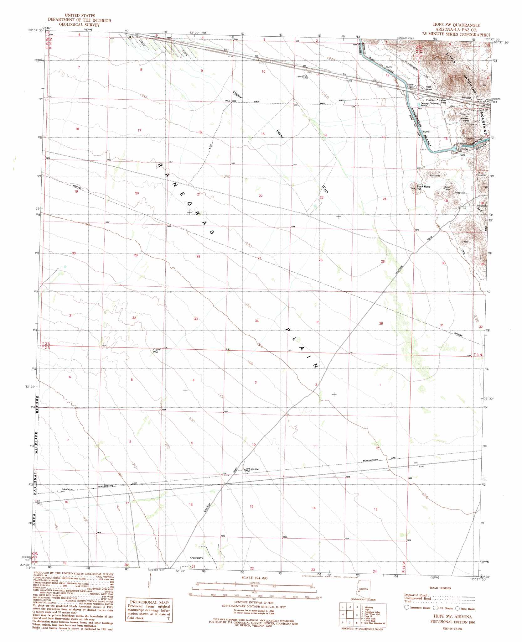
Hope Sw Topo Map Arizona
To zoom in, hover over the map of Hope Sw
USGS Topo Quad 33113e6 - 1:24,000 scale
| Topo Map Name: | Hope Sw |
| USGS Topo Quad ID: | 33113e6 |
| Print Size: | ca. 21 1/4" wide x 27" high |
| Southeast Coordinates: | 33.5° N latitude / 113.625° W longitude |
| Map Center Coordinates: | 33.5625° N latitude / 113.6875° W longitude |
| U.S. State: | AZ |
| Filename: | o33113e6.jpg |
| Download Map JPG Image: | Hope Sw topo map 1:24,000 scale |
| Map Type: | Topographic |
| Topo Series: | 7.5´ |
| Map Scale: | 1:24,000 |
| Source of Map Images: | United States Geological Survey (USGS) |
| Alternate Map Versions: |
Hope SW AZ 1990, updated 1990 Download PDF Buy paper map Hope SW AZ 2011 Download PDF Buy paper map Hope SW AZ 2014 Download PDF Buy paper map |
1:24,000 Topo Quads surrounding Hope Sw
Utting |
East Of Utting |
Harcuvar |
Salome |
Socorro Peak |
Bear Hills |
Vicksburg |
Hope |
Harrisburg Valley |
Socorro Mine |
New Water Mountains |
New Water Well |
Hope Sw |
Hope Se |
Lone Mountain |
Owl Head |
Cholla Tank |
Coyote Peak |
Little Horn Mountains Ne |
Eagletail Mountains West |
Kofa Butte |
Hoodoo Well |
Cementosa Wash |
Little Horn Mountains Se |
Nottbusch Butte |
> Back to 33113e1 at 1:100,000 scale
> Back to 33112a1 at 1:250,000 scale
> Back to U.S. Topo Maps home
Hope Sw topo map: Gazetteer
Hope Sw: Reservoirs
Charco Tank elevation 406m 1332′Hope Sw: Summits
Black Rock Hill elevation 415m 1361′Hope Sw: Wells
Coyote Well elevation 409m 1341′John Weisser Well elevation 412m 1351′
Hope Sw digital topo map on disk
Buy this Hope Sw topo map showing relief, roads, GPS coordinates and other geographical features, as a high-resolution digital map file on DVD: