Hidden Valley Topo Map Arizona
To zoom in, hover over the map of Hidden Valley
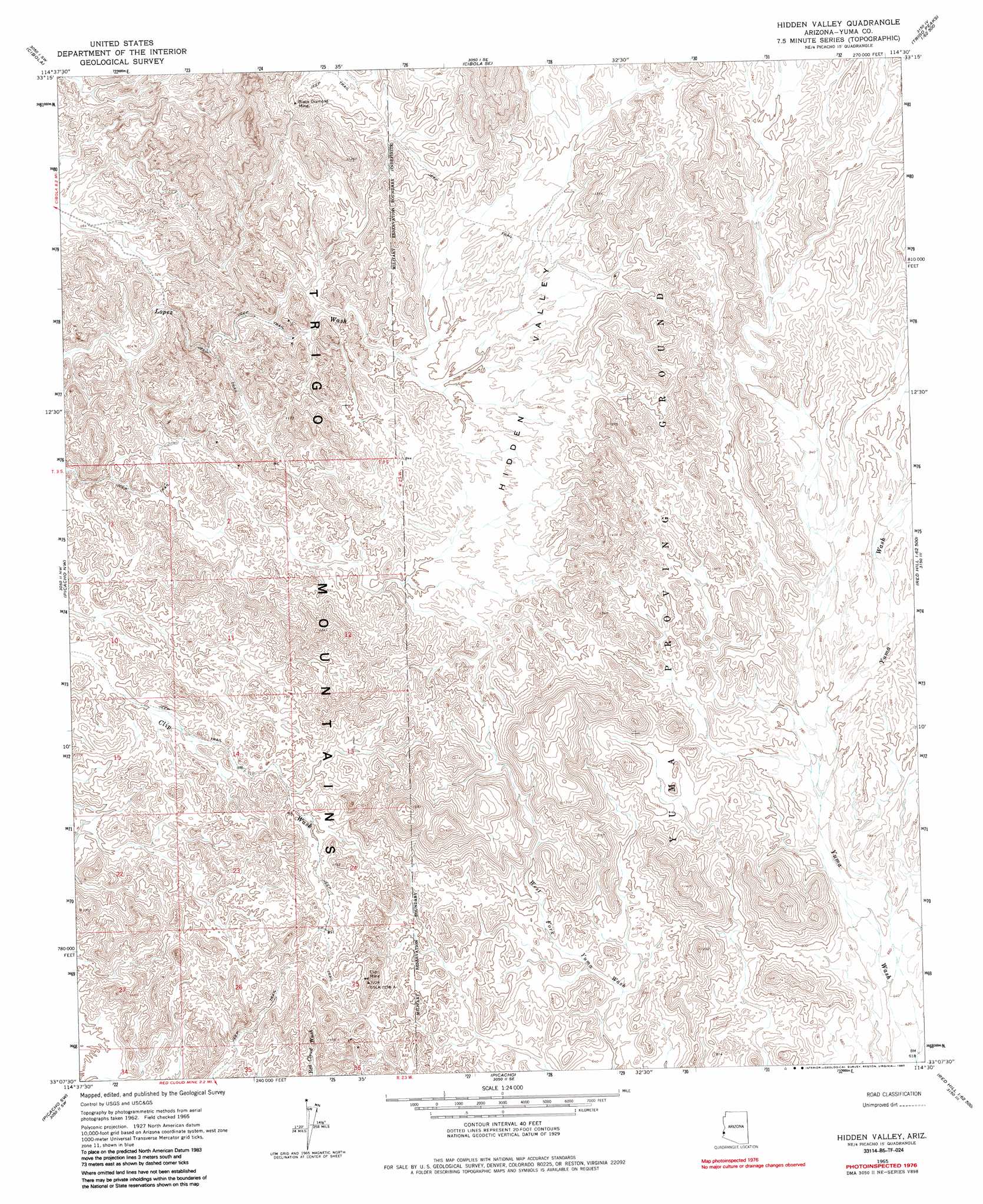
USGS Topo Quad 33114b5 - 1:24,000 scale
| Topo Map Name: | Hidden Valley |
| USGS Topo Quad ID: | 33114b5 |
| Print Size: | ca. 21 1/4" wide x 27" high |
| Southeast Coordinates: | 33.125° N latitude / 114.5° W longitude |
| Map Center Coordinates: | 33.1875° N latitude / 114.5625° W longitude |
| U.S. State: | AZ |
| Filename: | o33114b5.jpg |
| Download Map JPG Image: | Hidden Valley topo map 1:24,000 scale |
| Map Type: | Topographic |
| Topo Series: | 7.5´ |
| Map Scale: | 1:24,000 |
| Source of Map Images: | United States Geological Survey (USGS) |
| Alternate Map Versions: |
Hidden Valley AZ 1965, updated 1966 Download PDF Buy paper map Hidden Valley AZ 1965, updated 1985 Download PDF Buy paper map Hidden Valley AZ 2011 Download PDF Buy paper map Hidden Valley AZ 2014 Download PDF Buy paper map |
1:24,000 Topo Quads surrounding Hidden Valley
Thumb Peak |
Palo Verde |
Mule Wash |
North Trigo Peaks |
Trigo Pass |
Palo Verde Peak |
Cibola |
Cibola Se |
Mohave Peak |
Tweed Mine |
Buzzards Peak |
Picacho Nw |
Hidden Valley |
Red Hill |
Red Hill Ne |
Quartz Peak |
Picacho Sw |
Picacho |
Red Hill Sw |
Middle Mountains North |
Hedges |
Picacho Peak |
Little Picacho Peak |
Imperial Reservoir |
Middle Mountains South |
> Back to 33114a1 at 1:100,000 scale
> Back to 33114a1 at 1:250,000 scale
> Back to U.S. Topo Maps home
Hidden Valley topo map: Gazetteer
Hidden Valley: Mines
Black Diamond Mine elevation 308m 1010′Clip Mine elevation 347m 1138′
Hidden Valley: Valleys
Hidden Valley elevation 218m 715′Hidden Valley digital topo map on disk
Buy this Hidden Valley topo map showing relief, roads, GPS coordinates and other geographical features, as a high-resolution digital map file on DVD: