Wileys Well Topo Map California
To zoom in, hover over the map of Wileys Well
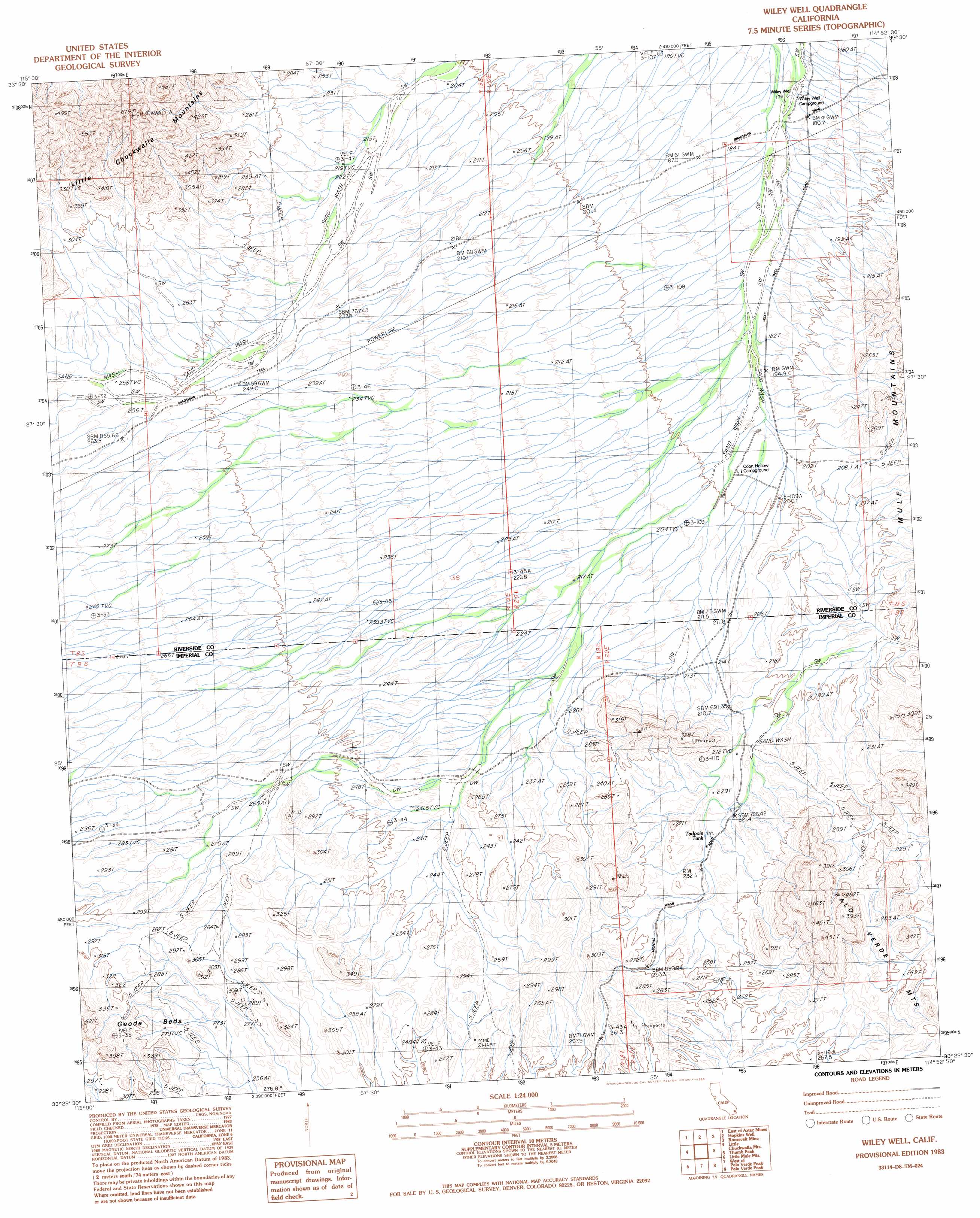
USGS Topo Quad 33114d8 - 1:24,000 scale
| Topo Map Name: | Wileys Well |
| USGS Topo Quad ID: | 33114d8 |
| Print Size: | ca. 21 1/4" wide x 27" high |
| Southeast Coordinates: | 33.375° N latitude / 114.875° W longitude |
| Map Center Coordinates: | 33.4375° N latitude / 114.9375° W longitude |
| U.S. State: | CA |
| Filename: | o33114d8.jpg |
| Download Map JPG Image: | Wileys Well topo map 1:24,000 scale |
| Map Type: | Topographic |
| Topo Series: | 7.5´ |
| Map Scale: | 1:24,000 |
| Source of Map Images: | United States Geological Survey (USGS) |
| Alternate Map Versions: |
Wiley Well CA 1983, updated 1983 Download PDF Buy paper map Wiley Well CA 2012 Download PDF Buy paper map Wiley Well CA 2015 Download PDF Buy paper map |
1:24,000 Topo Quads surrounding Wileys Well
Sidewinder Well |
Ford Dry Lake |
Mccoy Spring |
Mccoy Peak |
Mccoy Wash |
Aztec Mines |
East Of Aztec Mines |
Hopkins Well |
Roosevelt Mine |
Ripley |
Chuckwalla Spring |
Little Chuckwalla Mountains |
Wileys Well |
Thumb Peak |
Palo Verde |
Pegleg Well |
Little Mule Mountains |
West Of Palo Verde Peak |
Palo Verde Peak |
Cibola |
Mammoth Wash |
Blue Mountain |
Mount Barrow |
Buzzards Peak |
Picacho Nw |
> Back to 33114a1 at 1:100,000 scale
> Back to 33114a1 at 1:250,000 scale
> Back to U.S. Topo Maps home
Wileys Well topo map: Gazetteer
Wileys Well: Flats
Geode Beds elevation 270m 885′Wileys Well: Reservoirs
Tadpole Tank elevation 232m 761′Wileys Well: Wells
Wiley Well elevation 176m 577′Wileys Well digital topo map on disk
Buy this Wileys Well topo map showing relief, roads, GPS coordinates and other geographical features, as a high-resolution digital map file on DVD: