Big Maria Mountains Nw Topo Map California
To zoom in, hover over the map of Big Maria Mountains Nw
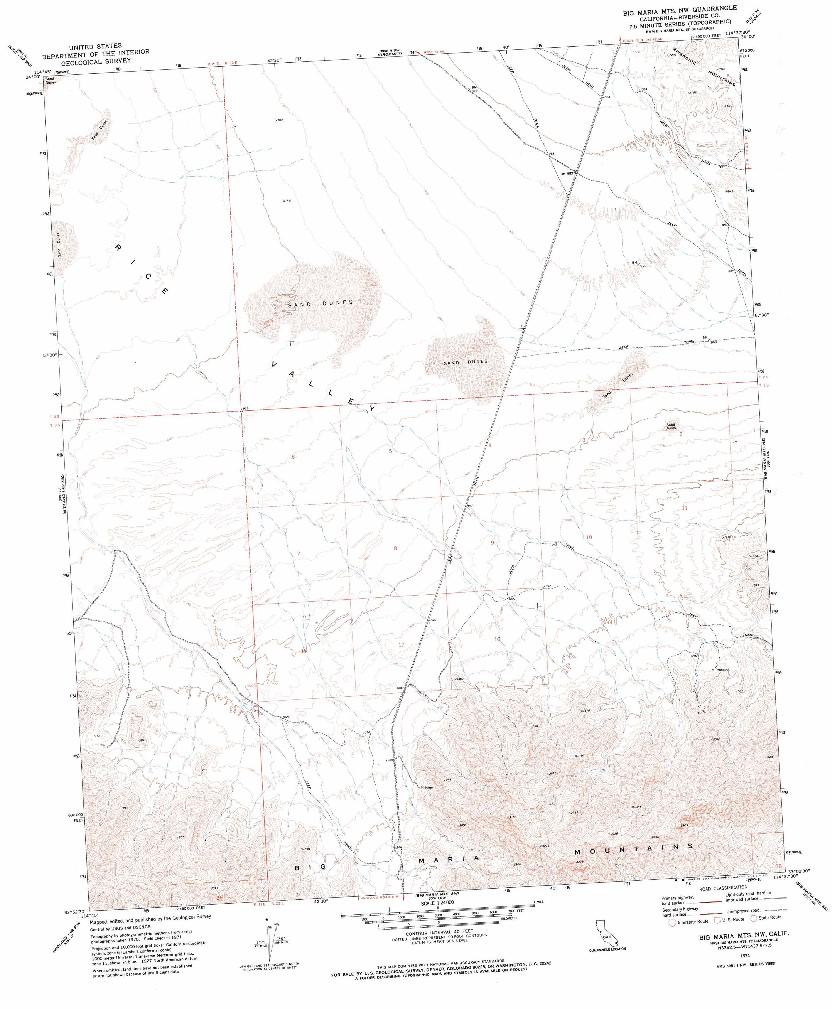
USGS Topo Quad 33114h6 - 1:24,000 scale
| Topo Map Name: | Big Maria Mountains Nw |
| USGS Topo Quad ID: | 33114h6 |
| Print Size: | ca. 21 1/4" wide x 27" high |
| Southeast Coordinates: | 33.875° N latitude / 114.625° W longitude |
| Map Center Coordinates: | 33.9375° N latitude / 114.6875° W longitude |
| U.S. State: | CA |
| Filename: | o33114h6.jpg |
| Download Map JPG Image: | Big Maria Mountains Nw topo map 1:24,000 scale |
| Map Type: | Topographic |
| Topo Series: | 7.5´ |
| Map Scale: | 1:24,000 |
| Source of Map Images: | United States Geological Survey (USGS) |
| Alternate Map Versions: |
Big Maria Mts. NW CA 1971, updated 1973 Download PDF Buy paper map Big Maria Mountains NW CA 2012 Download PDF Buy paper map Big Maria Mountains NW CA 2015 Download PDF Buy paper map |
1:24,000 Topo Quads surrounding Big Maria Mountains Nw
Sablon |
Horn Spring |
Vidal Nw |
Vidal Junction |
Parker Nw |
Arica Mountains |
Rice |
Grommet |
Vidal |
Parker Sw |
Little Maria Mountains |
Styx |
Big Maria Mountains Nw |
Big Maria Mountains Ne |
Poston |
Arlington Mine |
Inca |
Big Maria Mountains Sw |
Big Maria Mountains Se |
Moon Mountain |
Mccoy Spring |
Mccoy Peak |
Mccoy Wash |
Blythe Ne |
La Paz Mountain |
> Back to 33114e1 at 1:100,000 scale
> Back to 33114a1 at 1:250,000 scale
> Back to U.S. Topo Maps home
Big Maria Mountains Nw topo map: Gazetteer
Big Maria Mountains Nw: Valleys
Rice Valley elevation 239m 784′Big Maria Mountains Nw digital topo map on disk
Buy this Big Maria Mountains Nw topo map showing relief, roads, GPS coordinates and other geographical features, as a high-resolution digital map file on DVD: