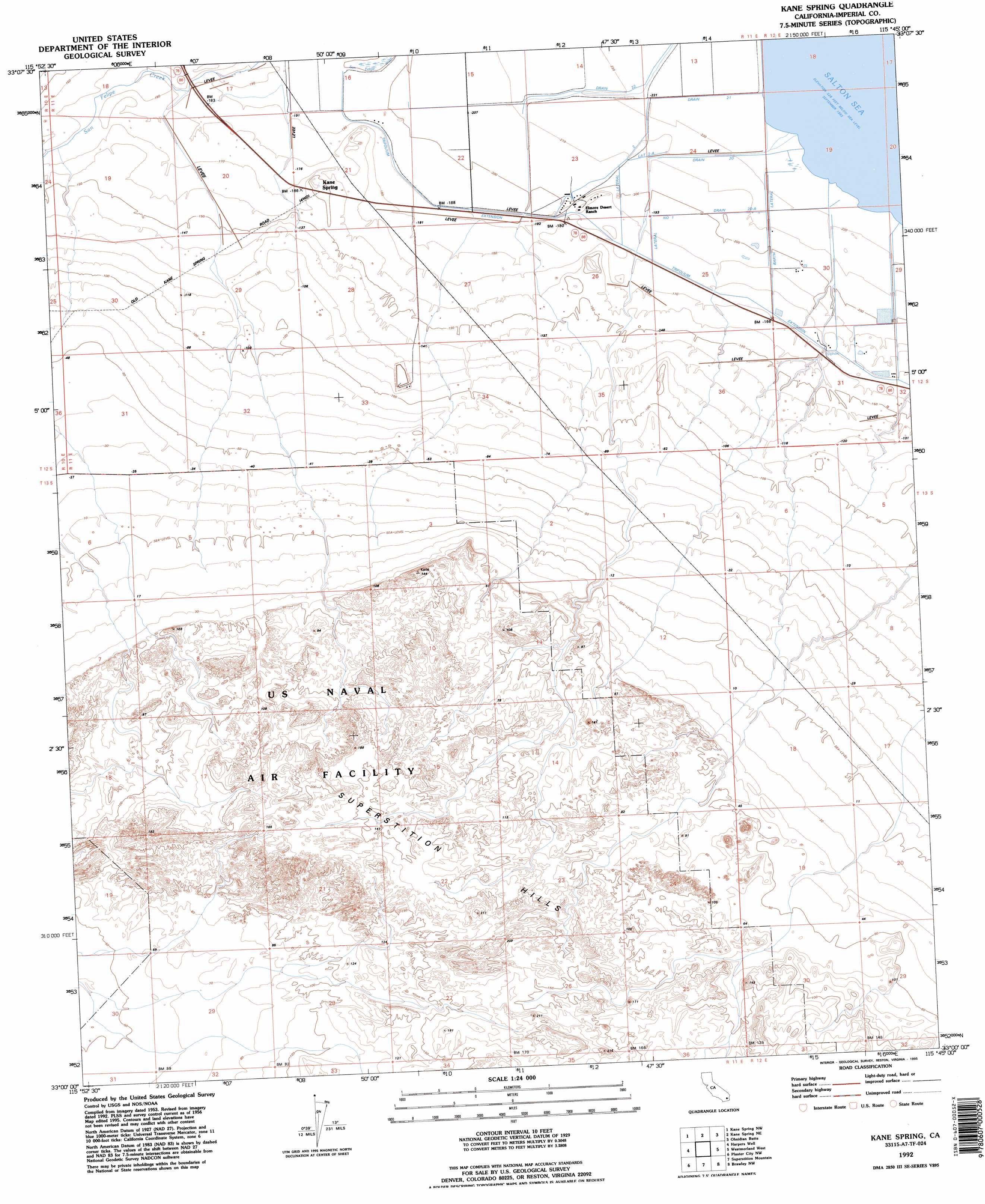
Kane Spring Topo Map California
To zoom in, hover over the map of Kane Spring
USGS Topo Quad 33115a7 - 1:24,000 scale
| Topo Map Name: | Kane Spring |
| USGS Topo Quad ID: | 33115a7 |
| Print Size: | ca. 21 1/4" wide x 27" high |
| Southeast Coordinates: | 33° N latitude / 115.75° W longitude |
| Map Center Coordinates: | 33.0625° N latitude / 115.8125° W longitude |
| U.S. State: | CA |
| Filename: | o33115a7.jpg |
| Download Map JPG Image: | Kane Spring topo map 1:24,000 scale |
| Map Type: | Topographic |
| Topo Series: | 7.5´ |
| Map Scale: | 1:24,000 |
| Source of Map Images: | United States Geological Survey (USGS) |
| Alternate Map Versions: |
Kane Spring CA 1956, updated 1957 Download PDF Buy paper map Kane Spring CA 1956, updated 1967 Download PDF Buy paper map Kane Spring CA 1992, updated 1995 Download PDF Buy paper map Kane Spring CA 2012 Download PDF Buy paper map Kane Spring CA 2015 Download PDF Buy paper map |
1:24,000 Topo Quads surrounding Kane Spring
Seventeen Palms |
Truckhaven |
Durmid Se |
Frink |
Wister |
Shell Reef |
Kane Spring Nw |
Kane Spring Ne |
Obsidian Butte |
Niland |
Borrego Mountain Se |
Harpers Well |
Kane Spring |
Westmorland West |
Westmorland East |
Carrizo Mountain Ne |
Plaster City Nw |
Superstition Mountain |
Brawley Nw |
Brawley |
Carrizo Mountain |
Painted Gorge |
Plaster City |
Seeley |
El Centro |
> Back to 33115a1 at 1:100,000 scale
> Back to 33114a1 at 1:250,000 scale
> Back to U.S. Topo Maps home
Kane Spring topo map: Gazetteer
Kane Spring: Canals
Barth Lateral elevation -63m -207′Drain Twenty elevation -66m -217′
Drain Twenty-A elevation -61m -201′
Drain Twenty-One elevation -67m -220′
Drain Twenty-Two elevation -62m -204′
Lateral Number One elevation -57m -188′
Lateral Seven-A elevation -61m -201′
Lateral Two elevation -61m -201′
Lateral Two-A elevation -62m -204′
Trifolium Extension elevation -52m -171′
Kane Spring: Populated Places
Elmore Desert Ranch elevation -54m -178′Kane Spring elevation -43m -142′
Kane Spring: Ranges
Superstition Hills elevation 43m 141′Kane Spring digital topo map on disk
Buy this Kane Spring topo map showing relief, roads, GPS coordinates and other geographical features, as a high-resolution digital map file on DVD: