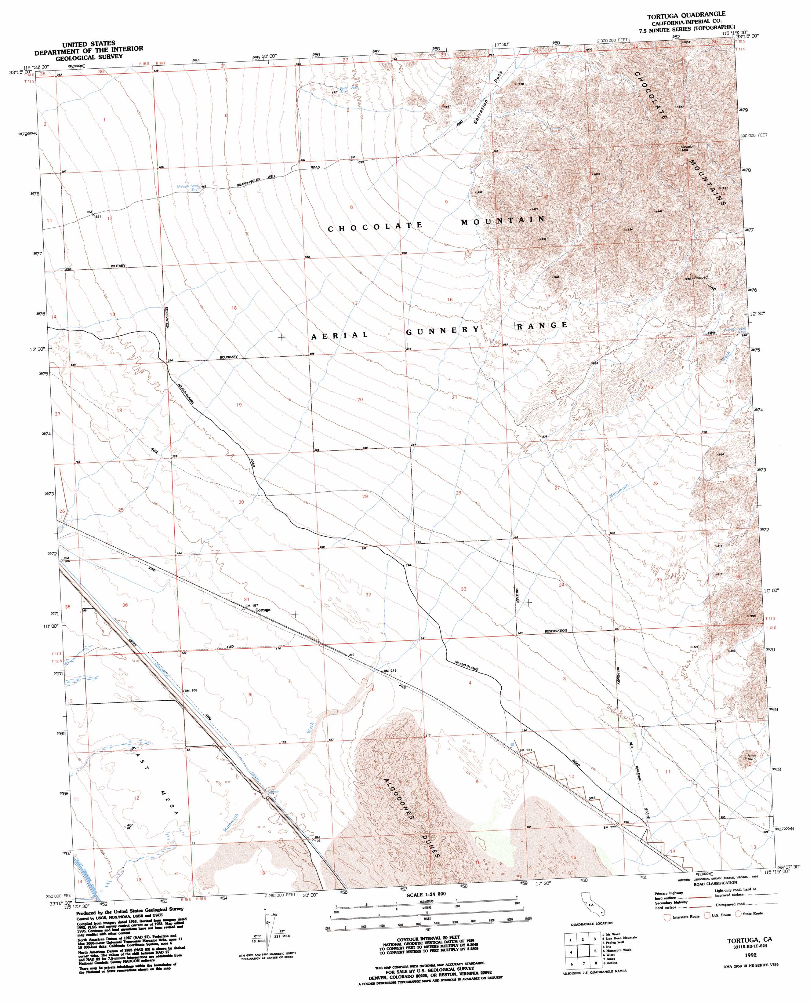
Tortuga Topo Map California
To zoom in, hover over the map of Tortuga
USGS Topo Quad 33115b3 - 1:24,000 scale
| Topo Map Name: | Tortuga |
| USGS Topo Quad ID: | 33115b3 |
| Print Size: | ca. 21 1/4" wide x 27" high |
| Southeast Coordinates: | 33.125° N latitude / 115.25° W longitude |
| Map Center Coordinates: | 33.1875° N latitude / 115.3125° W longitude |
| U.S. State: | CA |
| Filename: | o33115b3.jpg |
| Download Map JPG Image: | Tortuga topo map 1:24,000 scale |
| Map Type: | Topographic |
| Topo Series: | 7.5´ |
| Map Scale: | 1:24,000 |
| Source of Map Images: | United States Geological Survey (USGS) |
| Alternate Map Versions: |
Tortuga CA 1955, updated 1955 Download PDF Buy paper map Tortuga CA 1955, updated 1957 Download PDF Buy paper map Tortuga CA 1955, updated 1985 Download PDF Buy paper map Tortuga CA 1992, updated 1995 Download PDF Buy paper map Tortuga CA 1998, updated 2002 Download PDF Buy paper map Tortuga CA 2012 Download PDF Buy paper map Tortuga CA 2015 Download PDF Buy paper map |
1:24,000 Topo Quads surrounding Tortuga
Frink Ne |
Iris Pass |
Augustine Pass |
Chuckwalla Spring |
Little Chuckwalla Mountains |
Wister |
Iris Wash |
Lion Head Mountain |
Pegleg Well |
Little Mule Mountains |
Niland |
Iris |
Tortuga |
Mammoth Wash |
Blue Mountain |
Westmorland East |
Wiest |
Amos |
Acolita |
East Of Acolita |
Brawley |
Alamorio |
Holtville Ne |
Glamis Nw |
Glamis |
> Back to 33115a1 at 1:100,000 scale
> Back to 33114a1 at 1:250,000 scale
> Back to U.S. Topo Maps home
Tortuga topo map: Gazetteer
Tortuga: Canals
Siphon One elevation 31m 101′Tortuga: Populated Places
Tortuga elevation 57m 187′Tortuga: Streams
Mammoth Wash elevation -5m -17′Tortuga: Wells
Barth Well elevation 205m 672′Hayden Well elevation 281m 921′
Melson Well elevation 141m 462′
Tortuga digital topo map on disk
Buy this Tortuga topo map showing relief, roads, GPS coordinates and other geographical features, as a high-resolution digital map file on DVD: