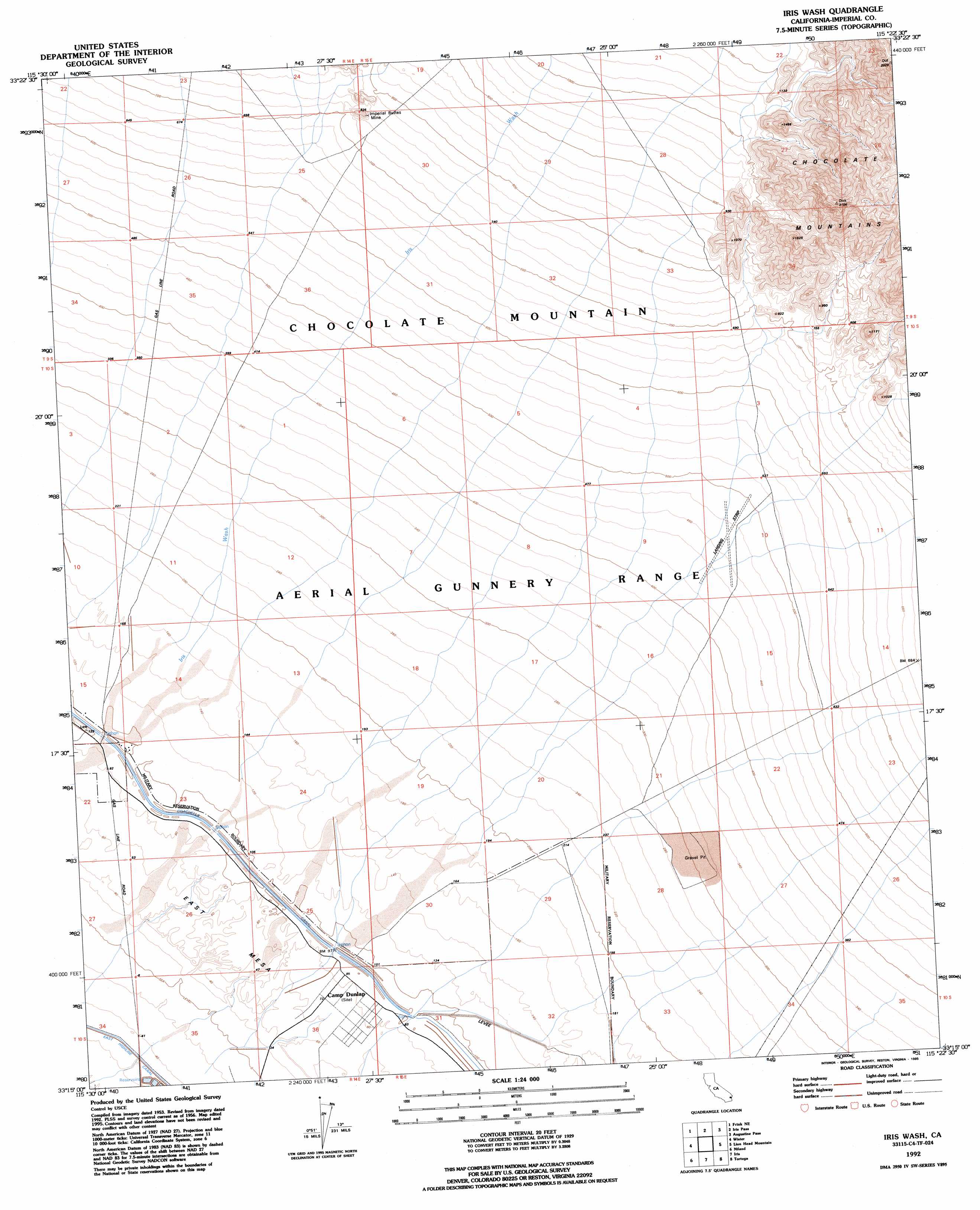
Iris Wash Topo Map California
To zoom in, hover over the map of Iris Wash
USGS Topo Quad 33115c4 - 1:24,000 scale
| Topo Map Name: | Iris Wash |
| USGS Topo Quad ID: | 33115c4 |
| Print Size: | ca. 21 1/4" wide x 27" high |
| Southeast Coordinates: | 33.25° N latitude / 115.375° W longitude |
| Map Center Coordinates: | 33.3125° N latitude / 115.4375° W longitude |
| U.S. State: | CA |
| Filename: | o33115c4.jpg |
| Download Map JPG Image: | Iris Wash topo map 1:24,000 scale |
| Map Type: | Topographic |
| Topo Series: | 7.5´ |
| Map Scale: | 1:24,000 |
| Source of Map Images: | United States Geological Survey (USGS) |
| Alternate Map Versions: |
Iris Wash CA 1956, updated 1957 Download PDF Buy paper map Iris Wash CA 1956, updated 1973 Download PDF Buy paper map Iris Wash CA 1956, updated 1985 Download PDF Buy paper map Iris Wash CA 1992, updated 1995 Download PDF Buy paper map Iris Wash CA 1992, updated 1995 Download PDF Buy paper map Iris Wash CA 1998, updated 2003 Download PDF Buy paper map Iris Wash CA 2012 Download PDF Buy paper map Iris Wash CA 2015 Download PDF Buy paper map |
1:24,000 Topo Quads surrounding Iris Wash
Red Canyon |
East Of Red Canyon |
Red Cloud Canyon |
Pilot Mountain |
Aztec Mines |
Frink Nw |
Frink Ne |
Iris Pass |
Augustine Pass |
Chuckwalla Spring |
Frink |
Wister |
Iris Wash |
Lion Head Mountain |
Pegleg Well |
Obsidian Butte |
Niland |
Iris |
Tortuga |
Mammoth Wash |
Westmorland West |
Westmorland East |
Wiest |
Amos |
Acolita |
> Back to 33115a1 at 1:100,000 scale
> Back to 33114a1 at 1:250,000 scale
> Back to U.S. Topo Maps home
Iris Wash topo map: Gazetteer
Iris Wash: Canals
Siphon Eight elevation 27m 88′Siphon Nine elevation 28m 91′
Siphon Seven elevation 27m 88′
Siphon Ten elevation 29m 95′
Iris Wash: Mines
Imperial Buttes Mine elevation 239m 784′Iris Wash digital topo map on disk
Buy this Iris Wash topo map showing relief, roads, GPS coordinates and other geographical features, as a high-resolution digital map file on DVD: