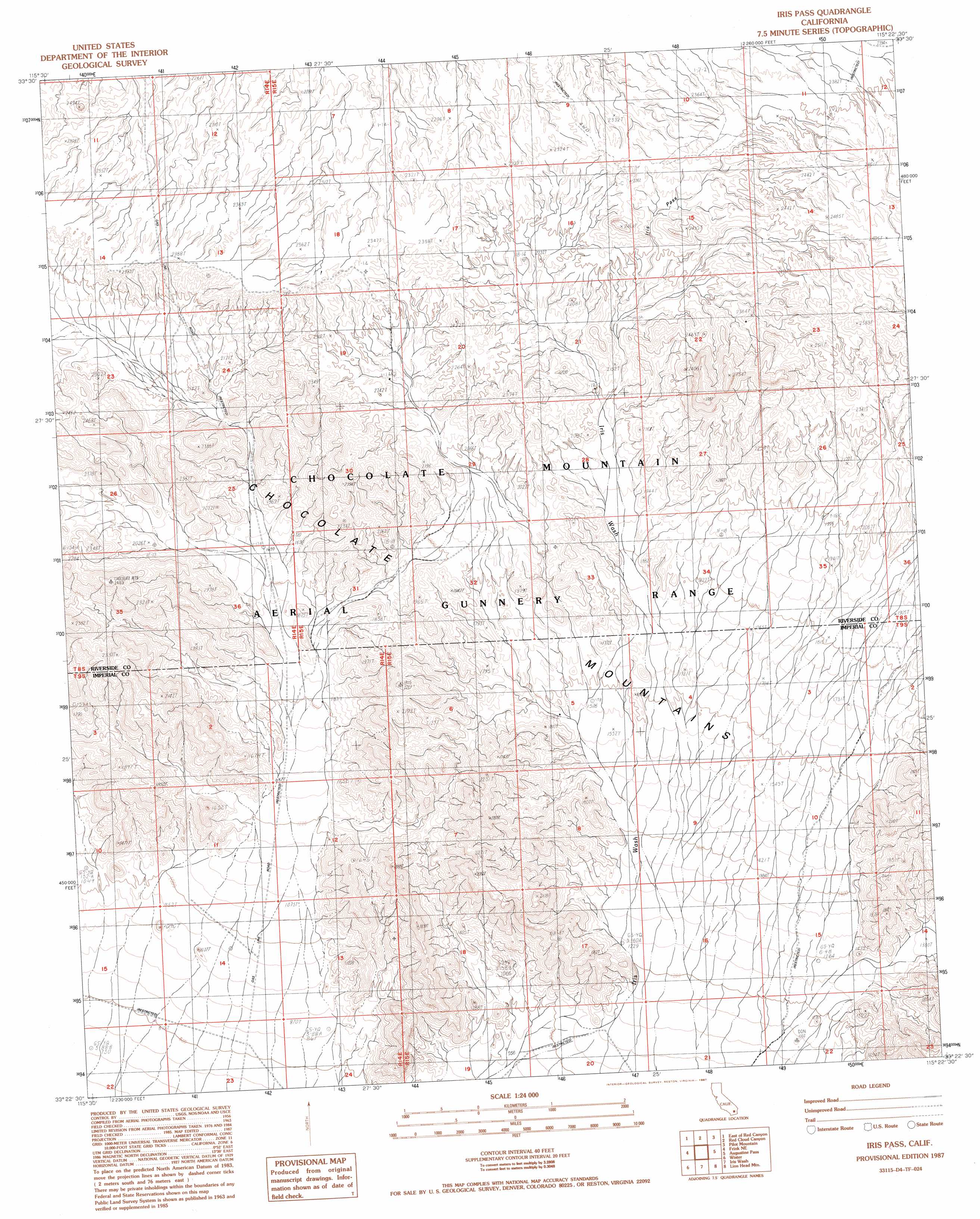
Iris Pass Topo Map California
To zoom in, hover over the map of Iris Pass
USGS Topo Quad 33115d4 - 1:24,000 scale
| Topo Map Name: | Iris Pass |
| USGS Topo Quad ID: | 33115d4 |
| Print Size: | ca. 21 1/4" wide x 27" high |
| Southeast Coordinates: | 33.375° N latitude / 115.375° W longitude |
| Map Center Coordinates: | 33.4375° N latitude / 115.4375° W longitude |
| U.S. State: | CA |
| Filename: | o33115d4.jpg |
| Download Map JPG Image: | Iris Pass topo map 1:24,000 scale |
| Map Type: | Topographic |
| Topo Series: | 7.5´ |
| Map Scale: | 1:24,000 |
| Source of Map Images: | United States Geological Survey (USGS) |
| Alternate Map Versions: |
Iris Pass CA 1987, updated 1987 Download PDF Buy paper map Iris Pass CA 1987, updated 1987 Download PDF Buy paper map Iris Pass CA 2012 Download PDF Buy paper map Iris Pass CA 2015 Download PDF Buy paper map |
1:24,000 Topo Quads surrounding Iris Pass
Hayfield |
Hayfield Spring |
Desert Center |
Corn Spring |
Sidewinder Well |
Red Canyon |
East Of Red Canyon |
Red Cloud Canyon |
Pilot Mountain |
Aztec Mines |
Frink Nw |
Frink Ne |
Iris Pass |
Augustine Pass |
Chuckwalla Spring |
Frink |
Wister |
Iris Wash |
Lion Head Mountain |
Pegleg Well |
Obsidian Butte |
Niland |
Iris |
Tortuga |
Mammoth Wash |
> Back to 33115a1 at 1:100,000 scale
> Back to 33114a1 at 1:250,000 scale
> Back to U.S. Topo Maps home
Iris Pass topo map: Gazetteer
Iris Pass: Gaps
Iris Pass elevation 715m 2345′Iris Pass: Ranges
Little Chuckwalla Mountains elevation 610m 2001′Iris Pass digital topo map on disk
Buy this Iris Pass topo map showing relief, roads, GPS coordinates and other geographical features, as a high-resolution digital map file on DVD: