Salton Topo Map California
To zoom in, hover over the map of Salton
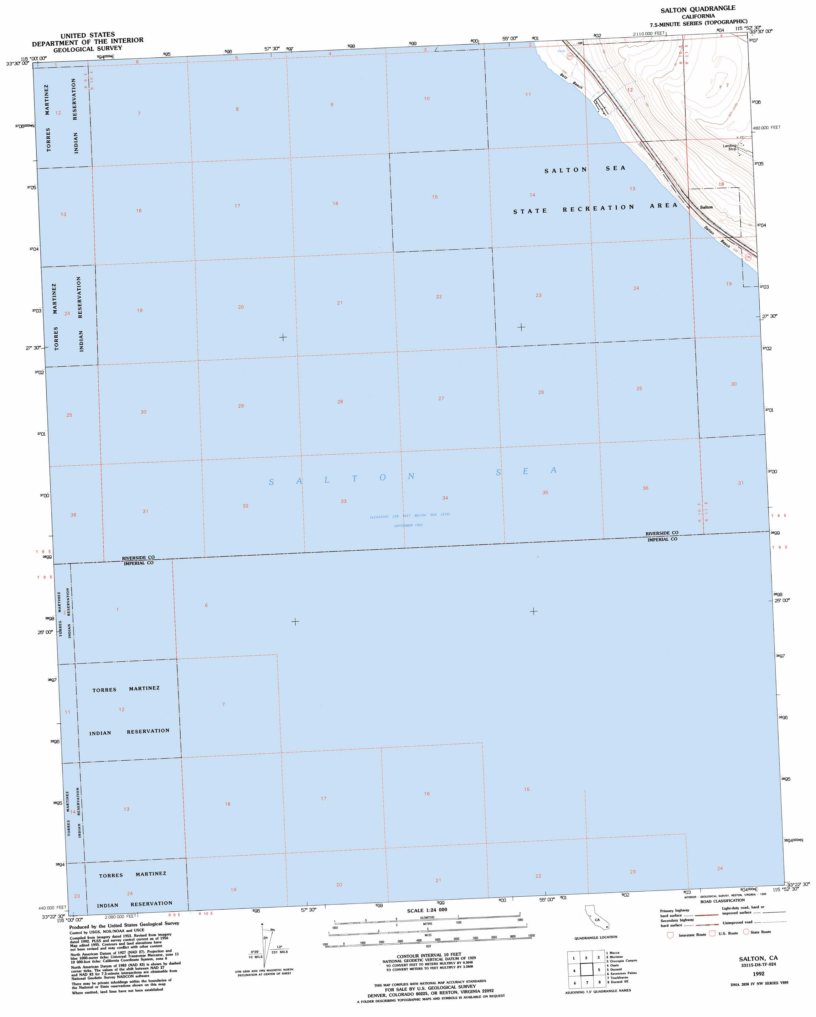
USGS Topo Quad 33115d8 - 1:24,000 scale
| Topo Map Name: | Salton |
| USGS Topo Quad ID: | 33115d8 |
| Print Size: | ca. 21 1/4" wide x 27" high |
| Southeast Coordinates: | 33.375° N latitude / 115.875° W longitude |
| Map Center Coordinates: | 33.4375° N latitude / 115.9375° W longitude |
| U.S. State: | CA |
| Filename: | o33115d8.jpg |
| Download Map JPG Image: | Salton topo map 1:24,000 scale |
| Map Type: | Topographic |
| Topo Series: | 7.5´ |
| Map Scale: | 1:24,000 |
| Source of Map Images: | United States Geological Survey (USGS) |
| Alternate Map Versions: |
Salton CA 1956, updated 1957 Download PDF Buy paper map Salton CA 1956, updated 1963 Download PDF Buy paper map Salton CA 1956, updated 1977 Download PDF Buy paper map Salton CA 1992, updated 1995 Download PDF Buy paper map Salton CA 1998, updated 2003 Download PDF Buy paper map Salton CA 2012 Download PDF Buy paper map Salton CA 2015 Download PDF Buy paper map |
1:24,000 Topo Quads surrounding Salton
Indio |
Thermal Canyon |
Cottonwood Basin |
Cottonwood Spring |
Hayfield |
Valerie |
Mecca |
Mortmar |
Orocopia Canyon |
Red Canyon |
Rabbit Peak |
Oasis |
Salton |
Durmid |
Frink Nw |
Fonts Point |
Seventeen Palms |
Truckhaven |
Durmid Se |
Frink |
Borrego Mountain |
Shell Reef |
Kane Spring Nw |
Kane Spring Ne |
Obsidian Butte |
> Back to 33115a1 at 1:100,000 scale
> Back to 33114a1 at 1:250,000 scale
> Back to U.S. Topo Maps home
Salton topo map: Gazetteer
Salton: Beaches
Betz Beach elevation -69m -227′Salton Beach elevation -69m -227′
Salton: Populated Places
Salton elevation -57m -188′Salton digital topo map on disk
Buy this Salton topo map showing relief, roads, GPS coordinates and other geographical features, as a high-resolution digital map file on DVD: