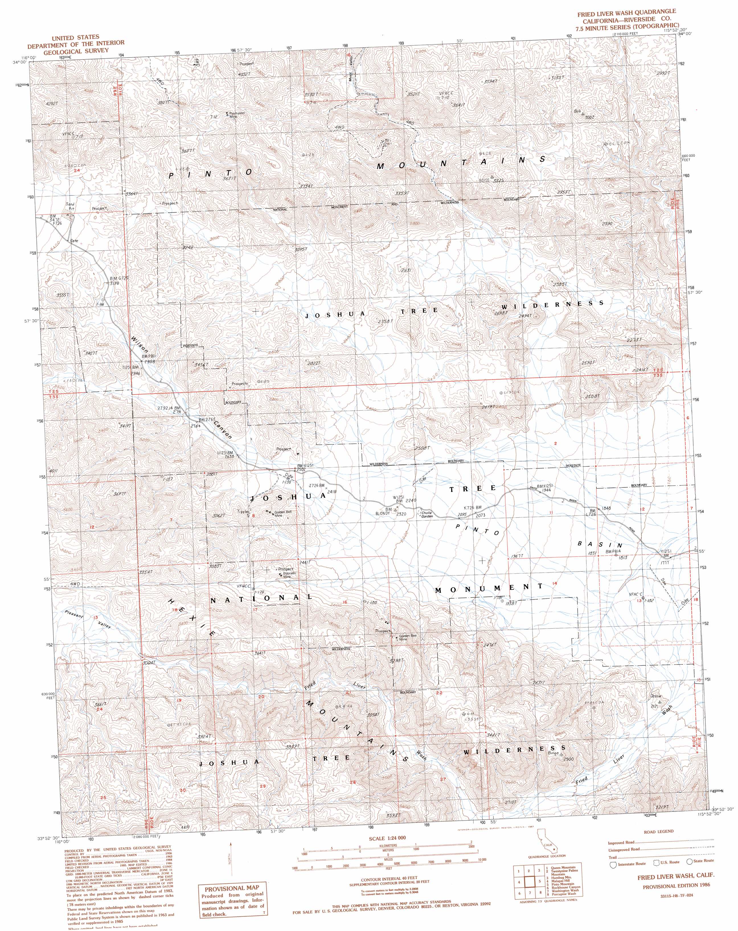
Fried Liver Wash Topo Map California
To zoom in, hover over the map of Fried Liver Wash
USGS Topo Quad 33115h8 - 1:24,000 scale
| Topo Map Name: | Fried Liver Wash |
| USGS Topo Quad ID: | 33115h8 |
| Print Size: | ca. 21 1/4" wide x 27" high |
| Southeast Coordinates: | 33.875° N latitude / 115.875° W longitude |
| Map Center Coordinates: | 33.9375° N latitude / 115.9375° W longitude |
| U.S. State: | CA |
| Filename: | o33115h8.jpg |
| Download Map JPG Image: | Fried Liver Wash topo map 1:24,000 scale |
| Map Type: | Topographic |
| Topo Series: | 7.5´ |
| Map Scale: | 1:24,000 |
| Source of Map Images: | United States Geological Survey (USGS) |
| Alternate Map Versions: |
Fried Liver Wash CA 1986, updated 1986 Download PDF Buy paper map Fried Liver Wash CA 2012 Download PDF Buy paper map Fried Liver Wash CA 2015 Download PDF Buy paper map |
1:24,000 Topo Quads surrounding Fried Liver Wash
Sunfair |
Twentynine Palms |
Valley Mountain |
East Of Valley Mountain |
Dale Lake |
Indian Cove |
Queen Mountain |
Twentynine Palms Mountain |
Humbug Mountain |
New Dale |
Keys View |
Malapai Hill |
Fried Liver Wash |
Pinto Mountain |
San Bernardino Wash |
West Berdoo Canyon |
Rockhouse Canyon |
Washington Wash |
Porcupine Wash |
Conejo Well |
Indio |
Thermal Canyon |
Cottonwood Basin |
Cottonwood Spring |
Hayfield |
> Back to 33115e1 at 1:100,000 scale
> Back to 33114a1 at 1:250,000 scale
> Back to U.S. Topo Maps home
Fried Liver Wash topo map: Gazetteer
Fried Liver Wash: Mines
Eldorado Mine elevation 827m 2713′Golden Bee Mine elevation 877m 2877′
Golden Bell Mine elevation 832m 2729′
Paymaster Mine elevation 1086m 3562′
Silver Bell Mine elevation 852m 2795′
Fried Liver Wash: Parks
Joshua Tree National Park elevation 614m 2014′Fried Liver Wash: Ranges
Hexie Mountains elevation 1167m 3828′Fried Liver Wash: Streams
Washington Wash elevation 699m 2293′Fried Liver Wash: Trails
Cholla Garden Nature Trail elevation 672m 2204′Fried Liver Wash: Valleys
Pleasant Valley elevation 925m 3034′Wilson Canyon elevation 754m 2473′
Fried Liver Wash digital topo map on disk
Buy this Fried Liver Wash topo map showing relief, roads, GPS coordinates and other geographical features, as a high-resolution digital map file on DVD: