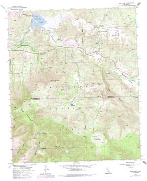
Vail Lake Topo Map California
To zoom in, hover over the map of Vail Lake
USGS Topo Quad 33116d8 - 1:24,000 scale
| Topo Map Name: | Vail Lake |
| USGS Topo Quad ID: | 33116d8 |
| Print Size: | ca. 21 1/4" wide x 27" high |
| Southeast Coordinates: | 33.375° N latitude / 116.875° W longitude |
| Map Center Coordinates: | 33.4375° N latitude / 116.9375° W longitude |
| U.S. State: | CA |
| Filename: | o33116d8.jpg |
| Download Map JPG Image: | Vail Lake topo map 1:24,000 scale |
| Map Type: | Topographic |
| Topo Series: | 7.5´ |
| Map Scale: | 1:24,000 |
| Source of Map Images: | United States Geological Survey (USGS) |
| Alternate Map Versions: |
Vail Lake CA 1953, updated 1955 Download PDF Buy paper map Vail Lake CA 1953, updated 1961 Download PDF Buy paper map Vail Lake CA 1953, updated 1973 Download PDF Buy paper map Vail Lake CA 1953, updated 1980 Download PDF Buy paper map Vail Lake CA 1953, updated 1984 Download PDF Buy paper map Vail Lake CA 1953, updated 1987 Download PDF Buy paper map Vail Lake CA 1953, updated 1988 Download PDF Buy paper map Vail Lake CA 1997, updated 2000 Download PDF Buy paper map Vail Lake CA 2012 Download PDF Buy paper map Vail Lake CA 2015 Download PDF Buy paper map |
| FStopo: | US Forest Service topo Vail Lake is available: Download FStopo PDF Download FStopo TIF |
1:24,000 Topo Quads surrounding Vail Lake
> Back to 33116a1 at 1:100,000 scale
> Back to 33116a1 at 1:250,000 scale
> Back to U.S. Topo Maps home
Vail Lake topo map: Gazetteer
Vail Lake: Dams
Vail 2028 Dam elevation 445m 1459′Vail Lake: Gaps
Crosley Saddle elevation 1200m 3937′Vail Lake: Populated Places
Butterfield Lake Estates elevation 452m 1482′Radec elevation 520m 1706′
Vail Lake: Reservoirs
Vail Lake elevation 445m 1459′Vail Lake: Springs
Dripping Springs elevation 463m 1519′Sawyer Spring elevation 668m 2191′
Vail Lake: Streams
Arroyo Seco Creek elevation 445m 1459′Cottonwood Creek elevation 546m 1791′
Kolb Creek elevation 455m 1492′
Spring Creek elevation 449m 1473′
Wilson Creek elevation 445m 1459′
Vail Lake: Summits
Agua Tibia Mountain elevation 1454m 4770′Eagle Crage elevation 1538m 5045′
Wild Horse Peak elevation 993m 3257′
Vail Lake: Trails
Crosley Truck Trail elevation 867m 2844′Cutca Valley Truck Trail elevation 1015m 3330′
Dripping Springs Trail elevation 973m 3192′
Vail Lake: Valleys
Aguanga Valley elevation 564m 1850′Butterfield Valley elevation 445m 1459′
Cutca Valley elevation 1049m 3441′
Devils Hole elevation 666m 2185′
Lancaster Valley elevation 500m 1640′
Long Canyon elevation 525m 1722′
Radec Valley elevation 489m 1604′
Wilson Valley elevation 610m 2001′
Vail Lake digital topo map on disk
Buy this Vail Lake topo map showing relief, roads, GPS coordinates and other geographical features, as a high-resolution digital map file on DVD:


