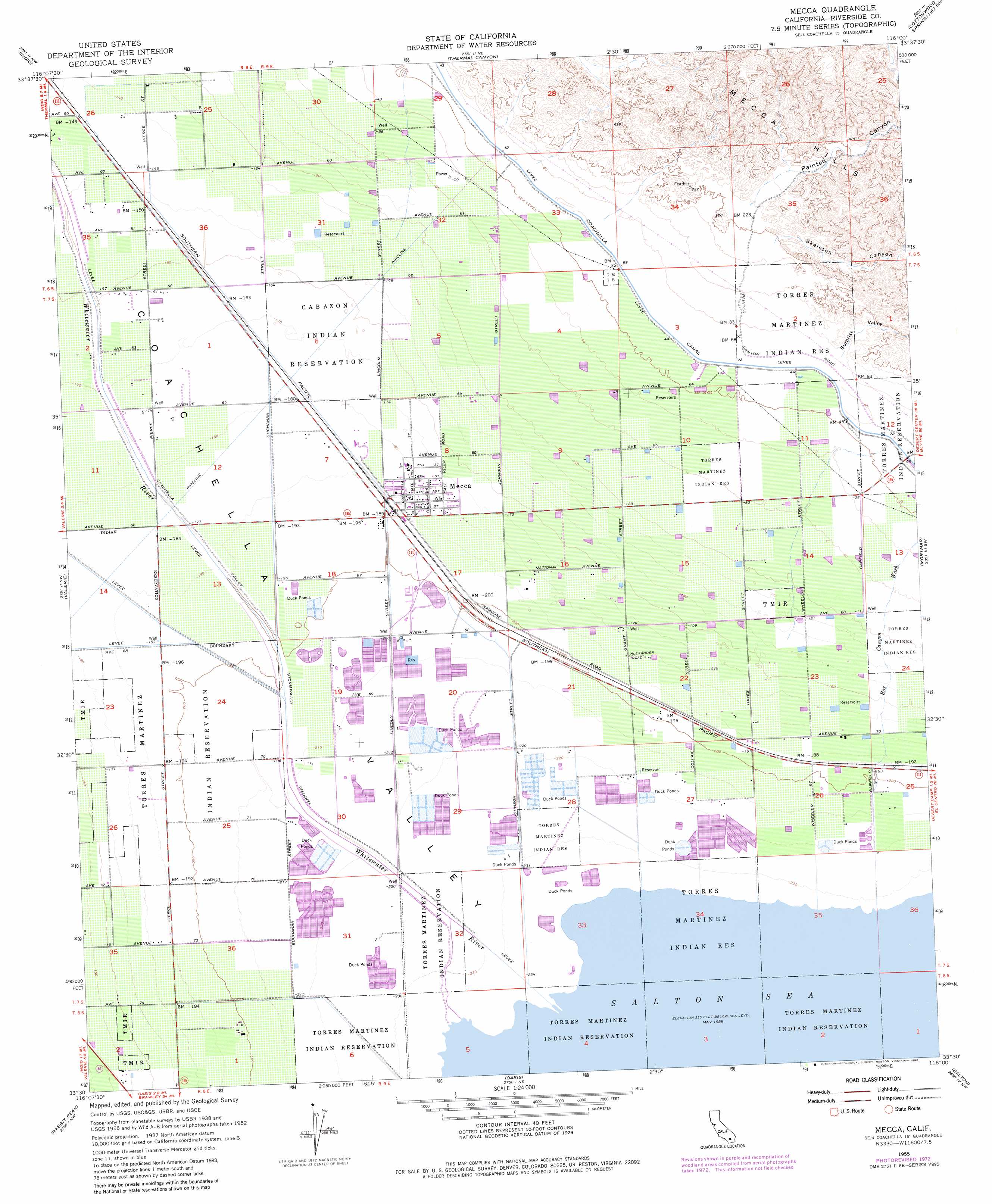
Mecca Topo Map California
To zoom in, hover over the map of Mecca
USGS Topo Quad 33116e1 - 1:24,000 scale
| Topo Map Name: | Mecca |
| USGS Topo Quad ID: | 33116e1 |
| Print Size: | ca. 21 1/4" wide x 27" high |
| Southeast Coordinates: | 33.5° N latitude / 116° W longitude |
| Map Center Coordinates: | 33.5625° N latitude / 116.0625° W longitude |
| U.S. State: | CA |
| Filename: | o33116e1.jpg |
| Download Map JPG Image: | Mecca topo map 1:24,000 scale |
| Map Type: | Topographic |
| Topo Series: | 7.5´ |
| Map Scale: | 1:24,000 |
| Source of Map Images: | United States Geological Survey (USGS) |
| Alternate Map Versions: |
Mecca CA 1955, updated 1957 Download PDF Buy paper map Mecca CA 1955, updated 1964 Download PDF Buy paper map Mecca CA 1955, updated 1973 Download PDF Buy paper map Mecca CA 1955, updated 1980 Download PDF Buy paper map Mecca CA 2012 Download PDF Buy paper map Mecca CA 2015 Download PDF Buy paper map |
1:24,000 Topo Quads surrounding Mecca
Myoma |
West Berdoo Canyon |
Rockhouse Canyon |
Washington Wash |
Porcupine Wash |
La Quinta |
Indio |
Thermal Canyon |
Cottonwood Basin |
Cottonwood Spring |
Martinez Mountain |
Valerie |
Mecca |
Mortmar |
Orocopia Canyon |
Clark Lake Ne |
Rabbit Peak |
Oasis |
Salton |
Durmid |
Clark Lake |
Fonts Point |
Seventeen Palms |
Truckhaven |
Durmid Se |
> Back to 33116e1 at 1:100,000 scale
> Back to 33116a1 at 1:250,000 scale
> Back to U.S. Topo Maps home
Mecca topo map: Gazetteer
Mecca: Bays
Whitewater Cove elevation -71m -233′Mecca: Populated Places
Caleb (historical) elevation -57m -188′Mecca elevation -57m -188′
Mecca: Streams
Box Canyon Wash elevation -69m -227′Whitewater River elevation -68m -224′
Mecca: Valleys
Painted Canyon elevation 70m 229′Skeleton Canyon elevation 60m 196′
Surprise Valley elevation 23m 75′
Mecca digital topo map on disk
Buy this Mecca topo map showing relief, roads, GPS coordinates and other geographical features, as a high-resolution digital map file on DVD: