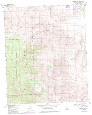
Martinez Mountain Topo Map California
To zoom in, hover over the map of Martinez Mountain
USGS Topo Quad 33116e3 - 1:24,000 scale
| Topo Map Name: | Martinez Mountain |
| USGS Topo Quad ID: | 33116e3 |
| Print Size: | ca. 21 1/4" wide x 27" high |
| Southeast Coordinates: | 33.5° N latitude / 116.25° W longitude |
| Map Center Coordinates: | 33.5625° N latitude / 116.3125° W longitude |
| U.S. State: | CA |
| Filename: | o33116e3.jpg |
| Download Map JPG Image: | Martinez Mountain topo map 1:24,000 scale |
| Map Type: | Topographic |
| Topo Series: | 7.5´ |
| Map Scale: | 1:24,000 |
| Source of Map Images: | United States Geological Survey (USGS) |
| Alternate Map Versions: |
Martinez Mtn CA 1981, updated 1982 Download PDF Buy paper map Martinez Mtn CA 1981, updated 1988 Download PDF Buy paper map Martinez Mountain CA 1996, updated 1999 Download PDF Buy paper map Martinez Mountain CA 2012 Download PDF Buy paper map Martinez Mountain CA 2015 Download PDF Buy paper map |
| FStopo: | US Forest Service topo Martinez Mountain is available: Download FStopo PDF Download FStopo TIF |
1:24,000 Topo Quads surrounding Martinez Mountain
> Back to 33116e1 at 1:100,000 scale
> Back to 33116a1 at 1:250,000 scale
> Back to U.S. Topo Maps home
Martinez Mountain topo map: Gazetteer
Martinez Mountain: Flats
Pinyon Alta Flat elevation 1156m 3792′Martinez Mountain: Parks
Lake Cahuilla County Park elevation 6m 19′Martinez Mountain: Springs
Agua Alta Spring elevation 1315m 4314′Martinez Mountain: Streams
Guadalupe Creek elevation 226m 741′Martinez Mountain: Summits
Martinez Mountain elevation 1986m 6515′Martinez Mountain: Trails
Cactus Spring Trail elevation 1299m 4261′Martinez Mountain: Valleys
Black Rabbit Canyon elevation 1138m 3733′Devil Canyon elevation 119m 390′
Ebbens Valley elevation 1250m 4101′
Tahquitz Canyon elevation 777m 2549′
Martinez Mountain digital topo map on disk
Buy this Martinez Mountain topo map showing relief, roads, GPS coordinates and other geographical features, as a high-resolution digital map file on DVD:


