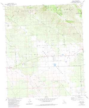
Anza Topo Map California
To zoom in, hover over the map of Anza
USGS Topo Quad 33116e6 - 1:24,000 scale
| Topo Map Name: | Anza |
| USGS Topo Quad ID: | 33116e6 |
| Print Size: | ca. 21 1/4" wide x 27" high |
| Southeast Coordinates: | 33.5° N latitude / 116.625° W longitude |
| Map Center Coordinates: | 33.5625° N latitude / 116.6875° W longitude |
| U.S. State: | CA |
| Filename: | o33116e6.jpg |
| Download Map JPG Image: | Anza topo map 1:24,000 scale |
| Map Type: | Topographic |
| Topo Series: | 7.5´ |
| Map Scale: | 1:24,000 |
| Source of Map Images: | United States Geological Survey (USGS) |
| Alternate Map Versions: |
Anza CA 1981, updated 1982 Download PDF Buy paper map Anza CA 1981, updated 1982 Download PDF Buy paper map Anza CA 1981, updated 1988 Download PDF Buy paper map Anza CA 1996, updated 1999 Download PDF Buy paper map Anza CA 2012 Download PDF Buy paper map Anza CA 2015 Download PDF Buy paper map |
| FStopo: | US Forest Service topo Anza is available: Download FStopo PDF Download FStopo TIF |
1:24,000 Topo Quads surrounding Anza
> Back to 33116e1 at 1:100,000 scale
> Back to 33116a1 at 1:250,000 scale
> Back to U.S. Topo Maps home
Anza topo map: Gazetteer
Anza: Basins
Anza Valley elevation 1267m 4156′Terwilliger Valley elevation 1184m 3884′
Anza: Dams
Cottonwood Fire Break elevation 1352m 4435′Anza: Flats
Tripp Flats elevation 1193m 3914′Anza: Lakes
Hog Lake elevation 1437m 4714′Anza: Mines
Lucky Deer Mine elevation 1504m 4934′Anza: Parks
Minor Park elevation 1194m 3917′Anza: Populated Places
Anza elevation 1195m 3920′Cahuilla elevation 1110m 3641′
Thomas Mountain elevation 1389m 4557′
Anza: Springs
Magee Spring elevation 1854m 6082′Tool Box Spring elevation 1824m 5984′
Anza: Streams
Hamilton Creek elevation 1178m 3864′Anza: Summits
Cave Rocks elevation 1236m 4055′Thomas Mountain elevation 2071m 6794′
Anza: Trails
Ramona Trail elevation 1780m 5839′Anza: Valleys
Cottonwood Canyon elevation 1141m 3743′Durasno Valley elevation 1120m 3674′
Anza digital topo map on disk
Buy this Anza topo map showing relief, roads, GPS coordinates and other geographical features, as a high-resolution digital map file on DVD:


