Cahuilla Mountain Topo Map California
To zoom in, hover over the map of Cahuilla Mountain
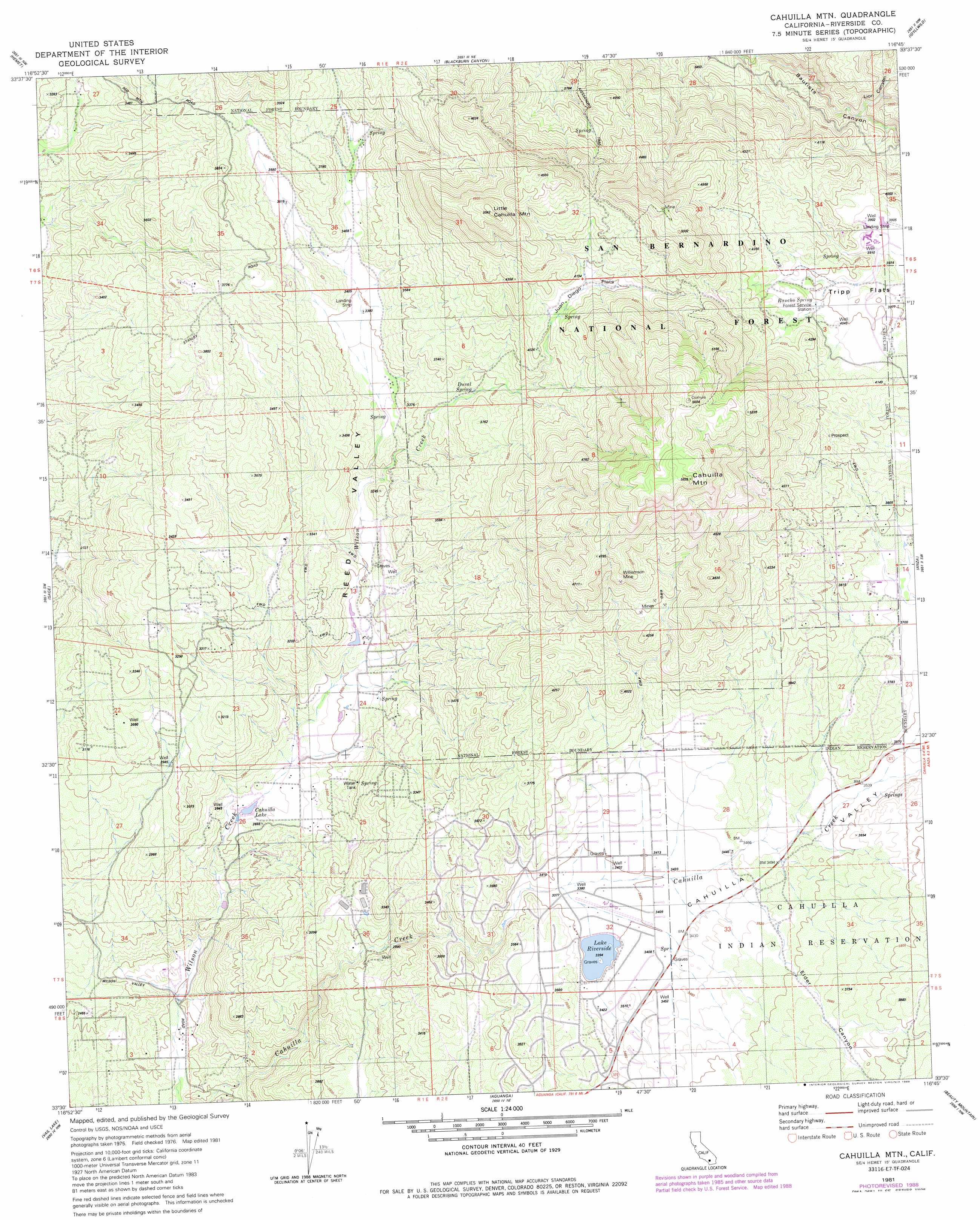
USGS Topo Quad 33116e7 - 1:24,000 scale
| Topo Map Name: | Cahuilla Mountain |
| USGS Topo Quad ID: | 33116e7 |
| Print Size: | ca. 21 1/4" wide x 27" high |
| Southeast Coordinates: | 33.5° N latitude / 116.75° W longitude |
| Map Center Coordinates: | 33.5625° N latitude / 116.8125° W longitude |
| U.S. State: | CA |
| Filename: | o33116e7.jpg |
| Download Map JPG Image: | Cahuilla Mountain topo map 1:24,000 scale |
| Map Type: | Topographic |
| Topo Series: | 7.5´ |
| Map Scale: | 1:24,000 |
| Source of Map Images: | United States Geological Survey (USGS) |
| Alternate Map Versions: |
Cahuilla Mtn CA 1981, updated 1982 Download PDF Buy paper map Cahuilla Mtn CA 1981, updated 1982 Download PDF Buy paper map Cahuilla Mtn CA 1981, updated 1988 Download PDF Buy paper map Cahuilla Mountain CA 1996, updated 1999 Download PDF Buy paper map Cahuilla Mountain CA 2012 Download PDF Buy paper map Cahuilla Mountain CA 2015 Download PDF Buy paper map |
| FStopo: | US Forest Service topo Cahuilla Mountain is available: Download FStopo PDF Download FStopo TIF |
1:24,000 Topo Quads surrounding Cahuilla Mountain
Lakeview |
San Jacinto |
Lake Fulmor |
San Jacinto Peak |
Palm Springs |
Winchester |
Hemet |
Blackburn Canyon |
Idyllwild |
Palm View Peak |
Bachelor Mountain |
Sage |
Cahuilla Mountain |
Anza |
Butterfly Peak |
Pechanga |
Vail Lake |
Aguanga |
Beauty Mountain |
Bucksnort Mountain |
Pala |
Boucher Hill |
Palomar Observatory |
Warner Springs |
Hot Springs Mountain |
> Back to 33116e1 at 1:100,000 scale
> Back to 33116a1 at 1:250,000 scale
> Back to U.S. Topo Maps home
Cahuilla Mountain topo map: Gazetteer
Cahuilla Mountain: Airports
Lake Riverside Estates Airport elevation 1032m 3385′Cahuilla Mountain: Flats
Juan Diego Flat elevation 1254m 4114′Cahuilla Mountain: Mines
Williamson Mine elevation 1286m 4219′Cahuilla Mountain: Reservoirs
Cahuilla Lake elevation 807m 2647′Lake Riverside elevation 1036m 3398′
Cahuilla Mountain: Springs
Duval Spring elevation 1082m 3549′Rancho Spring elevation 1223m 4012′
Cahuilla Mountain: Streams
Elder Creek elevation 1048m 3438′Cahuilla Mountain: Summits
Cahuilla Mountain elevation 1684m 5524′Little Cahuilla Mountain elevation 1530m 5019′
Cahuilla Mountain: Valleys
Elder Canyon elevation 1069m 3507′Lion Canyon elevation 1060m 3477′
Reed Valley elevation 939m 3080′
Cahuilla Mountain digital topo map on disk
Buy this Cahuilla Mountain topo map showing relief, roads, GPS coordinates and other geographical features, as a high-resolution digital map file on DVD: