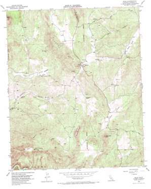
Sage Topo Map California
To zoom in, hover over the map of Sage
USGS Topo Quad 33116e8 - 1:24,000 scale
| Topo Map Name: | Sage |
| USGS Topo Quad ID: | 33116e8 |
| Print Size: | ca. 21 1/4" wide x 27" high |
| Southeast Coordinates: | 33.5° N latitude / 116.875° W longitude |
| Map Center Coordinates: | 33.5625° N latitude / 116.9375° W longitude |
| U.S. State: | CA |
| Filename: | o33116e8.jpg |
| Download Map JPG Image: | Sage topo map 1:24,000 scale |
| Map Type: | Topographic |
| Topo Series: | 7.5´ |
| Map Scale: | 1:24,000 |
| Source of Map Images: | United States Geological Survey (USGS) |
| Alternate Map Versions: |
Sage CA 1954, updated 1956 Download PDF Buy paper map Sage CA 1954, updated 1962 Download PDF Buy paper map Sage CA 1954, updated 1973 Download PDF Buy paper map Sage CA 1954, updated 1973 Download PDF Buy paper map Sage CA 2012 Download PDF Buy paper map Sage CA 2015 Download PDF Buy paper map |
1:24,000 Topo Quads surrounding Sage
> Back to 33116e1 at 1:100,000 scale
> Back to 33116a1 at 1:250,000 scale
> Back to U.S. Topo Maps home
Sage topo map: Gazetteer
Sage: Airports
Clark Ranch Airpark elevation 665m 2181′Ernst Field elevation 852m 2795′
Sage: Parks
Glenoak Hills Park elevation 520m 1706′Sage: Populated Places
Glenoak Hills elevation 686m 2250′Oakridge Ranches elevation 614m 2014′
Sage elevation 705m 2312′
Sycamore Hills elevation 726m 2381′
Sycamore Springs elevation 746m 2447′
Sage: Ranges
Black Hills elevation 835m 2739′Sage: Ridges
Rocky Ridge elevation 716m 2349′Sage: Slopes
Saint Johns Grade elevation 714m 2342′Sage: Springs
Adobe Spring elevation 505m 1656′Sage: Summits
Oak Mountain elevation 825m 2706′Roundtop elevation 787m 2582′
Sage: Valleys
Glenoak Valley elevation 513m 1683′Lewis Valley elevation 602m 1975′
Tucalota Valley elevation 534m 1751′
Weber Valley elevation 820m 2690′
Willow Canyon elevation 755m 2477′
Sage digital topo map on disk
Buy this Sage topo map showing relief, roads, GPS coordinates and other geographical features, as a high-resolution digital map file on DVD:


