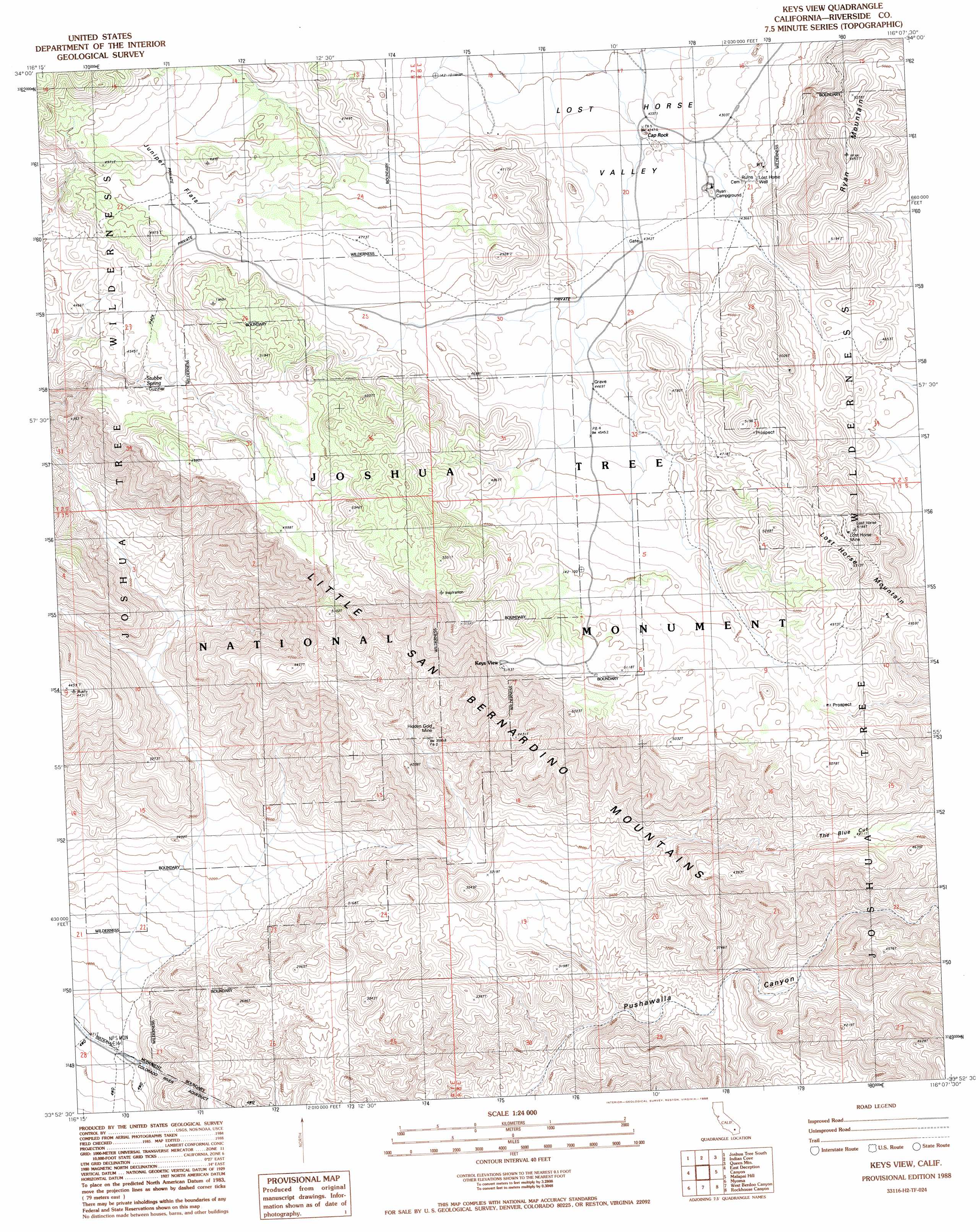
Keys View Topo Map California
To zoom in, hover over the map of Keys View
USGS Topo Quad 33116h2 - 1:24,000 scale
| Topo Map Name: | Keys View |
| USGS Topo Quad ID: | 33116h2 |
| Print Size: | ca. 21 1/4" wide x 27" high |
| Southeast Coordinates: | 33.875° N latitude / 116.125° W longitude |
| Map Center Coordinates: | 33.9375° N latitude / 116.1875° W longitude |
| U.S. State: | CA |
| Filename: | o33116h2.jpg |
| Download Map JPG Image: | Keys View topo map 1:24,000 scale |
| Map Type: | Topographic |
| Topo Series: | 7.5´ |
| Map Scale: | 1:24,000 |
| Source of Map Images: | United States Geological Survey (USGS) |
| Alternate Map Versions: |
Keys View CA 1988, updated 1988 Download PDF Buy paper map Keys View CA 1998, updated 2002 Download PDF Buy paper map Keys View CA 2012 Download PDF Buy paper map Keys View CA 2015 Download PDF Buy paper map |
1:24,000 Topo Quads surrounding Keys View
Yucca Valley North |
Joshua Tree North |
Sunfair |
Twentynine Palms |
Valley Mountain |
Yucca Valley South |
Joshua Tree South |
Indian Cove |
Queen Mountain |
Twentynine Palms Mountain |
Seven Palms Valley |
East Deception Canyon |
Keys View |
Malapai Hill |
Fried Liver Wash |
Cathedral City |
Myoma |
West Berdoo Canyon |
Rockhouse Canyon |
Washington Wash |
Rancho Mirage |
La Quinta |
Indio |
Thermal Canyon |
Cottonwood Basin |
> Back to 33116e1 at 1:100,000 scale
> Back to 33116a1 at 1:250,000 scale
> Back to U.S. Topo Maps home
Keys View topo map: Gazetteer
Keys View: Flats
Juniper Flats elevation 1473m 4832′Keys View: Gaps
The Blue Cut elevation 1347m 4419′Keys View: Mines
Hidden Gold Mine elevation 1096m 3595′Lost Horse Mine elevation 1525m 5003′
Keys View: Springs
Stubbe Spring elevation 1377m 4517′Keys View: Summits
Keys View elevation 1581m 5187′Lost Horse Mountain elevation 1609m 5278′
Ryan Mountain elevation 1663m 5456′
Keys View: Wells
Lost Horse Well elevation 1344m 4409′Keys View digital topo map on disk
Buy this Keys View topo map showing relief, roads, GPS coordinates and other geographical features, as a high-resolution digital map file on DVD: