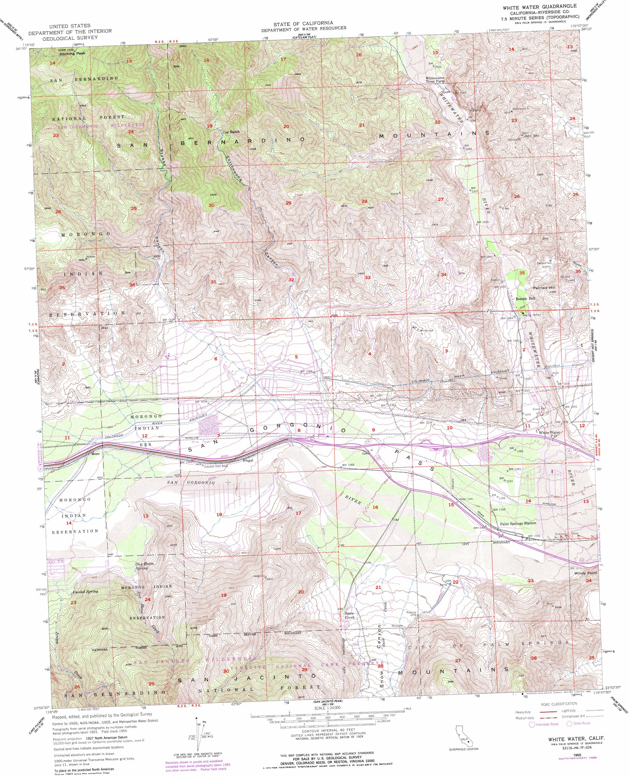
White Water Topo Map California
To zoom in, hover over the map of White Water
USGS Topo Quad 33116h6 - 1:24,000 scale
| Topo Map Name: | White Water |
| USGS Topo Quad ID: | 33116h6 |
| Print Size: | ca. 21 1/4" wide x 27" high |
| Southeast Coordinates: | 33.875° N latitude / 116.625° W longitude |
| Map Center Coordinates: | 33.9375° N latitude / 116.6875° W longitude |
| U.S. State: | CA |
| Filename: | o33116h6.jpg |
| Download Map JPG Image: | White Water topo map 1:24,000 scale |
| Map Type: | Topographic |
| Topo Series: | 7.5´ |
| Map Scale: | 1:24,000 |
| Source of Map Images: | United States Geological Survey (USGS) |
| Alternate Map Versions: |
Whitewater CA 1955, updated 1956 Download PDF Buy paper map Whitewater CA 1955, updated 1961 Download PDF Buy paper map Whitewater CA 1955, updated 1973 Download PDF Buy paper map White Water CA 1955, updated 1988 Download PDF Buy paper map White Water CA 1996, updated 1999 Download PDF Buy paper map White Water CA 2012 Download PDF Buy paper map White Water CA 2015 Download PDF Buy paper map |
| FStopo: | US Forest Service topo White Water is available: Download FStopo PDF Download FStopo TIF |
1:24,000 Topo Quads surrounding White Water
Big Bear Lake |
Moonridge |
Onyx Peak |
Rimrock |
Yucca Valley North |
Forest Falls |
San Gorgonio Mountain |
Catclaw Flat |
Morongo Valley |
Yucca Valley South |
Beaumont |
Cabazon |
White Water |
Desert Hot Springs |
Seven Palms Valley |
San Jacinto |
Lake Fulmor |
San Jacinto Peak |
Palm Springs |
Cathedral City |
Hemet |
Blackburn Canyon |
Idyllwild |
Palm View Peak |
Rancho Mirage |
> Back to 33116e1 at 1:100,000 scale
> Back to 33116a1 at 1:250,000 scale
> Back to U.S. Topo Maps home
White Water topo map: Gazetteer
White Water: Capes
Windy Point elevation 470m 1541′White Water: Dams
Cow Camp Dam elevation 360m 1181′Squaw Tank Dam elevation 360m 1181′
White Water: Mines
Painted Hill Quarry elevation 597m 1958′Super Creek Mine elevation 582m 1909′
White Water: Populated Places
Bonnie Bell elevation 513m 1683′Mons elevation 489m 1604′
Snow Creek elevation 389m 1276′
White Water elevation 416m 1364′
White Water: Reservoirs
Squaw Tank elevation 360m 1181′White Water: Springs
Dunkel Spring elevation 498m 1633′One Horse Spring elevation 460m 1509′
White Water: Streams
Jenson Creek elevation 464m 1522′One Horse Creek elevation 454m 1489′
San Gorgonio River elevation 334m 1095′
Snow Creek elevation 354m 1161′
White Water: Summits
Kitching Peak elevation 1999m 6558′Painted Hill elevation 718m 2355′
The Matterdome elevation 809m 2654′
White Water: Valleys
Cottonwood Canyon elevation 559m 1833′Snow Canyon elevation 354m 1161′
Stubbe Canyon elevation 571m 1873′
White Water digital topo map on disk
Buy this White Water topo map showing relief, roads, GPS coordinates and other geographical features, as a high-resolution digital map file on DVD: