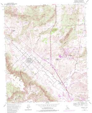
Murrieta Topo Map California
To zoom in, hover over the map of Murrieta
USGS Topo Quad 33117e2 - 1:24,000 scale
| Topo Map Name: | Murrieta |
| USGS Topo Quad ID: | 33117e2 |
| Print Size: | ca. 21 1/4" wide x 27" high |
| Southeast Coordinates: | 33.5° N latitude / 117.125° W longitude |
| Map Center Coordinates: | 33.5625° N latitude / 117.1875° W longitude |
| U.S. State: | CA |
| Filename: | o33117e2.jpg |
| Download Map JPG Image: | Murrieta topo map 1:24,000 scale |
| Map Type: | Topographic |
| Topo Series: | 7.5´ |
| Map Scale: | 1:24,000 |
| Source of Map Images: | United States Geological Survey (USGS) |
| Alternate Map Versions: |
Murrieta CA 1953, updated 1955 Download PDF Buy paper map Murrieta CA 1953, updated 1962 Download PDF Buy paper map Murrieta CA 1953, updated 1971 Download PDF Buy paper map Murrieta CA 1953, updated 1975 Download PDF Buy paper map Murrieta CA 1953, updated 1979 Download PDF Buy paper map Murrieta CA 1953, updated 1986 Download PDF Buy paper map Murrieta CA 2012 Download PDF Buy paper map Murrieta CA 2015 Download PDF Buy paper map |
1:24,000 Topo Quads surrounding Murrieta
> Back to 33117e1 at 1:100,000 scale
> Back to 33116a1 at 1:250,000 scale
> Back to U.S. Topo Maps home
Murrieta topo map: Gazetteer
Murrieta: Airports
Bear Creek Airport elevation 346m 1135′French Valley Airport elevation 407m 1335′
Inland Valley Regional Medical Center Heliport elevation 402m 1318′
Sky Park Landing Field elevation 349m 1145′
Thompson Airstrip elevation 345m 1131′
Murrieta: Capes
Point Lookout elevation 427m 1400′Murrieta: Crossings
Interchange 1 elevation 351m 1151′Interchange 2 elevation 376m 1233′
Interchange 4 elevation 460m 1509′
Interchange 59 elevation 311m 1020′
Interchange 61 elevation 321m 1053′
Interchange 64 elevation 337m 1105′
Interchange 65 elevation 358m 1174′
Interchange 68 elevation 397m 1302′
Murrieta: Parks
Alta Murrieta Sports Park elevation 375m 1230′California Oaks Sports Park elevation 382m 1253′
Meadow Ridge Park elevation 354m 1161′
Park E elevation 348m 1141′
Park F elevation 355m 1164′
Pond Park elevation 336m 1102′
Rancho Acacias Park elevation 386m 1266′
Temecula Sports Park elevation 342m 1122′
Willowglen Park elevation 380m 1246′
Murrieta: Populated Places
Antelope Hills elevation 468m 1535′Linda Rose elevation 318m 1043′
Mission Hills Mobile Home Park elevation 332m 1089′
Murrieta elevation 334m 1095′
Murrieta Hot Springs elevation 364m 1194′
Warm Springs Mobile Home Park elevation 332m 1089′
Murrieta: Post Offices
Murrieta Post Office elevation 333m 1092′Murrieta: Springs
Adobe Spring elevation 402m 1318′Iodine Spring elevation 505m 1656′
Murrieta: Streams
Santa Gertrudis Creek elevation 312m 1023′Tucalota Creek elevation 333m 1092′
Warm Springs Creek elevation 315m 1033′
Murrieta: Summits
Chaney Hill elevation 374m 1227′Hogbacks elevation 530m 1738′
Mesa de Burro elevation 619m 2030′
Murrieta: Valleys
Cole Canyon elevation 341m 1118′French Valley elevation 408m 1338′
Long Canyon elevation 314m 1030′
Miller Canyon elevation 338m 1108′
Murrieta digital topo map on disk
Buy this Murrieta topo map showing relief, roads, GPS coordinates and other geographical features, as a high-resolution digital map file on DVD:


