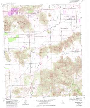
Winchester Topo Map California
To zoom in, hover over the map of Winchester
USGS Topo Quad 33117f1 - 1:24,000 scale
| Topo Map Name: | Winchester |
| USGS Topo Quad ID: | 33117f1 |
| Print Size: | ca. 21 1/4" wide x 27" high |
| Southeast Coordinates: | 33.625° N latitude / 117° W longitude |
| Map Center Coordinates: | 33.6875° N latitude / 117.0625° W longitude |
| U.S. State: | CA |
| Filename: | o33117f1.jpg |
| Download Map JPG Image: | Winchester topo map 1:24,000 scale |
| Map Type: | Topographic |
| Topo Series: | 7.5´ |
| Map Scale: | 1:24,000 |
| Source of Map Images: | United States Geological Survey (USGS) |
| Alternate Map Versions: |
Winchester CA 1953, updated 1954 Download PDF Buy paper map Winchester CA 1953, updated 1962 Download PDF Buy paper map Winchester CA 1953, updated 1970 Download PDF Buy paper map Winchester CA 1953, updated 1975 Download PDF Buy paper map Winchester CA 1953, updated 1979 Download PDF Buy paper map Winchester CA 1953, updated 1986 Download PDF Buy paper map Winchester CA 2012 Download PDF Buy paper map Winchester CA 2015 Download PDF Buy paper map |
1:24,000 Topo Quads surrounding Winchester
> Back to 33117e1 at 1:100,000 scale
> Back to 33116a1 at 1:250,000 scale
> Back to U.S. Topo Maps home
Winchester topo map: Gazetteer
Winchester: Airports
Hemet-Ryan Airport elevation 460m 1509′Pines Airpark elevation 432m 1417′
Winchester: Basins
Crown Valley elevation 639m 2096′Winchester: Parks
Double Butte County Park elevation 489m 1604′Southwest Park elevation 466m 1528′
Winchester: Populated Places
Egan elevation 464m 1522′Green Acres elevation 482m 1581′
Highland Plams Mobile Home Park elevation 478m 1568′
Homeland elevation 489m 1604′
Valley Vista elevation 497m 1630′
Winchester elevation 449m 1473′
Winchester: Post Offices
Homeland Post Office elevation 492m 1614′Winchester Post Office elevation 449m 1473′
Winchester: Ranges
Domenigoni Mountains elevation 631m 2070′Rawson Mountains elevation 795m 2608′
Winchester: Reservoirs
Diamond Valley Lake elevation 464m 1522′Winchester: Summits
Double Butte elevation 781m 2562′Winchester: Valleys
Diamond Valley elevation 467m 1532′Domenigoni Valley elevation 439m 1440′
Winchester digital topo map on disk
Buy this Winchester topo map showing relief, roads, GPS coordinates and other geographical features, as a high-resolution digital map file on DVD:


