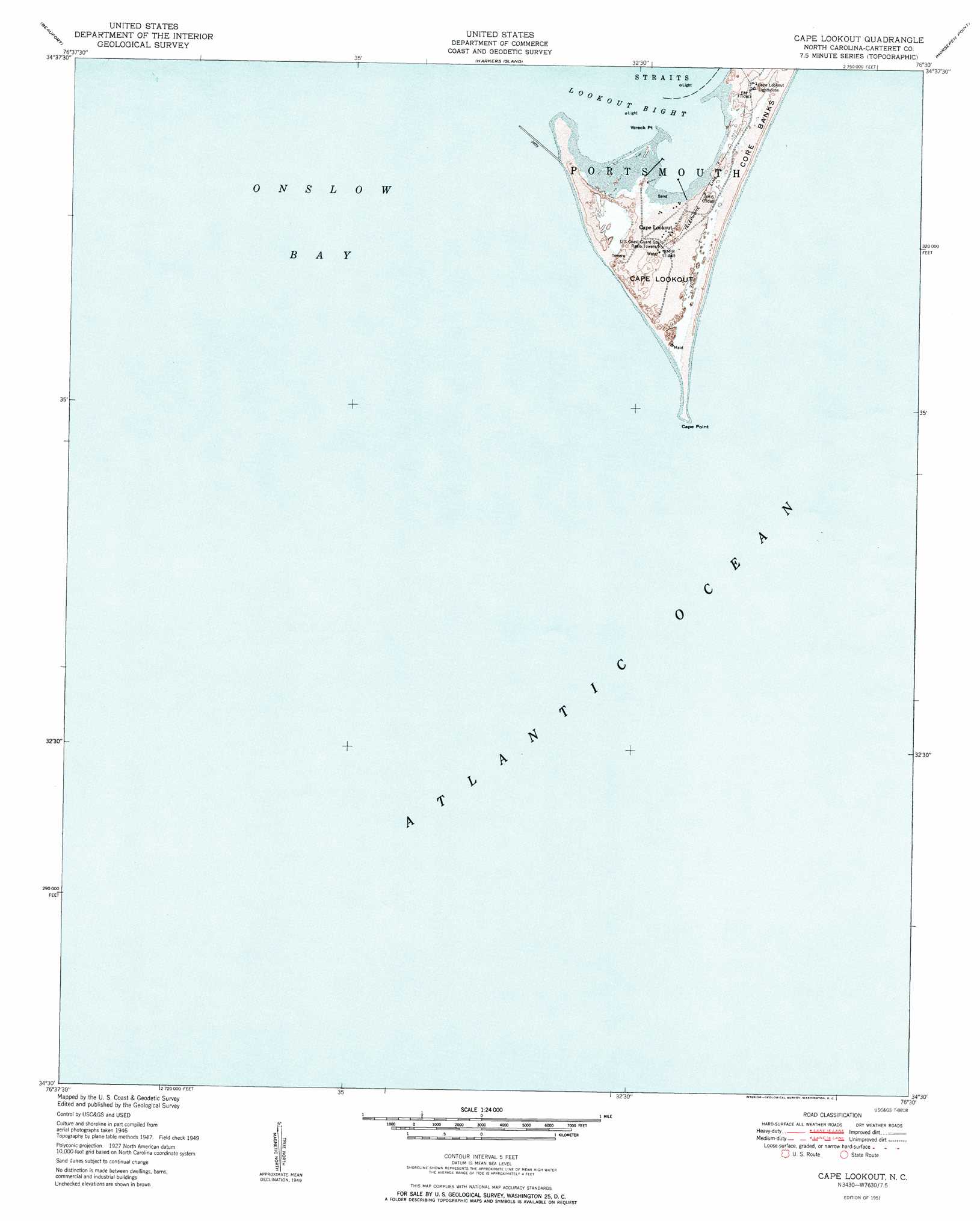
Cape Lookout Topo Map North Carolina
To zoom in, hover over the map of Cape Lookout
USGS Topo Quad 34076e5 - 1:24,000 scale
| Topo Map Name: | Cape Lookout |
| USGS Topo Quad ID: | 34076e5 |
| Print Size: | ca. 21 1/4" wide x 27" high |
| Southeast Coordinates: | 34.5° N latitude / 76.5° W longitude |
| Map Center Coordinates: | 34.5625° N latitude / 76.5625° W longitude |
| U.S. State: | NC |
| Filename: | o34076e5.jpg |
| Download Map JPG Image: | Cape Lookout topo map 1:24,000 scale |
| Map Type: | Topographic |
| Topo Series: | 7.5´ |
| Map Scale: | 1:24,000 |
| Source of Map Images: | United States Geological Survey (USGS) |
| Alternate Map Versions: |
Cape Lookout NC 1951 Download PDF Buy paper map Cape Lookout NC 2011 Download PDF Buy paper map Cape Lookout NC 2013 Download PDF Buy paper map Cape Lookout NC 2016 Download PDF Buy paper map |
1:24,000 Topo Quads surrounding Cape Lookout
Newport |
Core Creek |
Williston |
Davis |
Styron Bay |
Mansfield |
Beaufort |
Harkers Island |
Horsepen Point |
|
Cape Lookout |
||||
> Back to 34076e1 at 1:100,000 scale
> Back to 34076a1 at 1:250,000 scale
> Back to U.S. Topo Maps home
Cape Lookout topo map: Gazetteer
Cape Lookout: Bars
Catfish Point elevation 0m 0′Power Squadron Spit elevation 1m 3′
Cape Lookout: Bays
Lookout Bight elevation 0m 0′Cape Lookout: Capes
Cape Lookout elevation 2m 6′Cape Point elevation 0m 0′
Wreck Point elevation 0m 0′
Cape Lookout: Populated Places
Cape Lookout elevation 1m 3′Cape Lookout digital topo map on disk
Buy this Cape Lookout topo map showing relief, roads, GPS coordinates and other geographical features, as a high-resolution digital map file on DVD:
Atlantic Coast (NY, NJ, PA, DE, MD, VA, NC)
Buy digital topo maps: Atlantic Coast (NY, NJ, PA, DE, MD, VA, NC)
 map DVD")