Stag Park Topo Map North Carolina
To zoom in, hover over the map of Stag Park
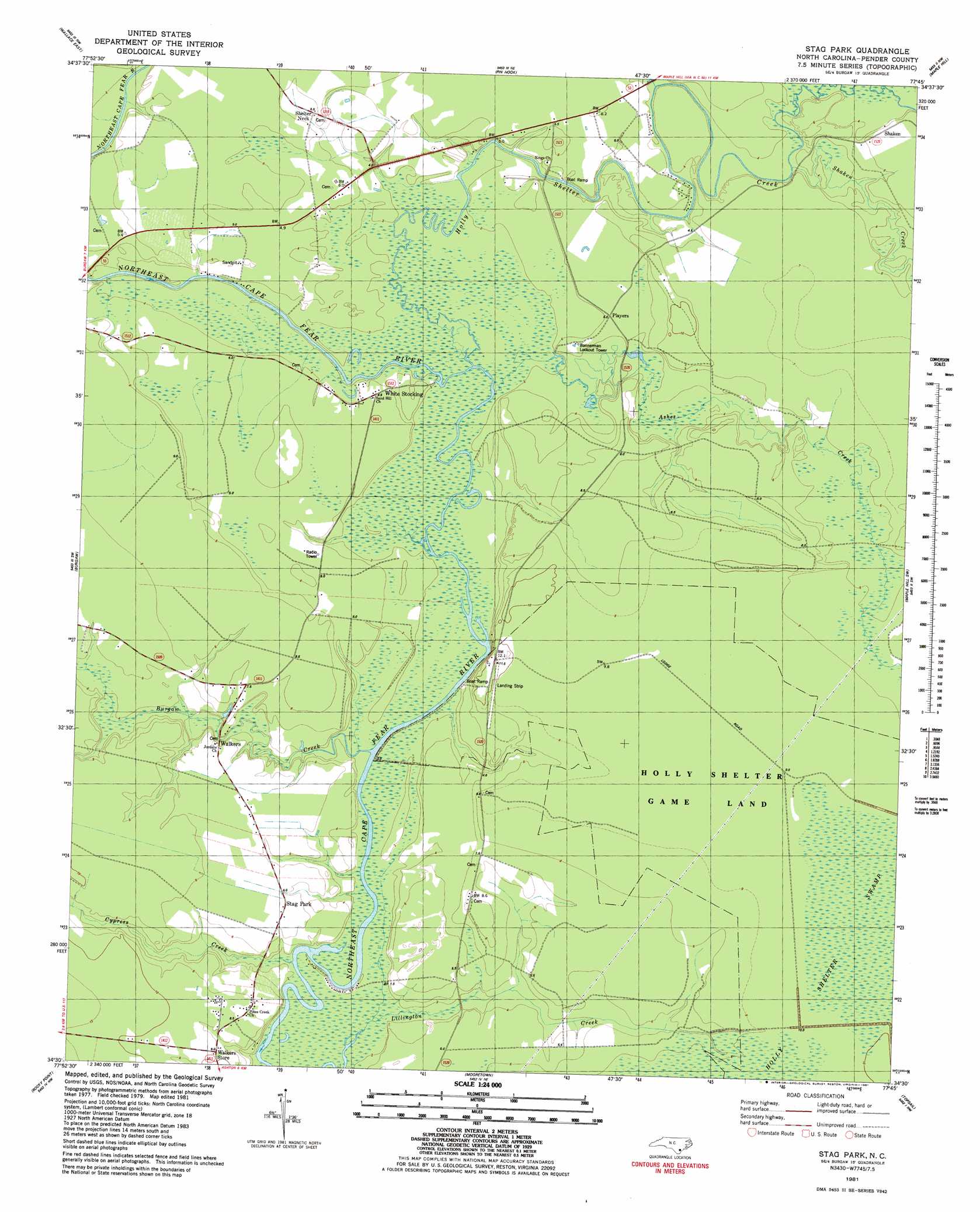
USGS Topo Quad 34077e7 - 1:24,000 scale
| Topo Map Name: | Stag Park |
| USGS Topo Quad ID: | 34077e7 |
| Print Size: | ca. 21 1/4" wide x 27" high |
| Southeast Coordinates: | 34.5° N latitude / 77.75° W longitude |
| Map Center Coordinates: | 34.5625° N latitude / 77.8125° W longitude |
| U.S. State: | NC |
| Filename: | o34077e7.jpg |
| Download Map JPG Image: | Stag Park topo map 1:24,000 scale |
| Map Type: | Topographic |
| Topo Series: | 7.5´ |
| Map Scale: | 1:24,000 |
| Source of Map Images: | United States Geological Survey (USGS) |
| Alternate Map Versions: |
Stag Park NC 1981, updated 1981 Download PDF Buy paper map Stag Park NC 1981, updated 1981 Download PDF Buy paper map Stag Park NC 2010 Download PDF Buy paper map Stag Park NC 2013 Download PDF Buy paper map Stag Park NC 2016 Download PDF Buy paper map |
1:24,000 Topo Quads surrounding Stag Park
Rose Hill |
Charity |
Chinquapin |
Lyman |
Catherine Lake |
Wallace West |
Wallace East |
Pin Hook |
Maple Hill |
Haws Run |
Costin |
Burgaw |
Stag Park |
Maple Hill Sw |
Folkstone |
Currie |
Rocky Point |
Mooretown |
Topsail |
Holly Ridge |
Leland |
Castle Hayne |
Scotts Hill |
Hampstead |
> Back to 34077e1 at 1:100,000 scale
> Back to 34076a1 at 1:250,000 scale
> Back to U.S. Topo Maps home
Stag Park topo map: Gazetteer
Stag Park: Populated Places
Exeter (historical) elevation 9m 29′Plear elevation 5m 16′
Shaken elevation 6m 19′
Shelter Neck elevation 5m 16′
Stag Park elevation 7m 22′
Walkers elevation 7m 22′
Walkers Store elevation 8m 26′
White Stocking elevation 4m 13′
Stag Park: Streams
Ashes Creek elevation 1m 3′Burgaw Creek elevation 2m 6′
Came Branch elevation 3m 9′
Cypress Creek elevation 0m 0′
Holly Shelter Creek elevation 0m 0′
Lillington Creek elevation 2m 6′
Mill Pond elevation 3m 9′
Shaken Creek elevation 1m 3′
Stag Park digital topo map on disk
Buy this Stag Park topo map showing relief, roads, GPS coordinates and other geographical features, as a high-resolution digital map file on DVD:
Atlantic Coast (NY, NJ, PA, DE, MD, VA, NC)
Buy digital topo maps: Atlantic Coast (NY, NJ, PA, DE, MD, VA, NC)
 map DVD")