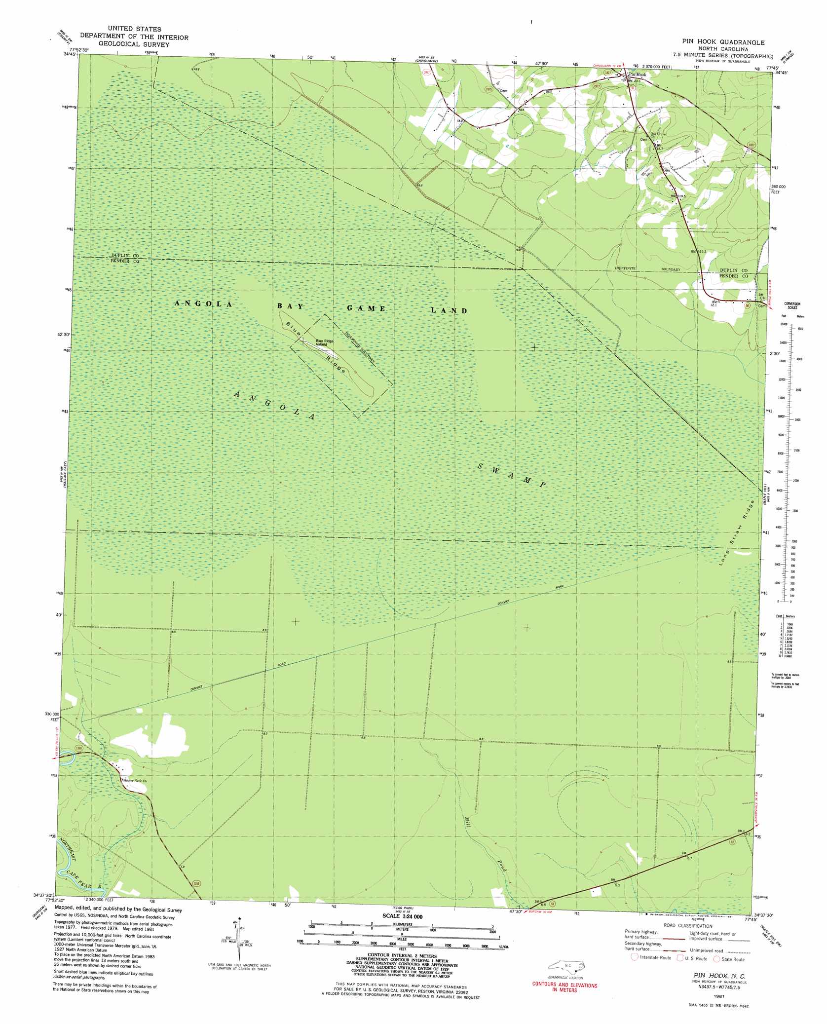
Pin Hook Topo Map North Carolina
To zoom in, hover over the map of Pin Hook
USGS Topo Quad 34077f7 - 1:24,000 scale
| Topo Map Name: | Pin Hook |
| USGS Topo Quad ID: | 34077f7 |
| Print Size: | ca. 21 1/4" wide x 27" high |
| Southeast Coordinates: | 34.625° N latitude / 77.75° W longitude |
| Map Center Coordinates: | 34.6875° N latitude / 77.8125° W longitude |
| U.S. State: | NC |
| Filename: | o34077f7.jpg |
| Download Map JPG Image: | Pin Hook topo map 1:24,000 scale |
| Map Type: | Topographic |
| Topo Series: | 7.5´ |
| Map Scale: | 1:24,000 |
| Source of Map Images: | United States Geological Survey (USGS) |
| Alternate Map Versions: |
Pin Hook NC 1981, updated 1981 Download PDF Buy paper map Pin Hook NC 2010 Download PDF Buy paper map Pin Hook NC 2013 Download PDF Buy paper map Pin Hook NC 2016 Download PDF Buy paper map |
1:24,000 Topo Quads surrounding Pin Hook
Warsaw South |
Kenansville |
Beulaville |
Potters Hill |
Richlands |
Rose Hill |
Charity |
Chinquapin |
Lyman |
Catherine Lake |
Wallace West |
Wallace East |
Pin Hook |
Maple Hill |
Haws Run |
Costin |
Burgaw |
Stag Park |
Maple Hill Sw |
Folkstone |
Currie |
Rocky Point |
Mooretown |
Topsail |
Holly Ridge |
> Back to 34077e1 at 1:100,000 scale
> Back to 34076a1 at 1:250,000 scale
> Back to U.S. Topo Maps home
Pin Hook topo map: Gazetteer
Pin Hook: Airports
Blue Ridge Airfield elevation 11m 36′Pin Hook: Flats
Long Straw Ridge elevation 9m 29′Pin Hook: Parks
Angola Bay Game Land elevation 10m 32′Pin Hook: Populated Places
Pin Hook elevation 25m 82′Pin Hook: Ridges
Blue Ridge elevation 11m 36′Pin Hook: Swamps
Angola Swamp elevation 10m 32′Pin Hook digital topo map on disk
Buy this Pin Hook topo map showing relief, roads, GPS coordinates and other geographical features, as a high-resolution digital map file on DVD:
Atlantic Coast (NY, NJ, PA, DE, MD, VA, NC)
Buy digital topo maps: Atlantic Coast (NY, NJ, PA, DE, MD, VA, NC)
 map DVD")