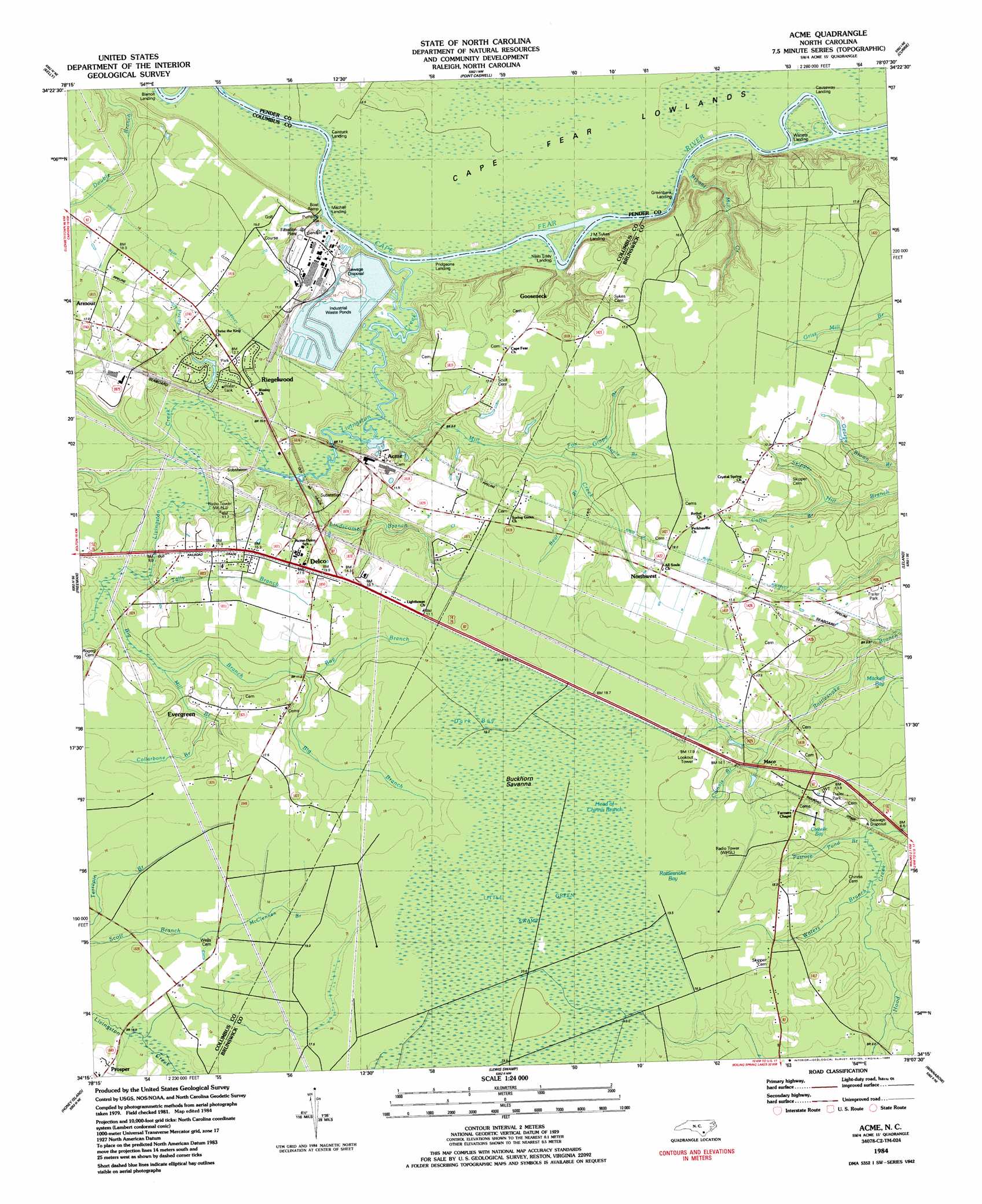
Acme Topo Map North Carolina
To zoom in, hover over the map of Acme
USGS Topo Quad 34078c2 - 1:24,000 scale
| Topo Map Name: | Acme |
| USGS Topo Quad ID: | 34078c2 |
| Print Size: | ca. 21 1/4" wide x 27" high |
| Southeast Coordinates: | 34.25° N latitude / 78.125° W longitude |
| Map Center Coordinates: | 34.3125° N latitude / 78.1875° W longitude |
| U.S. State: | NC |
| Filename: | o34078c2.jpg |
| Download Map JPG Image: | Acme topo map 1:24,000 scale |
| Map Type: | Topographic |
| Topo Series: | 7.5´ |
| Map Scale: | 1:24,000 |
| Source of Map Images: | United States Geological Survey (USGS) |
| Alternate Map Versions: |
Acme NC 1980, updated 1985 Download PDF Buy paper map Acme NC 1984, updated 1984 Download PDF Buy paper map Acme NC 2010 Download PDF Buy paper map Acme NC 2013 Download PDF Buy paper map Acme NC 2016 Download PDF Buy paper map |
1:24,000 Topo Quads surrounding Acme
Singletary Lake |
Rowan |
Atkinson |
Costin |
Burgaw |
Council |
Kelly |
Point Caswell |
Currie |
Rocky Point |
Lake Waccamaw East |
Freeman |
Acme |
Leland |
Castle Hayne |
Juniper Creek |
Honey Island |
Lewis Swamp |
Winnabow |
Wilmington |
Exum |
Supply |
Bolivia |
Funston |
Carolina Beach |
> Back to 34078a1 at 1:100,000 scale
> Back to 34078a1 at 1:250,000 scale
> Back to U.S. Topo Maps home
Acme topo map: Gazetteer
Acme: Basins
Mitchell Bay elevation 13m 42′Acme: Canals
Kings Bluff Aqueduct elevation 16m 52′Acme: Populated Places
Acme elevation 14m 45′Country Club Mobile Home Park elevation 15m 49′
Delco elevation 14m 45′
Evergreen elevation 14m 45′
Gooseneck elevation 16m 52′
Maco elevation 12m 39′
New Berlin elevation 15m 49′
Northwest elevation 18m 59′
Riegelwood elevation 11m 36′
Sandy Creek elevation 11m 36′
Acme: Post Offices
Delco Post Office elevation 16m 52′Acme: Streams
Bay Branch elevation 10m 32′Bear Branch elevation 7m 22′
Big Branch elevation 5m 16′
Bryant Mill Creek elevation 2m 6′
Chinnis Branch elevation 9m 29′
Coffin Branch elevation 7m 22′
Collarbone Branch elevation 10m 32′
Fox Maple Branch elevation 6m 19′
Grape Branch elevation 8m 26′
Lindscomb Branch elevation 3m 9′
Livingston Creek elevation 2m 6′
Mill Branch elevation 6m 19′
Mill Creek elevation 1m 3′
Pasture Pond Branch elevation 6m 19′
Pretty Creek elevation 2m 6′
Tally Branch elevation 4m 13′
Waters Branch elevation 6m 19′
Acme: Swamps
Buckhorn Savanna elevation 18m 59′Cape Fear Lowlands elevation 2m 6′
Catholic Bay elevation 13m 42′
Dark Bay elevation 19m 62′
Head of Chinnis Branch elevation 19m 62′
Rattlesnake Bay elevation 19m 62′
Acme digital topo map on disk
Buy this Acme topo map showing relief, roads, GPS coordinates and other geographical features, as a high-resolution digital map file on DVD:
South Carolina, Western North Carolina & Northeastern Georgia
Buy digital topo maps: South Carolina, Western North Carolina & Northeastern Georgia