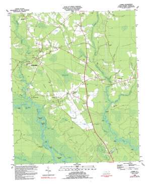
Currie Topo Map North Carolina
To zoom in, hover over the map of Currie
USGS Topo Quad 34078d1 - 1:24,000 scale
| Topo Map Name: | Currie |
| USGS Topo Quad ID: | 34078d1 |
| Print Size: | ca. 21 1/4" wide x 27" high |
| Southeast Coordinates: | 34.375° N latitude / 78° W longitude |
| Map Center Coordinates: | 34.4375° N latitude / 78.0625° W longitude |
| U.S. State: | NC |
| Filename: | o34078d1.jpg |
| Download Map JPG Image: | Currie topo map 1:24,000 scale |
| Map Type: | Topographic |
| Topo Series: | 7.5´ |
| Map Scale: | 1:24,000 |
| Source of Map Images: | United States Geological Survey (USGS) |
| Alternate Map Versions: |
Currie NC 1980, updated 1985 Download PDF Buy paper map Currie NC 1983, updated 1984 Download PDF Buy paper map Currie NC 1983, updated 1992 Download PDF Buy paper map Currie NC 2010 Download PDF Buy paper map Currie NC 2013 Download PDF Buy paper map Currie NC 2016 Download PDF Buy paper map |
1:24,000 Topo Quads surrounding Currie
> Back to 34078a1 at 1:100,000 scale
> Back to 34078a1 at 1:250,000 scale
> Back to U.S. Topo Maps home
Currie topo map: Gazetteer
Currie: Basins
Jack Bay elevation 8m 26′Currie: Bays
Narrow Mouth Cove elevation 1m 3′Currie: Capes
Herrings Neck elevation 1m 3′Currie: Guts
Cross Way Creek elevation 0m 0′Thorofare elevation 0m 0′
Currie: Islands
Birds Cove Island elevation 1m 3′Cross Way Island elevation 1m 3′
D Island elevation 1m 3′
Thorofare Island elevation 0m 0′
Currie: Parks
Grady Monument park elevation 2m 6′Loyalist Monument elevation 3m 9′
Moore Monument elevation 3m 9′
Moores Creek National Battlefield elevation 3m 9′
Slocumb Monument elevation 3m 9′
Stage Road Monument elevation 3m 9′
Currie: Populated Places
Currie elevation 9m 29′Cypress Grove Mobile Home Park elevation 9m 29′
E and H Mobile Home Park elevation 12m 39′
Long Creek elevation 8m 26′
Montague elevation 11m 36′
The Borough elevation 5m 16′
Yamacraw elevation 13m 42′
Currie: Post Offices
Currie Post Office elevation 10m 32′Currie: Streams
Bear Branch elevation 1m 3′Big Branch elevation 2m 6′
Buckle Swamp Creek elevation 0m 0′
Cane Creek elevation 1m 3′
Collins Branch elevation 4m 13′
Deer Valley Branch elevation 1m 3′
Guffords Branch elevation 2m 6′
Jumping Run Branch elevation 1m 3′
Juniper Branch elevation 1m 3′
Lee Ditch elevation 9m 29′
Lewis Branch elevation 6m 19′
Mill Branch elevation 1m 3′
Mill Creek elevation 1m 3′
Mill Run elevation 1m 3′
Moores Creek elevation 1m 3′
Mulberry Branch elevation 1m 3′
Rileys Creek elevation 1m 3′
Currie: Summits
Sand Ball Hill elevation 11m 36′Currie: Swamps
Black Swamp (historical) elevation 13m 42′Curve of the Railroad Bay elevation 12m 39′
Ditch Bay elevation 17m 55′
Flat Bay elevation 5m 16′
Goose Pond elevation 19m 62′
Horsepen Bay elevation 9m 29′
Lee Hugh Bay elevation 13m 42′
Station Bay elevation 10m 32′
Currie: Trails
History Trail elevation 8m 26′Tarheel Trail elevation 5m 16′
Currie digital topo map on disk
Buy this Currie topo map showing relief, roads, GPS coordinates and other geographical features, as a high-resolution digital map file on DVD:
South Carolina, Western North Carolina & Northeastern Georgia
Buy digital topo maps: South Carolina, Western North Carolina & Northeastern Georgia


