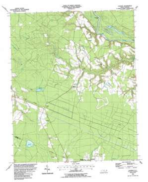
Council Topo Map North Carolina
To zoom in, hover over the map of Council
USGS Topo Quad 34078d4 - 1:24,000 scale
| Topo Map Name: | Council |
| USGS Topo Quad ID: | 34078d4 |
| Print Size: | ca. 21 1/4" wide x 27" high |
| Southeast Coordinates: | 34.375° N latitude / 78.375° W longitude |
| Map Center Coordinates: | 34.4375° N latitude / 78.4375° W longitude |
| U.S. State: | NC |
| Filename: | o34078d4.jpg |
| Download Map JPG Image: | Council topo map 1:24,000 scale |
| Map Type: | Topographic |
| Topo Series: | 7.5´ |
| Map Scale: | 1:24,000 |
| Source of Map Images: | United States Geological Survey (USGS) |
| Alternate Map Versions: |
Council NC 1986, updated 1986 Download PDF Buy paper map Council NC 2002, updated 2002 Download PDF Buy paper map Council NC 2010 Download PDF Buy paper map Council NC 2013 Download PDF Buy paper map Council NC 2016 Download PDF Buy paper map |
1:24,000 Topo Quads surrounding Council
> Back to 34078a1 at 1:100,000 scale
> Back to 34078a1 at 1:250,000 scale
> Back to U.S. Topo Maps home
Council topo map: Gazetteer
Council: Capes
Deepwater Point elevation 5m 16′Council: Dams
Council Mill Pond Dam elevation 21m 68′Gilliam Lake Dam elevation 20m 65′
Council: Flats
Seven Mile Bay elevation 21m 68′Council: Populated Places
Baltimore elevation 21m 68′Carvers elevation 21m 68′
Council elevation 21m 68′
Red Hill elevation 21m 68′
Westbrook elevation 23m 75′
Council: Reservoirs
Council Millpond elevation 21m 68′Dodds Millpond elevation 8m 26′
Gilliam Lake elevation 20m 65′
Meares Millpond elevation 18m 59′
Council: Streams
Boggy Branch elevation 18m 59′Donoho Creek elevation 4m 13′
Drunken Run elevation 6m 19′
Kitchens Branch elevation 12m 39′
Red Hill Branch elevation 15m 49′
Council: Swamps
Dismal Bay elevation 30m 98′Horseshoe Bay elevation 32m 104′
Juniper Bay elevation 32m 104′
Keeter Bay elevation 20m 65′
Long Bay elevation 20m 65′
Plummers Run Bay elevation 21m 68′
Rhodes Bay elevation 21m 68′
Sasspan Bay elevation 20m 65′
Webb Bay elevation 18m 59′
Wolf Bay elevation 31m 101′
Council digital topo map on disk
Buy this Council topo map showing relief, roads, GPS coordinates and other geographical features, as a high-resolution digital map file on DVD:
South Carolina, Western North Carolina & Northeastern Georgia
Buy digital topo maps: South Carolina, Western North Carolina & Northeastern Georgia


