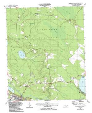
Elizabethtown North Topo Map North Carolina
To zoom in, hover over the map of Elizabethtown North
USGS Topo Quad 34078f5 - 1:24,000 scale
| Topo Map Name: | Elizabethtown North |
| USGS Topo Quad ID: | 34078f5 |
| Print Size: | ca. 21 1/4" wide x 27" high |
| Southeast Coordinates: | 34.625° N latitude / 78.5° W longitude |
| Map Center Coordinates: | 34.6875° N latitude / 78.5625° W longitude |
| U.S. State: | NC |
| Filename: | o34078f5.jpg |
| Download Map JPG Image: | Elizabethtown North topo map 1:24,000 scale |
| Map Type: | Topographic |
| Topo Series: | 7.5´ |
| Map Scale: | 1:24,000 |
| Source of Map Images: | United States Geological Survey (USGS) |
| Alternate Map Versions: |
Elizabethtown North NC 1987, updated 1987 Download PDF Buy paper map Elizabethtown North NC 2010 Download PDF Buy paper map Elizabethtown North NC 2013 Download PDF Buy paper map Elizabethtown North NC 2016 Download PDF Buy paper map |
1:24,000 Topo Quads surrounding Elizabethtown North
> Back to 34078e1 at 1:100,000 scale
> Back to 34078a1 at 1:250,000 scale
> Back to U.S. Topo Maps home
Elizabethtown North topo map: Gazetteer
Elizabethtown North: Airports
Bladen Lakes Airport elevation 18m 59′Elizabethtown North: Basins
Smith Swamp elevation 17m 55′Thumb Swamp elevation 27m 88′
Elizabethtown North: Dams
Greens Pond Dam elevation 14m 45′US Lock and Dam Number 2 elevation 7m 22′
Elizabethtown North: Forests
Bladen Lakes State Forest elevation 28m 91′Elizabethtown North: Lakes
Jones Lake elevation 21m 68′Elizabethtown North: Populated Places
Elizabethtown elevation 33m 108′Johnsontown elevation 22m 72′
Suttons Corner elevation 15m 49′
Elizabethtown North: Post Offices
Elizabethtown Post Office elevation 35m 114′Elizabethtown North: Reservoirs
Greenes Pond elevation 14m 45′Elizabethtown North: Streams
Browns Creek elevation 8m 26′Indian Creek elevation 20m 65′
Panther Branch elevation 17m 55′
Tub Mill Creek elevation 8m 26′
White Lake Drain elevation 10m 32′
Elizabethtown North: Summits
Susies Hill elevation 28m 91′Elizabethtown North: Swamps
Bloody Branch Bay elevation 27m 88′Caney Meadow elevation 25m 82′
Cedar Bay elevation 21m 68′
Cotton Head Bay elevation 22m 72′
Cypress Bay elevation 25m 82′
Ditch Bay elevation 17m 55′
Gum Swamp elevation 18m 59′
Johnson Mill Bay elevation 25m 82′
Jones Lake Bay elevation 22m 72′
Little Colly Bay elevation 22m 72′
Olin Tatum Millpond Bay elevation 26m 85′
Sawmill Bay elevation 17m 55′
Schoolhouse Bay elevation 18m 59′
Tatum Millpond Bay elevation 25m 82′
Wam Squam Bay elevation 18m 59′
Elizabethtown North digital topo map on disk
Buy this Elizabethtown North topo map showing relief, roads, GPS coordinates and other geographical features, as a high-resolution digital map file on DVD:
South Carolina, Western North Carolina & Northeastern Georgia
Buy digital topo maps: South Carolina, Western North Carolina & Northeastern Georgia


