Dublin Topo Map North Carolina
To zoom in, hover over the map of Dublin
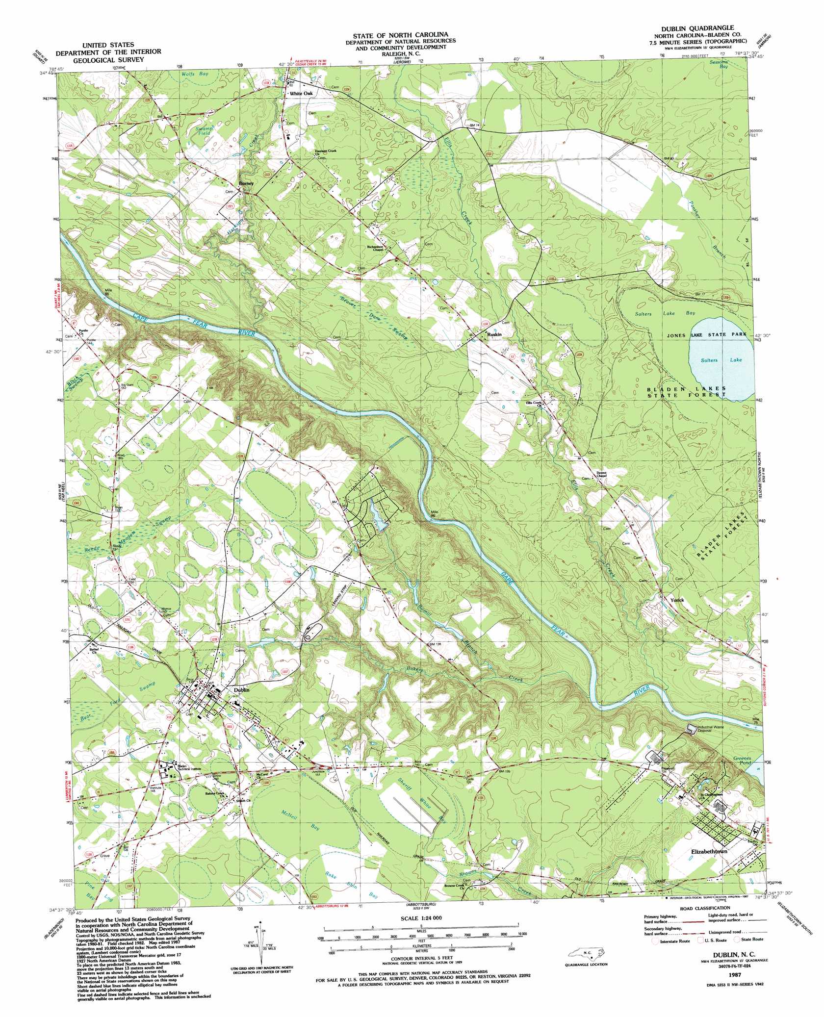
USGS Topo Quad 34078f6 - 1:24,000 scale
| Topo Map Name: | Dublin |
| USGS Topo Quad ID: | 34078f6 |
| Print Size: | ca. 21 1/4" wide x 27" high |
| Southeast Coordinates: | 34.625° N latitude / 78.625° W longitude |
| Map Center Coordinates: | 34.6875° N latitude / 78.6875° W longitude |
| U.S. State: | NC |
| Filename: | o34078f6.jpg |
| Download Map JPG Image: | Dublin topo map 1:24,000 scale |
| Map Type: | Topographic |
| Topo Series: | 7.5´ |
| Map Scale: | 1:24,000 |
| Source of Map Images: | United States Geological Survey (USGS) |
| Alternate Map Versions: |
Dublin NC 1987, updated 1987 Download PDF Buy paper map Dublin NC 2010 Download PDF Buy paper map Dublin NC 2013 Download PDF Buy paper map Dublin NC 2016 Download PDF Buy paper map |
1:24,000 Topo Quads surrounding Dublin
Hope Mills |
Cedar Creek |
Autryville |
Roseboro |
Bonnetsville |
Saint Pauls |
Duart |
Jerome |
Ammon |
Garland |
Northeast Lumberton |
Tar Heel |
Dublin |
Elizabethtown North |
White Lake |
Southeast Lumberton |
Bladenboro |
Abbottsburg |
Elizabethtown South |
Singletary Lake |
Evergreen |
Chadbourn Ne |
Clarkton |
Emerson |
Council |
> Back to 34078e1 at 1:100,000 scale
> Back to 34078a1 at 1:250,000 scale
> Back to U.S. Topo Maps home
Dublin topo map: Gazetteer
Dublin: Airports
Dublin Field elevation 37m 121′Dublin: Bays
McNeil Bay elevation 39m 127′Sheriff White Bay elevation 38m 124′
Dublin: Flats
Swamp Field elevation 22m 72′Dublin: Lakes
Salters Lake elevation 23m 75′Dublin: Parks
Jones Lake State Park elevation 23m 75′Dublin: Populated Places
Burney elevation 20m 65′Dublin elevation 40m 131′
Ruskin elevation 19m 62′
White Oak elevation 17m 55′
Yorick elevation 16m 52′
Dublin: Streams
Bakers Creek elevation 10m 32′Bomill Branch elevation 13m 42′
Ellis Creek elevation 7m 22′
Harrison Creek elevation 7m 22′
Dublin: Swamps
Beaver Dam Swamp elevation 17m 55′Salters Lake Bay elevation 23m 75′
Dublin digital topo map on disk
Buy this Dublin topo map showing relief, roads, GPS coordinates and other geographical features, as a high-resolution digital map file on DVD:
South Carolina, Western North Carolina & Northeastern Georgia
Buy digital topo maps: South Carolina, Western North Carolina & Northeastern Georgia