Ammon Topo Map North Carolina
To zoom in, hover over the map of Ammon
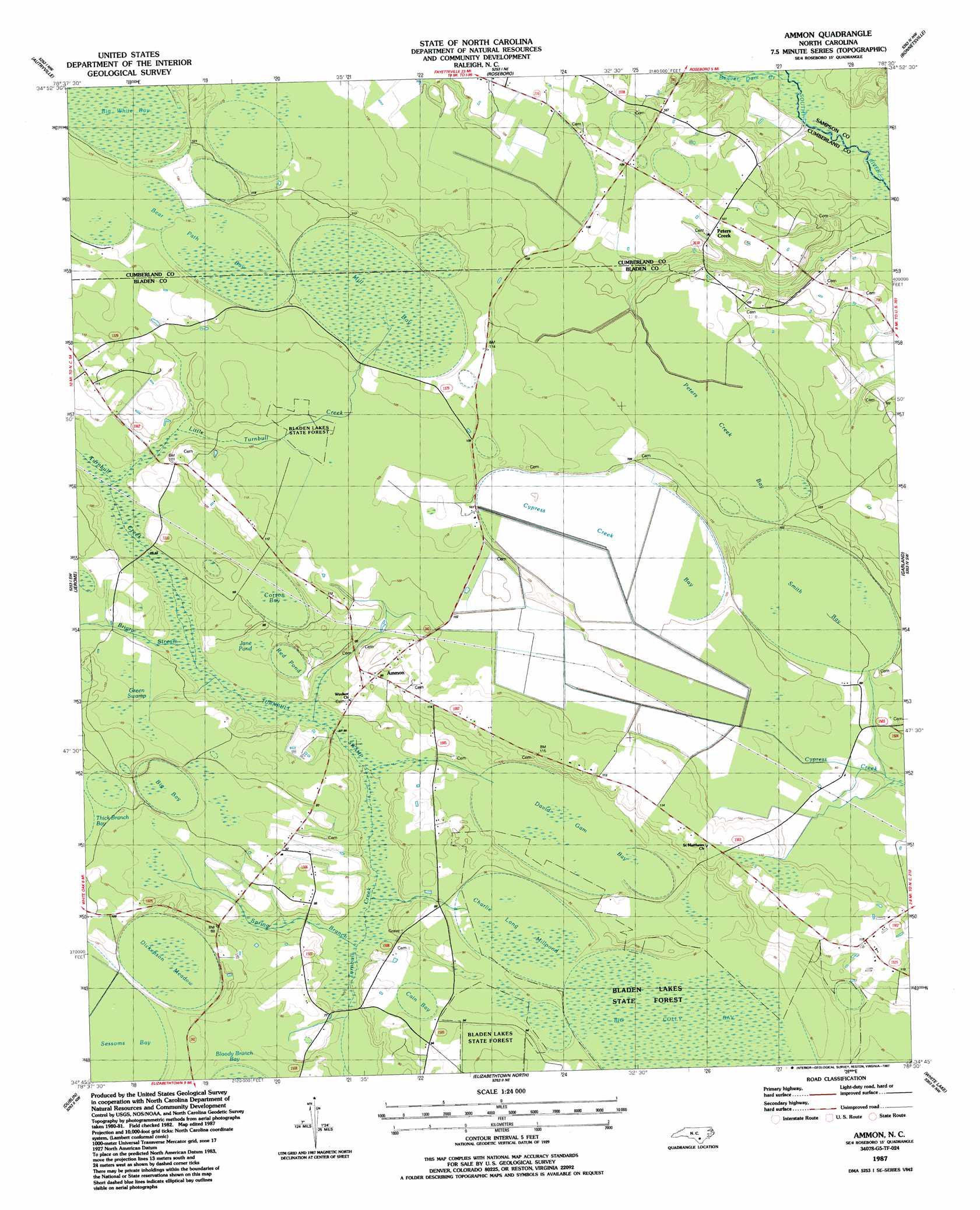
USGS Topo Quad 34078g5 - 1:24,000 scale
| Topo Map Name: | Ammon |
| USGS Topo Quad ID: | 34078g5 |
| Print Size: | ca. 21 1/4" wide x 27" high |
| Southeast Coordinates: | 34.75° N latitude / 78.5° W longitude |
| Map Center Coordinates: | 34.8125° N latitude / 78.5625° W longitude |
| U.S. State: | NC |
| Filename: | o34078g5.jpg |
| Download Map JPG Image: | Ammon topo map 1:24,000 scale |
| Map Type: | Topographic |
| Topo Series: | 7.5´ |
| Map Scale: | 1:24,000 |
| Source of Map Images: | United States Geological Survey (USGS) |
| Alternate Map Versions: |
Ammon NC 1987, updated 1987 Download PDF Buy paper map Ammon NC 2010 Download PDF Buy paper map Ammon NC 2013 Download PDF Buy paper map Ammon NC 2016 Download PDF Buy paper map |
1:24,000 Topo Quads surrounding Ammon
Vander |
Stedman |
Salemburg |
Bearskin |
Clinton North |
Cedar Creek |
Autryville |
Roseboro |
Bonnetsville |
Clinton South |
Duart |
Jerome |
Ammon |
Garland |
Ingold |
Tar Heel |
Dublin |
Elizabethtown North |
White Lake |
Tomahawk |
Bladenboro |
Abbottsburg |
Elizabethtown South |
Singletary Lake |
Rowan |
> Back to 34078e1 at 1:100,000 scale
> Back to 34078a1 at 1:250,000 scale
> Back to U.S. Topo Maps home
Ammon topo map: Gazetteer
Ammon: Basins
Bear Path Bay elevation 35m 114′Mill Bay elevation 35m 114′
Ammon: Lakes
Jane Pond elevation 30m 98′Ammon: Populated Places
Ammon elevation 29m 95′Ammon Ford elevation 26m 85′
Peters Creek elevation 31m 101′
Ammon: Streams
Beaver Dam Creek elevation 22m 72′Briary Stream elevation 25m 82′
Little Turnbull Creek elevation 27m 88′
Spring Branch elevation 22m 72′
Ammon: Swamps
Big Bay elevation 30m 98′Big Colly Bay elevation 29m 95′
Cain Bay elevation 28m 91′
Charlie Long Millpond elevation 27m 88′
Corson Bay elevation 32m 104′
Cypress Creek Bay elevation 30m 98′
David Gam Bay elevation 28m 91′
Dickenson Meadow elevation 31m 101′
Green Swamp elevation 28m 91′
Peters Creek Bay elevation 30m 98′
Red Pond elevation 29m 95′
Smith Bay elevation 29m 95′
Turnbull Swamp elevation 26m 85′
Ammon digital topo map on disk
Buy this Ammon topo map showing relief, roads, GPS coordinates and other geographical features, as a high-resolution digital map file on DVD:
South Carolina, Western North Carolina & Northeastern Georgia
Buy digital topo maps: South Carolina, Western North Carolina & Northeastern Georgia